 Aerial imagery: USGS National Map (public domain)
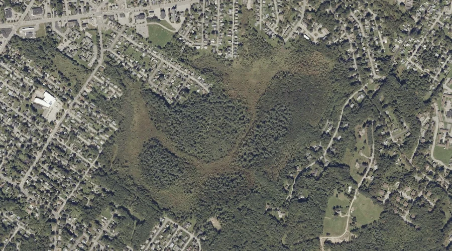
Garcelon Bog — Swamps 36.9 Miles SE of Chapman Inn
Androscoggin County, Maine · USGS Lewiston Quadrangle · GNIS 566683
Catalogued on the USGS Lewiston quadrangle in Androscoggin County, Maine, Garcelon Bog — a swamp — lies 36.9 miles southeast of Chapman Inn.
Wikidata short description: “swamp in Androscoggin County, Maine, United States of America”
Landmark Profile
Classification & USGS reference
Catalogued under GNIS Feature ID 566683, Garcelon Bog is recorded as a swamp on the USGS Lewiston quadrangle in Androscoggin County, Maine (FIPS 23/001). Catalogued in GNIS since 09/30/1980.
Coordinates & physical setting
Garcelon Bog sits at 44.09674° N, 70.18116° W (DMS 44°05′48″ N, 70°10′52″ W).
Features on the USGS Lewiston Quadrangle
The Lewiston 7.5-minute topographic quadrangle holds 26 catalogued natural features alongside Garcelon Bog. A sampling nearest to this location:
| Feature | Type | County | Offset |
|---|---|---|---|
| Highland Spring | Springs | Androscoggin County, ME | 0.9 mi |
| Apple Sass Hill | Summits | Androscoggin County, ME | 1 mi |
| Thorncrag Hill | Summits | Androscoggin County, ME | 1.3 mi |
| Montello Heights Reservoir | Reservoirs | Androscoggin County, ME | 1.3 mi |
| Lake Andrews | Lakes | Androscoggin County, ME | 1.3 mi |
| Mount David | Summits | Androscoggin County, ME | 1.5 mi |
| Androscoggin River Reservoir | Reservoirs | Androscoggin County, ME | 1.7 mi |
| Jepson Brook | Streams | Androscoggin County, ME | 1.7 mi |
| Fox Island | Islands | Androscoggin County, ME | 2 mi |
| Great Falls | Waterfalls | Androscoggin County, ME | 2.1 mi |
Visiting from Chapman Inn
Distance, bearing & drive time
A 63-minute drive along back roads separates the front door of Chapman Inn from Garcelon Bog — 36.9 miles southeast as the crow flies, on compass bearing SE.
Best time to visit
Late May through October; avoid black-fly peak in late May. At this latitude (44.097°), the shoulder seasons are workable — April and November can be comfortable on mild years. At 36.9 miles from the Inn, block the full day — sunrise start, late return, packed meals. Conditions at Garcelon Bog track the nearby Highland Spring (0.9 mi away) closely — if that is runnable, so is this.
Nearest features to Garcelon Bog
| Feature | Type | County | Distance |
|---|---|---|---|
| Highland Spring | Springs | Androscoggin County, ME | 0.9 mi |
| Apple Sass Hill | Summits | Androscoggin County, ME | 1 mi |
| Thorncrag Hill | Summits | Androscoggin County, ME | 1.3 mi |
| Montello Heights Reservoir | Reservoirs | Androscoggin County, ME | 1.3 mi |
| Lake Andrews | Lakes | Androscoggin County, ME | 1.3 mi |
Frequently Asked Questions
Where is Garcelon Bog located?
Garcelon Bog is in Androscoggin County, Maine, approximately 36.9 miles southeast of Chapman Inn in Bethel, Maine. It appears on the USGS Lewiston topographic quadrangle.
How far is Garcelon Bog from Chapman Inn?
The drive runs about 63 minutes, 36.9 miles southeast (bearing SE) of the Inn.
What type of natural feature is Garcelon Bog?
The U.S. Geological Survey classifies Garcelon Bog as a swamp, catalogued under GNIS Feature ID 566683 on the Lewiston quadrangle.
When is the best time to visit Garcelon Bog?
Late May through October; avoid black-fly peak in late May.
Wikidata: Q33174749.