 Aerial imagery: USGS National Map (public domain)
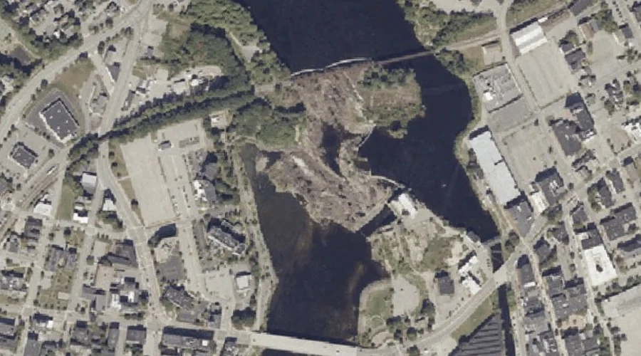
Great Falls — Waterfalls 35.1 Miles SE of Chapman Inn
Androscoggin County, Maine · USGS Lewiston Quadrangle · GNIS 567140
Within Androscoggin County, Maine, on the USGS Lewiston quadrangle, the waterfall known as Great Falls sits 35.1 miles southeast of Chapman Inn.
Landmark Profile
Classification & USGS reference
Within Androscoggin County, Maine, the U.S. Geological Survey lists Great Falls as a waterfall on the Lewiston topographic quadrangle (FIPS 23/001), under Feature ID 567140. Catalogued in GNIS since 09/30/1980.
Coordinates & physical setting
Great Falls sits at 44.09980° N, 70.22255° W (DMS 44°05′59″ N, 70°13′21″ W).
As a linear feature its source lies near 0.00000° N, 0.00000° W — useful for anglers and paddlers tracing the upstream end.
Features on the USGS Lewiston Quadrangle
The Lewiston 7.5-minute topographic quadrangle holds 26 catalogued natural features alongside Great Falls. A sampling nearest to this location:
| Feature | Type | County | Offset |
|---|---|---|---|
| Fox Island | Islands | Androscoggin County, ME | 0.1 mi |
| Androscoggin River Reservoir | Reservoirs | Androscoggin County, ME | 0.2 mi |
| Laurel Hill | Summits | Androscoggin County, ME | 0.7 mi |
| Little Androscoggin River | Streams | Androscoggin County, ME | 0.7 mi |
| Mount David | Summits | Androscoggin County, ME | 0.9 mi |
| Androscoggin River Reservoir | Reservoirs | Androscoggin County, ME | 1 mi |
| Barker Mill Dam Pond | Reservoirs | Androscoggin County, ME | 1 mi |
| Lake Andrews | Lakes | Androscoggin County, ME | 1.1 mi |
| Jepson Brook | Streams | Androscoggin County, ME | 1.2 mi |
| Boxer Island | Islands | Androscoggin County, ME | 1.3 mi |
Historical record
The U.S. Board on Geographic Names recorded a Official (Board Decision) on January 1, 1980 for this name.
Visiting from Chapman Inn
Distance, bearing & drive time
Follow the compass bearing SE out of Bethel for 35.1 miles (southeast) and you reach Great Falls; at typical rural speeds the trip runs roughly 60 minutes.
Best time to visit
Peak flow runs mid-April through June after snowmelt; late summer can be thin or dry. At this latitude (44.100°), the shoulder seasons are workable — April and November can be comfortable on mild years. At 35.1 miles from the Inn, block the full day — sunrise start, late return, packed meals. Conditions at Great Falls track the nearby Fox Island (essentially adjacent) closely — if that is runnable, so is this.
Nearest features to Great Falls
| Feature | Type | County | Distance |
|---|---|---|---|
| Fox Island | Islands | Androscoggin County, ME | 0.1 mi |
| Androscoggin River Reservoir | Reservoirs | Androscoggin County, ME | 0.2 mi |
| Laurel Hill | Summits | Androscoggin County, ME | 0.7 mi |
| Little Androscoggin River | Streams | Androscoggin County, ME | 0.7 mi |
| Mount David | Summits | Androscoggin County, ME | 0.9 mi |
Frequently Asked Questions
Where is Great Falls located?
Great Falls is in Androscoggin County, Maine, approximately 35.1 miles southeast of Chapman Inn in Bethel, Maine. It appears on the USGS Lewiston topographic quadrangle.
How far is Great Falls from Chapman Inn?
The drive runs about 60 minutes, 35.1 miles southeast (bearing SE) of the Inn.
What type of natural feature is Great Falls?
The U.S. Geological Survey classifies Great Falls as a waterfall, catalogued under GNIS Feature ID 567140 on the Lewiston quadrangle.
When is the best time to visit Great Falls?
Peak flow runs mid-April through June after snowmelt; late summer can be thin or dry.