 Aerial imagery: USGS National Map (public domain)
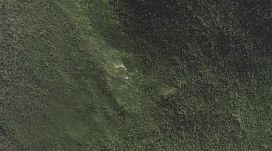
Middle Moriah Mountain — Summits 16.8 Miles WSW of Chapman Inn
Coos County, New Hampshire · USGS Wild River Quadrangle · GNIS 872290
At 3,755 feet of elevation, Middle Moriah Mountain rises above Coos County, New Hampshire as a named summit on the USGS Wild River topographic quadrangle — about 16.8 miles west-southwest of Chapman Inn in Bethel, Maine.
Wikidata short description: “mountain in United States of America”
Landmark Profile
Classification & USGS reference
Catalogued under GNIS Feature ID 872290, Middle Moriah Mountain is recorded as a summit on the USGS Wild River quadrangle in Coos County, New Hampshire (FIPS 33/007). Last revised by the Board on Geographic Names on 12/01/2020.
Coordinates & physical setting
Middle Moriah Mountain sits at 44.34978° N, 71.12119° W (DMS 44°20′59″ N, 71°07′16″ W).
Dimensions & elevation
- Summit elevation 3,755 ft / 1,145 m — a challenging elevation for day hikes.
Other summits in Coos County, New Hampshire
Coos County, NH contains 226 summits catalogued in the USGS Geographic Names Information System, counting Middle Moriah Mountain itself. The ones closest to Middle Moriah Mountain:
| Feature | USGS Quadrangle | Elevation | Distance |
|---|---|---|---|
| Mount Moriah | Carter Dome | 4,049 ft | 0.8 mi |
| Shelburne Moriah Mountain | Wild River | 3,734 ft | 1.1 mi |
| Mount Surprise | Carter Dome | — | 1.7 mi |
| Imp Mountain | Carter Dome | — | 2.3 mi |
| Howe Peak | Wild River | — | 2.5 mi |
| Mount Evans | Shelburne | — | 2.8 mi |
| North Carter Mountain | Carter Dome | — | 3.3 mi |
| Stevens Point | Berlin | — | 3.4 mi |
| Imp Face | Carter Dome | — | 3.8 mi |
| Mount Winthrop | Shelburne | — | 3.9 mi |
Features on the USGS Wild River Quadrangle
The Wild River 7.5-minute topographic quadrangle holds 34 catalogued natural features alongside Middle Moriah Mountain. A sampling nearest to this location:
| Feature | Type | County | Offset |
|---|---|---|---|
| Shelburne Moriah Mountain | Summits | Coos County, NH | 1.1 mi |
| Howe Peak | Summits | Coos County, NH | 2.5 mi |
| Moriah George | Gaps | Coos County, NH | 3.5 mi |
| Bull Brook | Streams | Coos County, NH | 3.8 mi |
| Twin Brook | Streams | Coos County, NH | 4 mi |
| Blue Brook | Streams | Coos County, NH | 4.1 mi |
| Moriah Brook | Streams | Coos County, NH | 4.1 mi |
| Martins Brook | Streams | Coos County, NH | 4.2 mi |
| Dewdrop Brook | Streams | Coos County, NH | 4.6 mi |
| Burnt Mill Brook | Streams | Coos County, NH | 4.8 mi |
Ranking & rarity
- Middle Moriah Mountain is #13 of 19 summits with recorded elevation in Coos County, New Hampshire.
- Among the 1280 summits catalogued within 80 km of Chapman Inn, Middle Moriah Mountain ranks #242 by proximity to the Inn (closer than 81%).
Historical record
Middle Moriah Mountain is a mountain located in Coos County, New Hampshire. The mountain is part of the Carter-Moriah Range of the White Mountains, which runs along the northern east side of Pinkham Notch. Middle Moriah is flanked to the northeast by Shelburne Moriah Mountain, and to the southwest by Mount Moriah. Extended history on Wikipedia →
Visiting from Chapman Inn
Distance, bearing & drive time
A 29-minute drive along back roads separates the front door of Chapman Inn from Middle Moriah Mountain — 16.8 miles west-southwest as the crow flies, on compass bearing WSW.
Best time to visit
Late June through early October, when the summit is reliably snow-free. Being this far north (lat 44.350°), first snows typically arrive by mid-October and linger into early May — narrow the window accordingly. At 16.8 miles from the Inn, plan on a comfortable day trip with time for lunch on the road. Conditions at Middle Moriah Mountain track the nearby Mount Moriah summit (0.8 mi away) closely — if that is runnable, so is this.
Nearest features to Middle Moriah Mountain
| Feature | Type | County | Distance |
|---|---|---|---|
| Mount Moriah | Summits | Coos County, NH | 0.8 mi |
| Shelburne Moriah Mountain | Summits | Coos County, NH | 1.1 mi |
| Mount Surprise | Summits | Coos County, NH | 1.7 mi |
| Imp Mountain | Summits | Coos County, NH | 2.3 mi |
| Howe Peak | Summits | Coos County, NH | 2.5 mi |
Frequently Asked Questions
Where is Middle Moriah Mountain located?
Middle Moriah Mountain is in Coos County, New Hampshire, approximately 16.8 miles west-southwest of Chapman Inn in Bethel, Maine. It appears on the USGS Wild River topographic quadrangle.
How far is Middle Moriah Mountain from Chapman Inn?
The drive runs about 29 minutes, 16.8 miles west-southwest (bearing WSW) of the Inn.
What type of natural feature is Middle Moriah Mountain?
The U.S. Geological Survey classifies Middle Moriah Mountain as a summit, catalogued under GNIS Feature ID 872290 on the Wild River quadrangle.
When is the best time to visit Middle Moriah Mountain?
Late June through early October, when the summit is reliably snow-free.
How tall is Middle Moriah Mountain?
Middle Moriah Mountain rises to 3,755 feet (1,145 metres) above sea level.
How many other summits are in Coos County, New Hampshire?
GNIS lists 225 other summits in Coos County, New Hampshire.
Wikidata: Q6841503.