 Aerial imagery: USGS National Map (public domain)
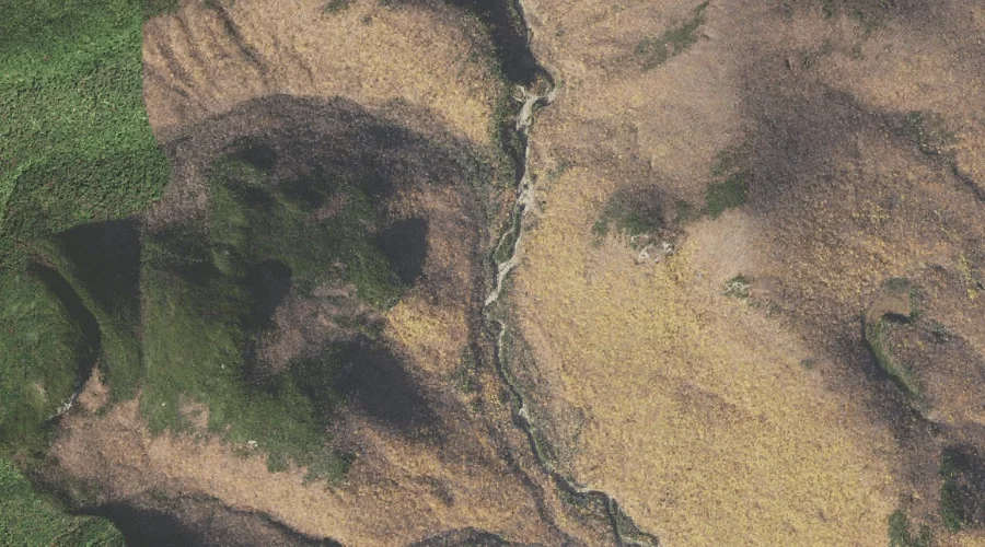
Upper Stairs Brook — Streams 29.9 Miles SW of Chapman Inn
Coos County, New Hampshire · USGS Stairs Mountain Quadrangle · GNIS 872852
Within Coos County, New Hampshire, on the USGS Stairs Mountain quadrangle, the stream known as Upper Stairs Brook sits 29.9 miles southwest of Chapman Inn.
Landmark Profile
Classification & USGS reference
Within Coos County, New Hampshire, the U.S. Geological Survey lists Upper Stairs Brook as a stream on the Stairs Mountain topographic quadrangle (FIPS 33/007), under Feature ID 872852. Catalogued in GNIS since 08/27/1980.
Coordinates & physical setting
Upper Stairs Brook sits at 44.16229° N, 71.28952° W (DMS 44°09′44″ N, 71°17′22″ W).
As a linear feature its source lies near 44.16111° N, 71.31583° W (DMS 44°09′40″ N, 71°18′57″ W) — useful for anglers and paddlers tracing the upstream end.
Other streams in Coos County, New Hampshire
Coos County, NH contains 300 streams catalogued in the USGS Geographic Names Information System, counting Upper Stairs Brook itself. The ones closest to Upper Stairs Brook:
| Feature | USGS Quadrangle | Distance |
|---|---|---|
| Dry River | Stairs Mountain | 4 mi |
| Razor Brook | Bartlett | 5.5 mi |
| Silver Cascade | Crawford Notch | 6.4 mi |
| New River | Mount Washington | 6.6 mi |
| Elephant Head Brook | Crawford Notch | 6.9 mi |
| Cutler River | Mount Washington | 7.1 mi |
| Gibbs Brook | Crawford Notch | 7.5 mi |
| Monroe Brook | Mount Washington | 7.6 mi |
| Thompson Brook | Carter Dome | 7.9 mi |
| Franklin Brook | Mount Washington | 8.2 mi |
Features on the USGS Stairs Mountain Quadrangle
The Stairs Mountain 7.5-minute topographic quadrangle holds 28 catalogued natural features alongside Upper Stairs Brook. A sampling nearest to this location:
| Feature | Type | County | Offset |
|---|---|---|---|
| Maple Mountain | Summits | Carroll County, NH | 0.7 mi |
| Lower Stairs Brook | Streams | Carroll County, NH | 1.2 mi |
| Giant Stairs | Other Natural Features | Coos County, NH | 1.5 mi |
| Stairs Mountain | Summits | Coos County, NH | 1.6 mi |
| Mount Resolution | Summits | Coos County, NH | 1.6 mi |
| Otis Brook | Streams | Carroll County, NH | 2.5 mi |
| Engine Hill | Summits | Coos County, NH | 2.7 mi |
| Bemis Ridge | Ridges | Coos County, NH | 2.8 mi |
| Mount Crawford | Summits | Coos County, NH | 2.8 mi |
| Mount Davis | Summits | Coos County, NH | 3.1 mi |
Visiting from Chapman Inn
Distance, bearing & drive time
Follow the compass bearing SW out of Bethel for 29.9 miles (southwest) and you reach Upper Stairs Brook; at typical rural speeds the trip runs roughly 51 minutes.
Best time to visit
Best observed in late spring and early summer when flow is strong and banks are visible. Being this far north (lat 44.162°), first snows typically arrive by mid-October and linger into early May — narrow the window accordingly. At 29.9 miles from the Inn, block the full day — sunrise start, late return, packed meals. Conditions at Upper Stairs Brook track the nearby Maple Mountain summit (0.7 mi away) closely — if that is runnable, so is this.
Nearest features to Upper Stairs Brook
| Feature | Type | County | Distance |
|---|---|---|---|
| Maple Mountain | Summits | Carroll County, NH | 0.7 mi |
| Lower Stairs Brook | Streams | Carroll County, NH | 1.2 mi |
| Giant Stairs | Other Natural Features | Coos County, NH | 1.5 mi |
| Stairs Mountain | Summits | Coos County, NH | 1.6 mi |
| Mount Resolution | Summits | Coos County, NH | 1.6 mi |
Frequently Asked Questions
Where is Upper Stairs Brook located?
Upper Stairs Brook is in Coos County, New Hampshire, approximately 29.9 miles southwest of Chapman Inn in Bethel, Maine. It appears on the USGS Stairs Mountain topographic quadrangle.
How far is Upper Stairs Brook from Chapman Inn?
The drive runs about 51 minutes, 29.9 miles southwest (bearing SW) of the Inn.
What type of natural feature is Upper Stairs Brook?
The U.S. Geological Survey classifies Upper Stairs Brook as a stream, catalogued under GNIS Feature ID 872852 on the Stairs Mountain quadrangle.
When is the best time to visit Upper Stairs Brook?
Best observed in late spring and early summer when flow is strong and banks are visible.
How many other streams are in Coos County, New Hampshire?
GNIS lists 299 other streams in Coos County, New Hampshire.