 Aerial imagery: USGS National Map (public domain)
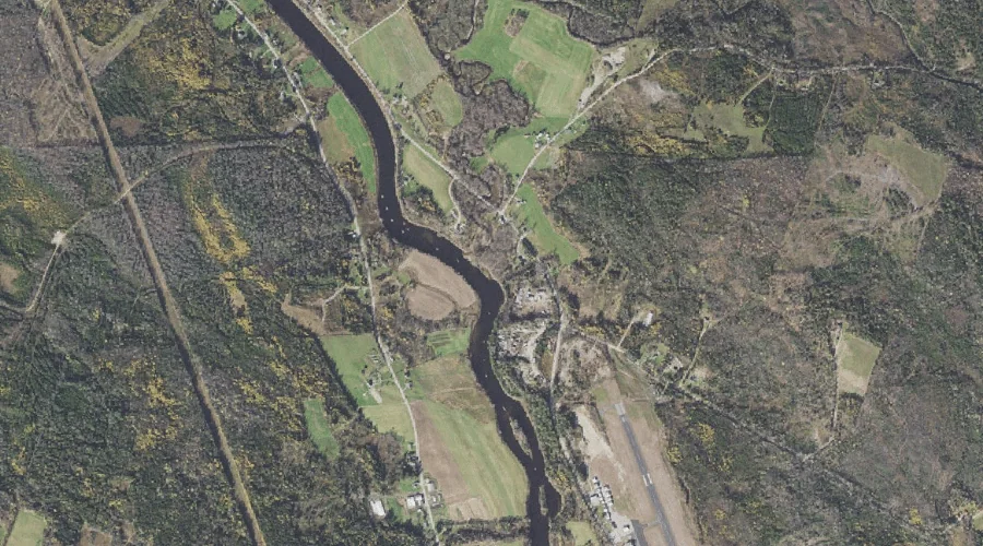
Chickwolnepy Stream — Streams 23.3 Miles WNW of Chapman Inn
Coos County, New Hampshire · USGS Milan Quadrangle · GNIS 866154
23.3 miles west-northwest of Chapman Inn, on the USGS Milan topographic quadrangle, Chickwolnepy Stream is a stream recorded in Coos County, New Hampshire by the federal Geographic Names Information System.
Wikidata short description: “River in New Hampshire, United States”
Landmark Profile
Classification & USGS reference
The USGS Milan 7.5-minute topographic quadrangle places Chickwolnepy Stream in Coos County, New Hampshire (FIPS 33/007), classified as a stream in the federal GNIS (Feature ID 866154). Last revised by the Board on Geographic Names on 02/28/2018.
Coordinates & physical setting
Chickwolnepy Stream sits at 44.58672° N, 71.18591° W (DMS 44°35′12″ N, 71°11′09″ W).
As a linear feature its source lies near 44.57895° N, 71.04758° W (DMS 44°34′44″ N, 71°02′51″ W) — useful for anglers and paddlers tracing the upstream end.
Other streams in Coos County, New Hampshire
Coos County, NH contains 300 streams catalogued in the USGS Geographic Names Information System, counting Chickwolnepy Stream itself. The ones closest to Chickwolnepy Stream:
| Feature | USGS Quadrangle | Distance |
|---|---|---|
| Leavitt Stream | Milan | 1.3 mi |
| Stearns Brook | Milan | 3 mi |
| Robbins Brook | Milan | 3.2 mi |
| Cedar Brook | West Milan | 4.4 mi |
| Island Brook | Teakettle Ridge | 5.1 mi |
| Horne Brook | Milan | 5.2 mi |
| North Branch Stearns Brook | Success Pond | 5.4 mi |
| South Branch Stearns Brook | Success Pond | 5.4 mi |
| Alder Brook | Success Pond | 5.4 mi |
| Bog Brook | Teakettle Ridge | 5.5 mi |
Features on the USGS Milan Quadrangle
The Milan 7.5-minute topographic quadrangle holds 14 catalogued natural features alongside Chickwolnepy Stream. A sampling nearest to this location:
| Feature | Type | County | Offset |
|---|---|---|---|
| Leavitt Stream | Streams | Coos County, NH | 1.3 mi |
| Milan Hill | Summits | Coos County, NH | 2.1 mi |
| Closton Hill | Summits | Coos County, NH | 2.4 mi |
| Jodrie Hill | Summits | Coos County, NH | 2.5 mi |
| Mud Pond Lake | Lakes | Coos County, NH | 2.9 mi |
| Oak Hill | Summits | Coos County, NH | 2.9 mi |
| Stearns Brook | Streams | Coos County, NH | 3 mi |
| Peabody Hill | Summits | Coos County, NH | 3 mi |
| Little Cambridge Mountain | Summits | Coos County, NH | 3.2 mi |
| Robbins Brook | Streams | Coos County, NH | 3.2 mi |
Historical record
Chickwolnepy Stream, also called Chickwollopy, is a 14.2-mile-long (22.9 km) river in northern New Hampshire in the United States. It is a tributary of the Androscoggin River, which flows south and east into Maine, joining the Kennebec River near the Atlantic Ocean. Extended history on Wikipedia →
Visiting from Chapman Inn
Distance, bearing & drive time
Chapman Inn sits 23.3 miles west-northwest (bearing WNW) of Chickwolnepy Stream. At moderate back-road speeds the drive runs about 40 minutes — comfortably inside a half-day outing window after breakfast.
Best time to visit
Best observed in late spring and early summer when flow is strong and banks are visible. Being this far north (lat 44.587°), first snows typically arrive by mid-October and linger into early May — narrow the window accordingly. At 23.3 miles from the Inn, plan on a comfortable day trip with time for lunch on the road. Conditions at Chickwolnepy Stream track the nearby Leavitt Stream (1.3 mi away) closely — if that is runnable, so is this.
Nearest features to Chickwolnepy Stream
| Feature | Type | County | Distance |
|---|---|---|---|
| Leavitt Stream | Streams | Coos County, NH | 1.3 mi |
| Milan Hill | Summits | Coos County, NH | 2.1 mi |
| Closton Hill | Summits | Coos County, NH | 2.4 mi |
| Jodrie Hill | Summits | Coos County, NH | 2.5 mi |
| Mud Pond Lake | Lakes | Coos County, NH | 2.9 mi |
Frequently Asked Questions
Where is Chickwolnepy Stream located?
Chickwolnepy Stream is in Coos County, New Hampshire, approximately 23.3 miles west-northwest of Chapman Inn in Bethel, Maine. It appears on the USGS Milan topographic quadrangle.
How far is Chickwolnepy Stream from Chapman Inn?
The drive runs about 40 minutes, 23.3 miles west-northwest (bearing WNW) of the Inn.
What type of natural feature is Chickwolnepy Stream?
The U.S. Geological Survey classifies Chickwolnepy Stream as a stream, catalogued under GNIS Feature ID 866154 on the Milan quadrangle.
When is the best time to visit Chickwolnepy Stream?
Best observed in late spring and early summer when flow is strong and banks are visible.
How many other streams are in Coos County, New Hampshire?
GNIS lists 299 other streams in Coos County, New Hampshire.
Wikidata: Q5096380.