 Aerial imagery: USGS National Map (public domain)
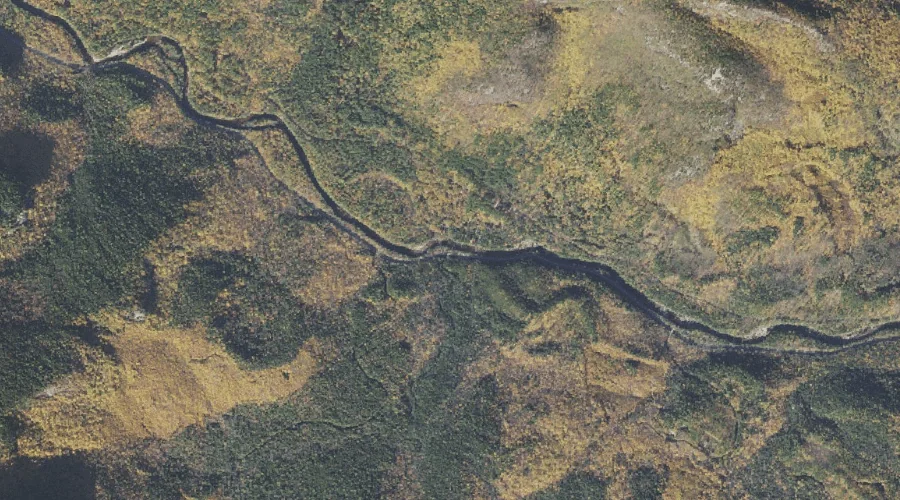
Hobbs Brook — Streams 35.4 Miles SW of Chapman Inn
Carroll County, New Hampshire · USGS Silver Lake Quadrangle · GNIS 872046
35.4 miles southwest of Chapman Inn, on the USGS Silver Lake topographic quadrangle, Hobbs Brook is a stream recorded in Carroll County, New Hampshire by the federal Geographic Names Information System.
Landmark Profile
Classification & USGS reference
The USGS Silver Lake 7.5-minute topographic quadrangle places Hobbs Brook in Carroll County, New Hampshire (FIPS 33/003), classified as a stream in the federal GNIS (Feature ID 872046). Last revised by the Board on Geographic Names on 06/22/2021.
Coordinates & physical setting
Hobbs Brook sits at 43.99370° N, 71.21484° W (DMS 43°59′37″ N, 71°12′53″ W).
As a linear feature its source lies near 43.97025° N, 71.24750° W (DMS 43°58′13″ N, 71°14′51″ W) — useful for anglers and paddlers tracing the upstream end.
Other streams in Carroll County, New Hampshire
Carroll County, NH contains 152 streams catalogued in the USGS Geographic Names Information System, counting Hobbs Brook itself. The ones closest to Hobbs Brook:
| Feature | USGS Quadrangle | Distance |
|---|---|---|
| Big Brook | Silver Lake | 0.6 mi |
| Allard Brook | Silver Lake | 1.5 mi |
| Deer Brook | North Conway West | 2.1 mi |
| Dry Brook | Silver Lake | 2.5 mi |
| Haskell Brook | Bartlett | 2.7 mi |
| Meadow Brook | Silver Lake | 2.9 mi |
| Steam Mill Brook | Mount Chocorua | 3.2 mi |
| Cilley Brook | Bartlett | 3.3 mi |
| Red Eagle Brook | Silver Lake | 3.6 mi |
| Swift Brook | Silver Lake | 3.6 mi |
Features on the USGS Silver Lake Quadrangle
The Silver Lake 7.5-minute topographic quadrangle holds 63 catalogued natural features alongside Hobbs Brook. A sampling nearest to this location:
| Feature | Type | County | Offset |
|---|---|---|---|
| Woodchuck Ledge | Benches | Carroll County, NH | 0.3 mi |
| Big Brook | Streams | Carroll County, NH | 0.6 mi |
| Eagle Ledge | Benches | Carroll County, NH | 0.7 mi |
| White Ledge | Benches | Carroll County, NH | 1.5 mi |
| Allard Brook | Streams | Carroll County, NH | 1.5 mi |
| Sugarloaf | Summits | Carroll County, NH | 1.6 mi |
| Roundtop | Summits | Carroll County, NH | 1.9 mi |
| Dry Brook | Streams | Carroll County, NH | 2.5 mi |
| Bald Hill | Summits | Carroll County, NH | 2.5 mi |
| Birch Hill | Summits | Carroll County, NH | 2.6 mi |
Visiting from Chapman Inn
Distance, bearing & drive time
Chapman Inn sits 35.4 miles southwest (bearing SW) of Hobbs Brook. At moderate back-road speeds the drive runs about 61 minutes — comfortably inside a half-day outing window after breakfast.
Best time to visit
Best observed in late spring and early summer when flow is strong and banks are visible. At this latitude (43.994°), the shoulder seasons are workable — April and November can be comfortable on mild years. At 35.4 miles from the Inn, block the full day — sunrise start, late return, packed meals. Conditions at Hobbs Brook track the nearby Woodchuck Ledge bench terrace (0.3 mi away) closely — if that is runnable, so is this.
Nearest features to Hobbs Brook
| Feature | Type | County | Distance |
|---|---|---|---|
| Woodchuck Ledge | Benches | Carroll County, NH | 0.3 mi |
| Big Brook | Streams | Carroll County, NH | 0.6 mi |
| Eagle Ledge | Benches | Carroll County, NH | 0.7 mi |
| Haystack | Pillars | Carroll County, NH | 1 mi |
| White Ledge | Benches | Carroll County, NH | 1.5 mi |
Frequently Asked Questions
Where is Hobbs Brook located?
Hobbs Brook is in Carroll County, New Hampshire, approximately 35.4 miles southwest of Chapman Inn in Bethel, Maine. It appears on the USGS Silver Lake topographic quadrangle.
How far is Hobbs Brook from Chapman Inn?
The drive runs about 61 minutes, 35.4 miles southwest (bearing SW) of the Inn.
What type of natural feature is Hobbs Brook?
The U.S. Geological Survey classifies Hobbs Brook as a stream, catalogued under GNIS Feature ID 872046 on the Silver Lake quadrangle.
When is the best time to visit Hobbs Brook?
Best observed in late spring and early summer when flow is strong and banks are visible.
How many other streams are in Carroll County, New Hampshire?
GNIS lists 151 other streams in Carroll County, New Hampshire.