 Aerial imagery: USGS National Map (public domain)
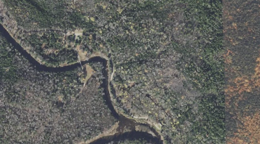
Dart Wentworth Spring — Springs 35.9 Miles NNW of Chapman Inn
Coos County, New Hampshire · USGS Wilsons Mills Quadrangle · GNIS 871087
One of only 11 springs catalogued within the 80 km reach of Chapman Inn, Dart Wentworth Spring lies on the USGS Wilsons Mills quadrangle in Coos County, New Hampshire — 35.9 miles north-northwest of the Inn.
Wikidata short description: “spring in Coös County, New Hampshire, United States of America”
Landmark Profile
Classification & USGS reference
Catalogued under GNIS Feature ID 871087, Dart Wentworth Spring is recorded as a spring on the USGS Wilsons Mills quadrangle in Coos County, New Hampshire (FIPS 33/007). Catalogued in GNIS since 02/01/1990.
Coordinates & physical setting
Dart Wentworth Spring sits at 44.88449° N, 71.07119° W (DMS 44°53′04″ N, 71°04′16″ W).
Features on the USGS Wilsons Mills Quadrangle
The Wilsons Mills 7.5-minute topographic quadrangle holds 35 catalogued natural features alongside Dart Wentworth Spring. A sampling nearest to this location:
| Feature | Type | County | Offset |
|---|---|---|---|
| Swift Diamond River | Streams | Coos County, NH | 0.2 mi |
| Alice Ledge | Cliffs | Coos County, NH | 0.4 mi |
| Linda Ledge | Cliffs | Coos County, NH | 0.5 mi |
| Diamond Peaks | Summits | Coos County, NH | 0.7 mi |
| Dead Diamond River | Streams | Coos County, NH | 1.2 mi |
| Windey Ridge | Ridges | Coos County, NH | 1.4 mi |
| Meadow Brook | Streams | Oxford County, ME | 1.8 mi |
| Alder Brook | Streams | Coos County, NH | 1.8 mi |
| Rands Rock | Summits | Coos County, NH | 2.2 mi |
| Bennett Brook | Streams | Coos County, NH | 2.2 mi |
Ranking & rarity
- Among the 11 springs catalogued within 80 km of Chapman Inn, Dart Wentworth Spring ranks #8 by proximity to the Inn (closer than 27%).
- This is one of only 11 springs catalogued within Chapman Inn’s 80 km reach — a rare classification in the local landscape.
Visiting from Chapman Inn
Distance, bearing & drive time
A 62-minute drive along back roads separates the front door of Chapman Inn from Dart Wentworth Spring — 35.9 miles north-northwest as the crow flies, on compass bearing NNW.
Best time to visit
Best observed in late spring and early summer when flow is strong and banks are visible. Being this far north (lat 44.884°), first snows typically arrive by mid-October and linger into early May — narrow the window accordingly. At 35.9 miles from the Inn, block the full day — sunrise start, late return, packed meals. Conditions at Dart Wentworth Spring track the nearby Swift Diamond River stream (0.2 mi away) closely — if that is runnable, so is this.
Nearest features to Dart Wentworth Spring
| Feature | Type | County | Distance |
|---|---|---|---|
| Swift Diamond River | Streams | Coos County, NH | 0.2 mi |
| Alice Ledge | Cliffs | Coos County, NH | 0.4 mi |
| Linda Ledge | Cliffs | Coos County, NH | 0.5 mi |
| Diamond Peaks | Summits | Coos County, NH | 0.7 mi |
| Dead Diamond River | Streams | Coos County, NH | 1.2 mi |
Frequently Asked Questions
Where is Dart Wentworth Spring located?
Dart Wentworth Spring is in Coos County, New Hampshire, approximately 35.9 miles north-northwest of Chapman Inn in Bethel, Maine. It appears on the USGS Wilsons Mills topographic quadrangle.
How far is Dart Wentworth Spring from Chapman Inn?
The drive runs about 62 minutes, 35.9 miles north-northwest (bearing NNW) of the Inn.
What type of natural feature is Dart Wentworth Spring?
The U.S. Geological Survey classifies Dart Wentworth Spring as a spring, catalogued under GNIS Feature ID 871087 on the Wilsons Mills quadrangle.
When is the best time to visit Dart Wentworth Spring?
Best observed in late spring and early summer when flow is strong and banks are visible.
How rare is springs as a classification near Chapman Inn?
Only 11 springs are catalogued within the 80 km radius of the Inn — a comparatively rare classification.
Wikidata: Q34968345.