 Aerial imagery: USGS National Map (public domain)
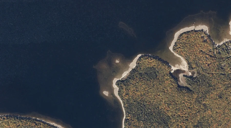
Mooselookmeguntic Lake — Reservoirs 34.4 Miles N of Chapman Inn
Oxford County, Maine · USGS Oquossoc Quadrangle · GNIS 571651
Catalogued on the USGS Oquossoc quadrangle in Oxford County, Maine, Mooselookmeguntic Lake — a reservoir — lies 34.4 miles north of Chapman Inn.
Landmark Profile
Classification & USGS reference
Catalogued under GNIS Feature ID 571651, Mooselookmeguntic Lake is recorded as a reservoir on the USGS Oquossoc quadrangle in Oxford County, Maine (FIPS 23/017). Last revised by the Board on Geographic Names on 05/15/2018.
Coordinates & physical setting
Mooselookmeguntic Lake sits at 44.90209° N, 70.80004° W (DMS 44°54′08″ N, 70°48′00″ W).
Other reservoirs in Oxford County, Maine
Oxford County, ME contains 51 reservoirs catalogued in the USGS Geographic Names Information System, counting Mooselookmeguntic Lake itself. The ones closest to Mooselookmeguntic Lake:
| Feature | USGS Quadrangle | Distance |
|---|---|---|
| Lower Richardson Lake | Middle Dam | 9.7 mi |
| Richardson Lake | Middle Dam | 11.6 mi |
| Aziscohos Lake | Wilsons Mills | 11.6 mi |
| Swift River Reservoir | Rumford | 24.6 mi |
| Androscoggin River Reservoir | Rumford | 27.5 mi |
| Androscoggin River Reservoir | Rumford | 27.8 mi |
| Androscoggin River Reservoir | Rumford | 28.2 mi |
| Mount Zircon Reservoir | Mount Zircon | 30.2 mi |
| Round Pond | Bryant Pond | 35 mi |
| Alder River South Branch Reservoir | Bryant Pond | 35.2 mi |
Features on the USGS Oquossoc Quadrangle
The Oquossoc 7.5-minute topographic quadrangle holds 34 catalogued natural features alongside Mooselookmeguntic Lake. A sampling nearest to this location:
| Feature | Type | County | Offset |
|---|---|---|---|
| Students Island | Islands | Oxford County, ME | 0.6 mi |
| Birch Point | Capes | Oxford County, ME | 1.4 mi |
| Brandy Point | Capes | Oxford County, ME | 1.5 mi |
| Sandy Cove | Bays | Oxford County, ME | 2.3 mi |
| Farrington Island | Islands | Oxford County, ME | 2.5 mi |
| Black Point | Capes | Oxford County, ME | 2.5 mi |
| Shelter Island | Islands | Oxford County, ME | 2.9 mi |
| Lunch Island | Islands | Oxford County, ME | 3.1 mi |
| Turner Island | Islands | Oxford County, ME | 3.1 mi |
| Bald Mountain | Summits | Franklin County, ME | 3.1 mi |
Historical record
The U.S. Board on Geographic Names recorded a Official (Board Decision) on January 1, 1894 for this name.
Visiting from Chapman Inn
Distance, bearing & drive time
A 59-minute drive along back roads separates the front door of Chapman Inn from Mooselookmeguntic Lake — 34.4 miles north as the crow flies, on compass bearing N.
Best time to visit
June through September for paddling and swimming; January through March for ice fishing. Being this far north (lat 44.902°), first snows typically arrive by mid-October and linger into early May — narrow the window accordingly. At 34.4 miles from the Inn, block the full day — sunrise start, late return, packed meals. Conditions at Mooselookmeguntic Lake track the nearby Students Island (0.6 mi away) closely — if that is runnable, so is this.
Nearest features to Mooselookmeguntic Lake
| Feature | Type | County | Distance |
|---|---|---|---|
| Students Island | Islands | Oxford County, ME | 0.6 mi |
| Birch Point | Capes | Oxford County, ME | 1.4 mi |
| Brandy Point | Capes | Oxford County, ME | 1.5 mi |
| Sandy Cove | Bays | Oxford County, ME | 2.3 mi |
| Farrington Island | Islands | Oxford County, ME | 2.5 mi |
Frequently Asked Questions
Where is Mooselookmeguntic Lake located?
Mooselookmeguntic Lake is in Oxford County, Maine, approximately 34.4 miles north of Chapman Inn in Bethel, Maine. It appears on the USGS Oquossoc topographic quadrangle.
How far is Mooselookmeguntic Lake from Chapman Inn?
The drive runs about 59 minutes, 34.4 miles north (bearing N) of the Inn.
What type of natural feature is Mooselookmeguntic Lake?
The U.S. Geological Survey classifies Mooselookmeguntic Lake as a reservoir, catalogued under GNIS Feature ID 571651 on the Oquossoc quadrangle.
When is the best time to visit Mooselookmeguntic Lake?
June through September for paddling and swimming; January through March for ice fishing.
How many other reservoirs are in Oxford County, Maine?
GNIS lists 50 other reservoirs in Oxford County, Maine.