 Aerial imagery: USGS National Map (public domain)
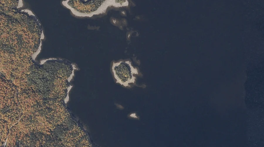
Farrington Island — Islands 36.2 Miles N of Chapman Inn
Oxford County, Maine · USGS Oquossoc Quadrangle · GNIS 566071
Catalogued on the USGS Oquossoc quadrangle in Oxford County, Maine, Farrington Island — a island — lies 36.2 miles north of Chapman Inn.
Wikidata short description: “island in Oxford County, Maine, United States of America”
Landmark Profile
Classification & USGS reference
Catalogued under GNIS Feature ID 566071, Farrington Island is recorded as a island on the USGS Oquossoc quadrangle in Oxford County, Maine (FIPS 23/017). Catalogued in GNIS since 09/30/1980.
Coordinates & physical setting
Farrington Island sits at 44.92728° N, 70.83701° W (DMS 44°55′38″ N, 70°50′13″ W).
Other islands in Oxford County, Maine
Oxford County, ME contains 44 islands catalogued in the USGS Geographic Names Information System, counting Farrington Island itself. The ones closest to Farrington Island:
| Feature | USGS Quadrangle | Distance |
|---|---|---|
| Shelter Island | Oquossoc | 0.4 mi |
| Johnson Island | Oquossoc | 1.2 mi |
| Lunch Island | Oquossoc | 1.2 mi |
| Turner Island | Oquossoc | 1.4 mi |
| Griffin Island | Oquossoc | 1.6 mi |
| Students Island | Oquossoc | 2.7 mi |
| Dollar Island | Oquossoc | 3.5 mi |
| Browns Island | Oquossoc | 4 mi |
| Blueberry Island | Oquossoc | 4.1 mi |
| Big Beaver Island | Richardson Pond | 4.2 mi |
Features on the USGS Oquossoc Quadrangle
The Oquossoc 7.5-minute topographic quadrangle holds 34 catalogued natural features alongside Farrington Island. A sampling nearest to this location:
| Feature | Type | County | Offset |
|---|---|---|---|
| Shelter Island | Islands | Oxford County, ME | 0.4 mi |
| Wildwood Cove | Bays | Oxford County, ME | 0.8 mi |
| Goodwin Pond | Lakes | Oxford County, ME | 1.1 mi |
| Johnson Island | Islands | Oxford County, ME | 1.2 mi |
| Lunch Island | Islands | Oxford County, ME | 1.2 mi |
| Birch Point | Capes | Oxford County, ME | 1.4 mi |
| Turner Island | Islands | Oxford County, ME | 1.4 mi |
| Griffin Island | Islands | Oxford County, ME | 1.6 mi |
| Stony Batter Point | Capes | Oxford County, ME | 1.9 mi |
| Bowley Rock | Pillars | Oxford County, ME | 2.1 mi |
Visiting from Chapman Inn
Distance, bearing & drive time
A 62-minute drive along back roads separates the front door of Chapman Inn from Farrington Island — 36.2 miles north as the crow flies, on compass bearing N.
Best time to visit
Late May through early October, when the water is safe for small-boat access. Being this far north (lat 44.927°), first snows typically arrive by mid-October and linger into early May — narrow the window accordingly. At 36.2 miles from the Inn, block the full day — sunrise start, late return, packed meals. Conditions at Farrington Island track the nearby Shelter Island (0.4 mi away) closely — if that is runnable, so is this.
Nearest features to Farrington Island
| Feature | Type | County | Distance |
|---|---|---|---|
| Shelter Island | Islands | Oxford County, ME | 0.4 mi |
| Wildwood Cove | Bays | Oxford County, ME | 0.8 mi |
| Goodwin Pond | Lakes | Oxford County, ME | 1.1 mi |
| Johnson Island | Islands | Oxford County, ME | 1.2 mi |
| Lunch Island | Islands | Oxford County, ME | 1.2 mi |
Frequently Asked Questions
Where is Farrington Island located?
Farrington Island is in Oxford County, Maine, approximately 36.2 miles north of Chapman Inn in Bethel, Maine. It appears on the USGS Oquossoc topographic quadrangle.
How far is Farrington Island from Chapman Inn?
The drive runs about 62 minutes, 36.2 miles north (bearing N) of the Inn.
What type of natural feature is Farrington Island?
The U.S. Geological Survey classifies Farrington Island as a island, catalogued under GNIS Feature ID 566071 on the Oquossoc quadrangle.
When is the best time to visit Farrington Island?
Late May through early October, when the water is safe for small-boat access.
How many other islands are in Oxford County, Maine?
GNIS lists 43 other islands in Oxford County, Maine.
Wikidata: Q49637871.