 Aerial imagery: USGS National Map (public domain)
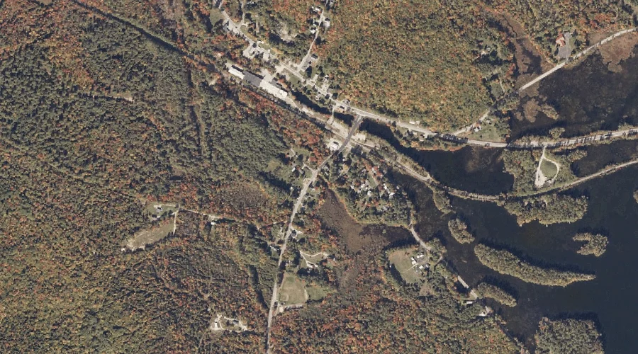
Alder River South Branch Reservoir — Reservoirs 4.3 Miles E of Chapman Inn
Oxford County, Maine · USGS Bryant Pond Quadrangle · GNIS 1774544
Within Oxford County, Maine, on the USGS Bryant Pond quadrangle, the reservoir known as Alder River South Branch Reservoir sits 4.3 miles east of Chapman Inn.
Landmark Profile
Classification & USGS reference
Within Oxford County, Maine, the U.S. Geological Survey lists Alder River South Branch Reservoir as a reservoir on the Bryant Pond topographic quadrangle (FIPS 23/017), under Feature ID 1774544. Last revised by the Board on Geographic Names on 05/24/2010.
Coordinates & physical setting
Alder River South Branch Reservoir sits at 44.39734° N, 70.70245° W (DMS 44°23′50″ N, 70°42′09″ W).
Other reservoirs in Oxford County, Maine
Oxford County, ME contains 51 reservoirs catalogued in the USGS Geographic Names Information System, counting Alder River South Branch Reservoir itself. The ones closest to Alder River South Branch Reservoir:
| Feature | USGS Quadrangle | Distance |
|---|---|---|
| Round Pond | Bryant Pond | 0.2 mi |
| Twitchell Pond | Greenwood | 2.9 mi |
| Bryant Pond | Bryant Pond | 2.9 mi |
| Hicks Pond | Greenwood | 6.4 mi |
| Patte Brook Waterfowl Impoundment Reservoir | East Stoneham | 7.9 mi |
| Little Androscoggin River Reservoir | West Paris | 8.1 mi |
| Mount Zircon Reservoir | Mount Zircon | 9.5 mi |
| North Pond | West Paris | 10.4 mi |
| Keewaydin Lake | East Stoneham | 11.4 mi |
| Virginia Lake | East Stoneham | 11.8 mi |
Features on the USGS Bryant Pond Quadrangle
The Bryant Pond 7.5-minute topographic quadrangle holds 29 catalogued natural features alongside Alder River South Branch Reservoir. A sampling nearest to this location:
| Feature | Type | County | Offset |
|---|---|---|---|
| Round Pond | Reservoirs | Oxford County, ME | 0.2 mi |
| Howe Hill | Summits | Oxford County, ME | 0.9 mi |
| Beaver Brook | Streams | Oxford County, ME | 1 mi |
| South Pond | Lakes | Oxford County, ME | 1.1 mi |
| McCrillian Brook | Streams | Oxford County, ME | 1.3 mi |
| North Pond | Lakes | Oxford County, ME | 1.4 mi |
| Peaked Mountain | Summits | Oxford County, ME | 1.5 mi |
| Goss Ledge | Cliffs | Oxford County, ME | 1.6 mi |
| Oak Hill | Summits | Oxford County, ME | 1.8 mi |
| Bucks Ledge | Cliffs | Oxford County, ME | 2 mi |
Visiting from Chapman Inn
Distance, bearing & drive time
Follow the compass bearing E out of Bethel for 4.3 miles (east) and you reach Alder River South Branch Reservoir; at typical rural speeds the trip runs roughly 7 minutes.
Best time to visit
June through September for paddling and swimming; January through March for ice fishing. At this latitude (44.397°), the shoulder seasons are workable — April and November can be comfortable on mild years. The 4.3-mile drive from Chapman Inn makes it practical for a half-day outing — you can check conditions in the morning and still turn back if the weather closes in. Conditions at Alder River South Branch Reservoir track the nearby Round Pond reservoir (0.2 mi away) closely — if that is runnable, so is this.
Nearest features to Alder River South Branch Reservoir
| Feature | Type | County | Distance |
|---|---|---|---|
| Round Pond | Reservoirs | Oxford County, ME | 0.2 mi |
| Howe Hill | Summits | Oxford County, ME | 0.9 mi |
| Beaver Brook | Streams | Oxford County, ME | 1 mi |
| South Pond | Lakes | Oxford County, ME | 1.1 mi |
| McCrillian Brook | Streams | Oxford County, ME | 1.3 mi |
Frequently Asked Questions
Where is Alder River South Branch Reservoir located?
Alder River South Branch Reservoir is in Oxford County, Maine, approximately 4.3 miles east of Chapman Inn in Bethel, Maine. It appears on the USGS Bryant Pond topographic quadrangle.
How far is Alder River South Branch Reservoir from Chapman Inn?
The drive runs about 7 minutes, 4.3 miles east (bearing E) of the Inn.
What type of natural feature is Alder River South Branch Reservoir?
The U.S. Geological Survey classifies Alder River South Branch Reservoir as a reservoir, catalogued under GNIS Feature ID 1774544 on the Bryant Pond quadrangle.
When is the best time to visit Alder River South Branch Reservoir?
June through September for paddling and swimming; January through March for ice fishing.
How many other reservoirs are in Oxford County, Maine?
GNIS lists 50 other reservoirs in Oxford County, Maine.