 Aerial imagery: USGS National Map (public domain)
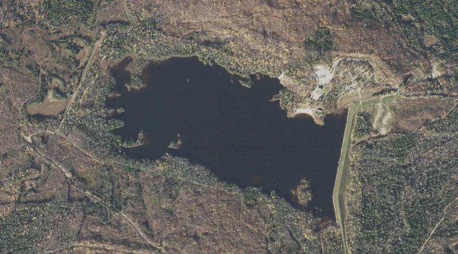
Jericho Lake — Reservoirs 24.2 Miles WNW of Chapman Inn
Coos County, New Hampshire · USGS Mount Crescent Quadrangle · GNIS 1775604
24.2 miles west-northwest of Chapman Inn, on the USGS Mount Crescent topographic quadrangle, Jericho Lake is a reservoir recorded in Coos County, New Hampshire by the federal Geographic Names Information System.
Landmark Profile
Classification & USGS reference
The USGS Mount Crescent 7.5-minute topographic quadrangle places Jericho Lake in Coos County, New Hampshire (FIPS 33/007), classified as a reservoir in the federal GNIS (Feature ID 1775604). Last revised by the Board on Geographic Names on 06/16/2021.
Coordinates & physical setting
Jericho Lake sits at 44.49801° N, 71.26270° W (DMS 44°29′53″ N, 71°15′46″ W).
Other reservoirs in Coos County, New Hampshire
Coos County, NH contains 30 reservoirs catalogued in the USGS Geographic Names Information System, counting Jericho Lake itself. The ones closest to Jericho Lake:
| Feature | USGS Quadrangle | Distance |
|---|---|---|
| Godfrey Pond | Mount Crescent | 3.1 mi |
| York Pond | West Milan | 3.7 mi |
| J Brodie Smith Reservoir | Berlin | 4.8 mi |
| Androscoggin River Reservoir | Berlin | 4.8 mi |
| Androscoggin River Reservoir | Berlin | 5 mi |
| Androscoggin River Reservoir | Berlin | 5.1 mi |
| Cascade Mill Lagoons | Berlin | 5.2 mi |
| Cascade Brook Reservoir | Berlin | 5.5 mi |
| Berlin Reservoir | Berlin | 5.9 mi |
| Anderson Reservoir | Berlin | 6.1 mi |
Features on the USGS Mount Crescent Quadrangle
The Mount Crescent 7.5-minute topographic quadrangle holds 23 catalogued natural features alongside Jericho Lake. A sampling nearest to this location:
| Feature | Type | County | Offset |
|---|---|---|---|
| West Branch Upper Ammonoosuc River | Streams | Coos County, NH | 2.2 mi |
| Lonesome Ridge | Ridges | Coos County, NH | 2.9 mi |
| Godfrey Pond | Reservoirs | Coos County, NH | 3.1 mi |
| Bend Brook | Streams | Coos County, NH | 3.3 mi |
| Brandy Brook | Streams | Coos County, NH | 3.9 mi |
| Refuge Brook | Streams | Coos County, NH | 4 mi |
| Black Crescent Mountain | Summits | Coos County, NH | 4 mi |
| Crescent Range | Ranges | Coos County, NH | 4.1 mi |
| Number Nine Brook | Streams | Coos County, NH | 4.1 mi |
| Spring Brook | Streams | Coos County, NH | 4.3 mi |
Visiting from Chapman Inn
Distance, bearing & drive time
Chapman Inn sits 24.2 miles west-northwest (bearing WNW) of Jericho Lake. At moderate back-road speeds the drive runs about 42 minutes — comfortably inside a half-day outing window after breakfast.
Best time to visit
June through September for paddling and swimming; January through March for ice fishing. Being this far north (lat 44.498°), first snows typically arrive by mid-October and linger into early May — narrow the window accordingly. At 24.2 miles from the Inn, plan on a comfortable day trip with time for lunch on the road. Conditions at Jericho Lake track the nearby One Mile Brook stream (1.7 mi away) closely — if that is runnable, so is this.
Nearest features to Jericho Lake
| Feature | Type | County | Distance |
|---|---|---|---|
| One Mile Brook | Streams | Coos County, NH | 1.7 mi |
| Betty Brook | Streams | Coos County, NH | 1.9 mi |
| Jericho Brook | Streams | Coos County, NH | 2 mi |
| West Branch Upper Ammonoosuc River | Streams | Coos County, NH | 2.2 mi |
| Head Pond | Lakes | Coos County, NH | 2.2 mi |
Frequently Asked Questions
Where is Jericho Lake located?
Jericho Lake is in Coos County, New Hampshire, approximately 24.2 miles west-northwest of Chapman Inn in Bethel, Maine. It appears on the USGS Mount Crescent topographic quadrangle.
How far is Jericho Lake from Chapman Inn?
The drive runs about 42 minutes, 24.2 miles west-northwest (bearing WNW) of the Inn.
What type of natural feature is Jericho Lake?
The U.S. Geological Survey classifies Jericho Lake as a reservoir, catalogued under GNIS Feature ID 1775604 on the Mount Crescent quadrangle.
When is the best time to visit Jericho Lake?
June through September for paddling and swimming; January through March for ice fishing.
How many other reservoirs are in Coos County, New Hampshire?
GNIS lists 29 other reservoirs in Coos County, New Hampshire.