 Aerial imagery: USGS National Map (public domain)
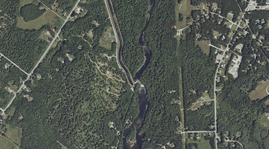
Eel Weir Canal — Reservoirs 43.9 Miles SSE of Chapman Inn
Cumberland County, Maine · USGS North Windham Quadrangle · GNIS 1773632
Within Cumberland County, Maine, on the USGS North Windham quadrangle, the reservoir known as Eel Weir Canal sits 43.9 miles south-southeast of Chapman Inn.
Wikidata short description: “canal in Cumberland County, Maine, United States of America”
Landmark Profile
Classification & USGS reference
Within Cumberland County, Maine, the U.S. Geological Survey lists Eel Weir Canal as a reservoir on the North Windham topographic quadrangle (FIPS 23/005), under Feature ID 1773632. Catalogued in GNIS since 01/08/1998.
Coordinates & physical setting
Eel Weir Canal sits at 43.81841° N, 70.44950° W (DMS 43°49′06″ N, 70°26′58″ W).
Other reservoirs in Cumberland County, Maine
Cumberland County, ME contains 29 reservoirs catalogued in the USGS Geographic Names Information System, counting Eel Weir Canal itself. The ones closest to Eel Weir Canal:
| Feature | USGS Quadrangle | Distance |
|---|---|---|
| Sebago Lake Basin | North Windham | 1.1 mi |
| Mill Pond | North Windham | 1.9 mi |
| Dundee Pond | North Windham | 2.2 mi |
| Little Sebago Lake | Raymond | 4.6 mi |
| Half Moon Pond | Sebago Lake | 5 mi |
| Sebago Lake | Sebago Lake | 5.6 mi |
| Highland Lake | Cumberland Center | 5.6 mi |
| Rich Millpond | Sebago Lake | 6.4 mi |
| Panther Pond | Raymond | 7.5 mi |
| Thomas Pond | Naples | 7.6 mi |
Features on the USGS North Windham Quadrangle
The North Windham 7.5-minute topographic quadrangle holds 58 catalogued natural features alongside Eel Weir Canal. A sampling nearest to this location:
| Feature | Type | County | Offset |
|---|---|---|---|
| Gillman Island | Islands | Cumberland County, ME | 0.3 mi |
| Eel Weir Canal | Other Natural Features | Cumberland County, ME | 0.3 mi |
| Rollins Hill | Summits | Cumberland County, ME | 0.4 mi |
| Lindsay Island | Islands | Cumberland County, ME | 1.1 mi |
| Sebago Lake Basin | Reservoirs | Cumberland County, ME | 1.1 mi |
| Otter Brook | Streams | Cumberland County, ME | 1.3 mi |
| Whites Hill | Summits | Cumberland County, ME | 1.5 mi |
| Collins Pond | Lakes | Cumberland County, ME | 1.5 mi |
| Outlet Brook | Streams | Cumberland County, ME | 1.8 mi |
| Windham Hill | Summits | Cumberland County, ME | 1.8 mi |
Visiting from Chapman Inn
Distance, bearing & drive time
Follow the compass bearing SSE out of Bethel for 43.9 miles (south-southeast) and you reach Eel Weir Canal; at typical rural speeds the trip runs roughly 75 minutes.
Best time to visit
June through September for paddling and swimming; January through March for ice fishing. At this latitude (43.818°), the shoulder seasons are workable — April and November can be comfortable on mild years. At 43.9 miles from the Inn, block the full day — sunrise start, late return, packed meals. Conditions at Eel Weir Canal track the nearby Gillman Island (0.3 mi away) closely — if that is runnable, so is this.
Nearest features to Eel Weir Canal
| Feature | Type | County | Distance |
|---|---|---|---|
| Gillman Island | Islands | Cumberland County, ME | 0.3 mi |
| Eel Weir Canal | Other Natural Features | Cumberland County, ME | 0.3 mi |
| Rollins Hill | Summits | Cumberland County, ME | 0.4 mi |
| Lindsay Island | Islands | Cumberland County, ME | 1.1 mi |
| Sebago Lake Basin | Reservoirs | Cumberland County, ME | 1.1 mi |
Frequently Asked Questions
Where is Eel Weir Canal located?
Eel Weir Canal is in Cumberland County, Maine, approximately 43.9 miles south-southeast of Chapman Inn in Bethel, Maine. It appears on the USGS North Windham topographic quadrangle.
How far is Eel Weir Canal from Chapman Inn?
The drive runs about 75 minutes, 43.9 miles south-southeast (bearing SSE) of the Inn.
What type of natural feature is Eel Weir Canal?
The U.S. Geological Survey classifies Eel Weir Canal as a reservoir, catalogued under GNIS Feature ID 1773632 on the North Windham quadrangle.
When is the best time to visit Eel Weir Canal?
June through September for paddling and swimming; January through March for ice fishing.
How many other reservoirs are in Cumberland County, Maine?
GNIS lists 28 other reservoirs in Cumberland County, Maine.
Wikidata: Q33191904.