 Aerial imagery: USGS National Map (public domain)
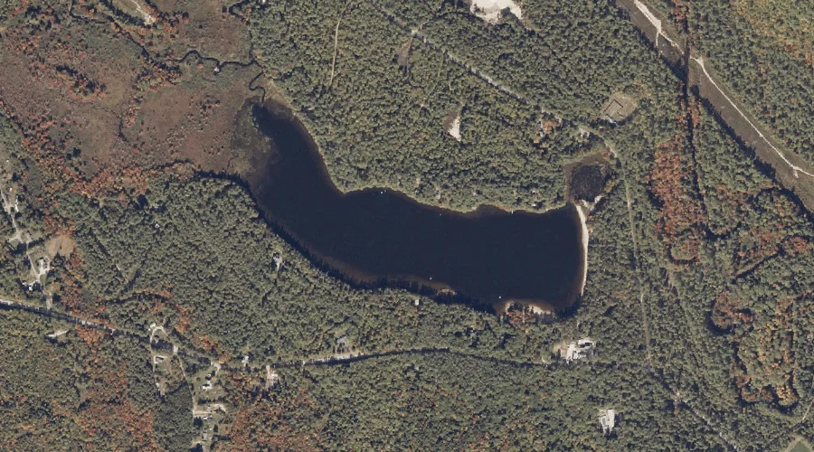
Papoose Pond — Lakes 12.5 Miles SSE of Chapman Inn
Oxford County, Maine · USGS Waterford Flat Quadrangle · GNIS 572957
Within Oxford County, Maine, on the USGS Waterford Flat quadrangle, the lake known as Papoose Pond sits 12.5 miles south-southeast of Chapman Inn.
Landmark Profile
Classification & USGS reference
Within Oxford County, Maine, the U.S. Geological Survey lists Papoose Pond as a lake on the Waterford Flat topographic quadrangle (FIPS 23/017), under Feature ID 572957. Last revised by the Board on Geographic Names on 05/15/2018.
Coordinates & physical setting
Papoose Pond sits at 44.23282° N, 70.71325° W (DMS 44°13′58″ N, 70°42′48″ W).
Other lakes in Oxford County, Maine
Oxford County, ME contains 157 lakes catalogued in the USGS Geographic Names Information System, counting Papoose Pond itself. The ones closest to Papoose Pond:
| Feature | USGS Quadrangle | Distance |
|---|---|---|
| Speck Ponds | Greenwood | 2.2 mi |
| Chalk Pond | East Stoneham | 2.9 mi |
| Hutchinson Pond | Greenwood | 2.9 mi |
| Mud Pond | North Waterford | 3.4 mi |
| McWain Pond | Waterford Flat | 3.5 mi |
| Furlong Pond | Greenwood | 3.6 mi |
| Keoka Lake | Waterford Flat | 3.7 mi |
| Whitney Pond | North Waterford | 4 mi |
| Proctor Pond | North Waterford | 4.2 mi |
| Weymouth Pond | North Waterford | 4.4 mi |
Features on the USGS Waterford Flat Quadrangle
The Waterford Flat 7.5-minute topographic quadrangle holds 47 catalogued natural features alongside Papoose Pond. A sampling nearest to this location:
| Feature | Type | County | Offset |
|---|---|---|---|
| Swell Brook | Streams | Oxford County, ME | 0.6 mi |
| Hobbs Brook | Streams | Oxford County, ME | 0.6 mi |
| Hemlock Brook | Streams | Oxford County, ME | 0.6 mi |
| Pulpit Rock | Summits | Oxford County, ME | 0.9 mi |
| Page Mountain | Summits | Oxford County, ME | 1.2 mi |
| Hemlock Hill | Summits | Oxford County, ME | 1.5 mi |
| McIntire Brook | Streams | Oxford County, ME | 1.5 mi |
| Brown Hill | Summits | Oxford County, ME | 1.6 mi |
| Rice Hill | Summits | Oxford County, ME | 1.7 mi |
| Newcomb Mountain | Summits | Oxford County, ME | 1.9 mi |
Visiting from Chapman Inn
Distance, bearing & drive time
Follow the compass bearing SSE out of Bethel for 12.5 miles (south-southeast) and you reach Papoose Pond; at typical rural speeds the trip runs roughly 21 minutes.
Best time to visit
June through September for paddling and swimming; January through March for ice fishing. At this latitude (44.233°), the shoulder seasons are workable — April and November can be comfortable on mild years. At 12.5 miles from the Inn, plan on a comfortable day trip with time for lunch on the road. Conditions at Papoose Pond track the nearby Swell Brook stream (0.6 mi away) closely — if that is runnable, so is this.
Nearest features to Papoose Pond
| Feature | Type | County | Distance |
|---|---|---|---|
| Swell Brook | Streams | Oxford County, ME | 0.6 mi |
| Hobbs Brook | Streams | Oxford County, ME | 0.6 mi |
| Hemlock Brook | Streams | Oxford County, ME | 0.6 mi |
| Pulpit Rock | Summits | Oxford County, ME | 0.9 mi |
| Page Mountain | Summits | Oxford County, ME | 1.2 mi |
Frequently Asked Questions
Where is Papoose Pond located?
Papoose Pond is in Oxford County, Maine, approximately 12.5 miles south-southeast of Chapman Inn in Bethel, Maine. It appears on the USGS Waterford Flat topographic quadrangle.
How far is Papoose Pond from Chapman Inn?
The drive runs about 21 minutes, 12.5 miles south-southeast (bearing SSE) of the Inn.
What type of natural feature is Papoose Pond?
The U.S. Geological Survey classifies Papoose Pond as a lake, catalogued under GNIS Feature ID 572957 on the Waterford Flat quadrangle.
When is the best time to visit Papoose Pond?
June through September for paddling and swimming; January through March for ice fishing.
How many other lakes are in Oxford County, Maine?
GNIS lists 156 other lakes in Oxford County, Maine.