 Aerial imagery: USGS National Map (public domain)
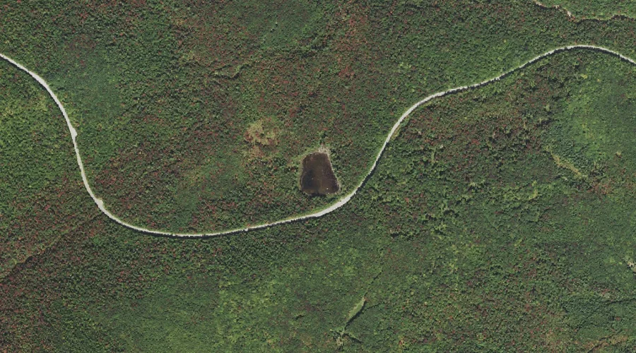
Lily Pond — Lakes 42.4 Miles SW of Chapman Inn
Grafton County, New Hampshire · USGS Mount Carrigain Quadrangle · GNIS 872170
Catalogued on the USGS Mount Carrigain quadrangle in Grafton County, New Hampshire, Lily Pond — a lake — lies 42.4 miles southwest of Chapman Inn.
Landmark Profile
Classification & USGS reference
Catalogued under GNIS Feature ID 872170, Lily Pond is recorded as a lake on the USGS Mount Carrigain quadrangle in Grafton County, New Hampshire (FIPS 33/009). Last revised by the Board on Geographic Names on 05/15/2018.
Coordinates & physical setting
Lily Pond sits at 44.01825° N, 71.45292° W (DMS 44°01′06″ N, 71°27′11″ W).
Other lakes in Grafton County, New Hampshire
Grafton County, NH contains 24 lakes catalogued in the USGS Geographic Names Information System, counting Lily Pond itself. The ones closest to Lily Pond:
| Feature | USGS Quadrangle | Distance |
|---|---|---|
| Greeley Ponds | Mount Osceola | 2.7 mi |
| Church Ponds | Mount Carrigain | 3.6 mi |
| Sawyer Pond | Mount Carrigain | 4.3 mi |
| Little Sawyer Pond | Mount Carrigain | 4.3 mi |
| Carrigain Pond | Mount Carrigain | 4.8 mi |
| East Pond | Mount Osceola | 5.7 mi |
| Little East Pond | Mount Osceola | 6.5 mi |
| Nancy Pond | Mount Carrigain | 6.9 mi |
| Norcross Pond | Mount Carrigain | 7.1 mi |
| Flat Mountain Ponds | Mount Tripyramid | 7.2 mi |
Features on the USGS Mount Carrigain Quadrangle
The Mount Carrigain 7.5-minute topographic quadrangle holds 36 catalogued natural features alongside Lily Pond. A sampling nearest to this location:
| Feature | Type | County | Offset |
|---|---|---|---|
| Meadow Brook | Streams | Grafton County, NH | 1.2 mi |
| Mount Kancamagus | Summits | Grafton County, NH | 1.4 mi |
| Ledge Brook | Streams | Grafton County, NH | 1.6 mi |
| Horne Brook | Streams | Grafton County, NH | 1.9 mi |
| Kancamagus Pass | Gaps | Grafton County, NH | 2 mi |
| Pine Bend Brook | Streams | Grafton County, NH | 2.1 mi |
| Greens Cliff | Cliffs | Grafton County, NH | 2.7 mi |
| Sugar Hill | Summits | Grafton County, NH | 2.8 mi |
| Mount Huntington | Summits | Grafton County, NH | 2.9 mi |
| Hancock Notch | Gaps | Grafton County, NH | 3.2 mi |
Visiting from Chapman Inn
Distance, bearing & drive time
A 73-minute drive along back roads separates the front door of Chapman Inn from Lily Pond — 42.4 miles southwest as the crow flies, on compass bearing SW.
Best time to visit
June through September for paddling and swimming; January through March for ice fishing. At this latitude (44.018°), the shoulder seasons are workable — April and November can be comfortable on mild years. At 42.4 miles from the Inn, block the full day — sunrise start, late return, packed meals. Conditions at Lily Pond track the nearby Meadow Brook stream (1.2 mi away) closely — if that is runnable, so is this.
Nearest features to Lily Pond
| Feature | Type | County | Distance |
|---|---|---|---|
| Meadow Brook | Streams | Grafton County, NH | 1.2 mi |
| Mount Kancamagus | Summits | Grafton County, NH | 1.4 mi |
| Ledge Brook | Streams | Grafton County, NH | 1.6 mi |
| Livermore Pass | Gaps | Grafton County, NH | 1.6 mi |
| Horne Brook | Streams | Grafton County, NH | 1.9 mi |
Frequently Asked Questions
Where is Lily Pond located?
Lily Pond is in Grafton County, New Hampshire, approximately 42.4 miles southwest of Chapman Inn in Bethel, Maine. It appears on the USGS Mount Carrigain topographic quadrangle.
How far is Lily Pond from Chapman Inn?
The drive runs about 73 minutes, 42.4 miles southwest (bearing SW) of the Inn.
What type of natural feature is Lily Pond?
The U.S. Geological Survey classifies Lily Pond as a lake, catalogued under GNIS Feature ID 872170 on the Mount Carrigain quadrangle.
When is the best time to visit Lily Pond?
June through September for paddling and swimming; January through March for ice fishing.
How many other lakes are in Grafton County, New Hampshire?
GNIS lists 23 other lakes in Grafton County, New Hampshire.