 Aerial imagery: USGS National Map (public domain)
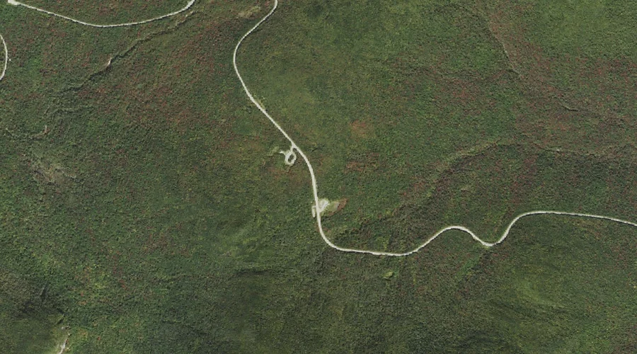
Kancamagus Pass — Gaps 43.6 Miles SW of Chapman Inn
Grafton County, New Hampshire · USGS Mount Carrigain Quadrangle · GNIS 872120
Within Grafton County, New Hampshire, on the USGS Mount Carrigain quadrangle, the mountain gap known as Kancamagus Pass sits 43.6 miles southwest of Chapman Inn.
Landmark Profile
Classification & USGS reference
Within Grafton County, New Hampshire, the U.S. Geological Survey lists Kancamagus Pass as a mountain gap on the Mount Carrigain topographic quadrangle (FIPS 33/009), under Feature ID 872120. Catalogued in GNIS since 08/27/2002.
Coordinates & physical setting
Kancamagus Pass sits at 44.02507° N, 71.49258° W (DMS 44°01′30″ N, 71°29′33″ W).
Other gaps in Grafton County, New Hampshire
Grafton County, NH contains 10 gaps catalogued in the USGS Geographic Names Information System, counting Kancamagus Pass itself. The ones closest to Kancamagus Pass:
| Feature | USGS Quadrangle | Distance |
|---|---|---|
| Mad River Notch | Mount Osceola | 0.9 mi |
| Hancock Notch | Mount Carrigain | 2.1 mi |
| Livermore Pass | Mount Tripyramid | 2.5 mi |
| North Slide | Mount Tripyramid | 4 mi |
| Thornton Gap | Waterville Valley | 4.4 mi |
| South Slide | Mount Tripyramid | 5.2 mi |
| Lost Pass | Mount Tripyramid | 6.1 mi |
| Carrigain Notch | Mount Carrigain | 6.5 mi |
| Franconia Notch | Franconia | 12.8 mi |
Features on the USGS Mount Carrigain Quadrangle
The Mount Carrigain 7.5-minute topographic quadrangle holds 36 catalogued natural features alongside Kancamagus Pass. A sampling nearest to this location:
| Feature | Type | County | Offset |
|---|---|---|---|
| Mount Kancamagus | Summits | Grafton County, NH | 1.2 mi |
| Mount Huntington | Summits | Grafton County, NH | 1.7 mi |
| Lily Pond | Lakes | Grafton County, NH | 2 mi |
| Hancock Notch | Gaps | Grafton County, NH | 2.1 mi |
| Meadow Brook | Streams | Grafton County, NH | 3.2 mi |
| Ledge Brook | Streams | Grafton County, NH | 3.6 mi |
| Horne Brook | Streams | Grafton County, NH | 3.8 mi |
| Mount Hancock | Summits | Grafton County, NH | 4 mi |
| Pine Bend Brook | Streams | Grafton County, NH | 4.1 mi |
| Greens Cliff | Cliffs | Grafton County, NH | 4.5 mi |
Historical record
The U.S. Board on Geographic Names recorded a Official (Board Decision) on January 1, 1961 for this name.
Visiting from Chapman Inn
Distance, bearing & drive time
Follow the compass bearing SW out of Bethel for 43.6 miles (southwest) and you reach Kancamagus Pass; at typical rural speeds the trip runs roughly 75 minutes.
Best time to visit
Late May through October; avoid black-fly peak in late May. At this latitude (44.025°), the shoulder seasons are workable — April and November can be comfortable on mild years. At 43.6 miles from the Inn, block the full day — sunrise start, late return, packed meals. Conditions at Kancamagus Pass track the nearby Mad River Notch mountain gap (0.9 mi away) closely — if that is runnable, so is this.
Nearest features to Kancamagus Pass
| Feature | Type | County | Distance |
|---|---|---|---|
| Mad River Notch | Gaps | Grafton County, NH | 0.9 mi |
| Mount Kancamagus | Summits | Grafton County, NH | 1.2 mi |
| Greeley Ponds | Lakes | Grafton County, NH | 1.4 mi |
| Mount Huntington | Summits | Grafton County, NH | 1.7 mi |
| East Peak | Summits | Grafton County, NH | 1.9 mi |
Frequently Asked Questions
Where is Kancamagus Pass located?
Kancamagus Pass is in Grafton County, New Hampshire, approximately 43.6 miles southwest of Chapman Inn in Bethel, Maine. It appears on the USGS Mount Carrigain topographic quadrangle.
How far is Kancamagus Pass from Chapman Inn?
The drive runs about 75 minutes, 43.6 miles southwest (bearing SW) of the Inn.
What type of natural feature is Kancamagus Pass?
The U.S. Geological Survey classifies Kancamagus Pass as a mountain gap, catalogued under GNIS Feature ID 872120 on the Mount Carrigain quadrangle.
When is the best time to visit Kancamagus Pass?
Late May through October; avoid black-fly peak in late May.
How many other gaps are in Grafton County, New Hampshire?
GNIS lists 9 other gaps in Grafton County, New Hampshire.