 Aerial imagery: USGS National Map (public domain)
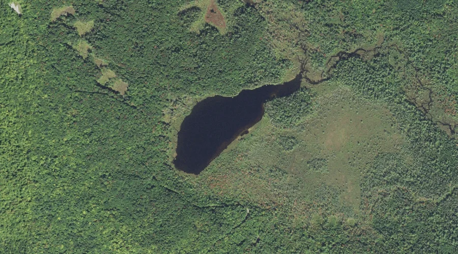
Church Ponds — Lakes 40.2 Miles SW of Chapman Inn
Grafton County, New Hampshire · USGS Mount Carrigain Quadrangle · GNIS 871682
Within Grafton County, New Hampshire, on the USGS Mount Carrigain quadrangle, the lake known as Church Ponds sits 40.2 miles southwest of Chapman Inn.
Wikidata short description: “lake in Grafton County, New Hampshire”
Landmark Profile
Classification & USGS reference
Within Grafton County, New Hampshire, the U.S. Geological Survey lists Church Ponds as a lake on the Mount Carrigain topographic quadrangle (FIPS 33/009), under Feature ID 871682. Last revised by the Board on Geographic Names on 05/15/2018.
Coordinates & physical setting
Church Ponds sits at 44.00729° N, 71.38212° W (DMS 44°00′26″ N, 71°22′56″ W).
Other lakes in Grafton County, New Hampshire
Grafton County, NH contains 24 lakes catalogued in the USGS Geographic Names Information System, counting Church Ponds itself. The ones closest to Church Ponds:
| Feature | USGS Quadrangle | Distance |
|---|---|---|
| Sawyer Pond | Mount Carrigain | 2.9 mi |
| Little Sawyer Pond | Mount Carrigain | 3.1 mi |
| Lily Pond | Mount Carrigain | 3.6 mi |
| Greeley Ponds | Mount Osceola | 6.1 mi |
| Carrigain Pond | Mount Carrigain | 6.8 mi |
| Nancy Pond | Mount Carrigain | 7.3 mi |
| Flat Mountain Ponds | Mount Tripyramid | 7.3 mi |
| Norcross Pond | Mount Carrigain | 7.6 mi |
| East Pond | Mount Osceola | 9.1 mi |
| Little East Pond | Mount Osceola | 10.1 mi |
Features on the USGS Mount Carrigain Quadrangle
The Mount Carrigain 7.5-minute topographic quadrangle holds 36 catalogued natural features alongside Church Ponds. A sampling nearest to this location:
| Feature | Type | County | Offset |
|---|---|---|---|
| Sugar Hill | Summits | Grafton County, NH | 0.8 mi |
| Pine Bend Brook | Streams | Grafton County, NH | 1.7 mi |
| Horne Brook | Streams | Grafton County, NH | 2 mi |
| Ledge Brook | Streams | Grafton County, NH | 2 mi |
| Greens Cliff | Cliffs | Grafton County, NH | 2.1 mi |
| Meadow Brook | Streams | Grafton County, NH | 2.5 mi |
| Sawyer Pond | Lakes | Grafton County, NH | 2.9 mi |
| Little Sawyer Pond | Lakes | Grafton County, NH | 3.1 mi |
| Lily Pond | Lakes | Grafton County, NH | 3.6 mi |
| Carrigain Brook | Streams | Grafton County, NH | 3.6 mi |
Historical record
The U.S. Board on Geographic Names recorded a Official (Board Decision) on January 1, 1936 for this name.
Visiting from Chapman Inn
Distance, bearing & drive time
Follow the compass bearing SW out of Bethel for 40.2 miles (southwest) and you reach Church Ponds; at typical rural speeds the trip runs roughly 69 minutes.
Best time to visit
June through September for paddling and swimming; January through March for ice fishing. At this latitude (44.007°), the shoulder seasons are workable — April and November can be comfortable on mild years. At 40.2 miles from the Inn, block the full day — sunrise start, late return, packed meals. Conditions at Church Ponds track the nearby Sabbaday Brook stream (0.8 mi away) closely — if that is runnable, so is this.
Nearest features to Church Ponds
| Feature | Type | County | Distance |
|---|---|---|---|
| Sabbaday Brook | Streams | Grafton County, NH | 0.8 mi |
| Sugar Hill | Summits | Grafton County, NH | 0.8 mi |
| Downes Brook | Streams | Carroll County, NH | 0.8 mi |
| Sabbaday Falls | Waterfalls | Grafton County, NH | 1.1 mi |
| Birch Hill | Summits | Carroll County, NH | 1.2 mi |
Frequently Asked Questions
Where is Church Ponds located?
Church Ponds is in Grafton County, New Hampshire, approximately 40.2 miles southwest of Chapman Inn in Bethel, Maine. It appears on the USGS Mount Carrigain topographic quadrangle.
How far is Church Ponds from Chapman Inn?
The drive runs about 69 minutes, 40.2 miles southwest (bearing SW) of the Inn.
What type of natural feature is Church Ponds?
The U.S. Geological Survey classifies Church Ponds as a lake, catalogued under GNIS Feature ID 871682 on the Mount Carrigain quadrangle.
When is the best time to visit Church Ponds?
June through September for paddling and swimming; January through March for ice fishing.
How many other lakes are in Grafton County, New Hampshire?
GNIS lists 23 other lakes in Grafton County, New Hampshire.
Wikidata: Q49300569.