 Aerial imagery: USGS National Map (public domain)
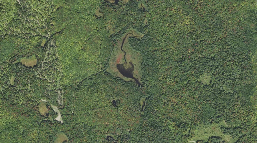
Jonathan Pond — Lakes 39.0 Miles WNW of Chapman Inn
Coos County, New Hampshire · USGS Stratford Quadrangle · GNIS 867802
Catalogued on the USGS Stratford quadrangle in Coos County, New Hampshire, Jonathan Pond — a lake — lies 39.0 miles west-northwest of Chapman Inn.
Landmark Profile
Classification & USGS reference
Catalogued under GNIS Feature ID 867802, Jonathan Pond is recorded as a lake on the USGS Stratford quadrangle in Coos County, New Hampshire (FIPS 33/007). Last revised by the Board on Geographic Names on 02/18/2018.
Coordinates & physical setting
Jonathan Pond sits at 44.64049° N, 71.50893° W (DMS 44°38′26″ N, 71°30′32″ W).
Other lakes in Coos County, New Hampshire
Coos County, NH contains 99 lakes catalogued in the USGS Geographic Names Information System, counting Jonathan Pond itself. The ones closest to Jonathan Pond:
| Feature | USGS Quadrangle | Distance |
|---|---|---|
| Hoskins Pond | Stratford | 4 mi |
| Christine Lake | Percy Peaks | 5.1 mi |
| Long Mountain Pond | Percy Peaks | 6.2 mi |
| Sugarloaf Pond | Percy Peaks | 6.3 mi |
| Whitcomb Pond | Percy Peaks | 7.3 mi |
| Pike Pond | Dummer Ponds | 7.8 mi |
| South Ponds | West Milan | 7.8 mi |
| Trio Ponds | Dummer Ponds | 8.6 mi |
| Nash Bog Pond | Bunnell Mountain | 8.8 mi |
| Rocky Pond | West Milan | 8.9 mi |
Features on the USGS Stratford Quadrangle
The Stratford 7.5-minute topographic quadrangle holds 22 catalogued natural features alongside Jonathan Pond. A sampling nearest to this location:
| Feature | Type | County | Offset |
|---|---|---|---|
| Morse Mountain | Summits | Coos County, NH | 1.3 mi |
| Potato Hill | Summits | Coos County, NH | 1.6 mi |
| East Branch Bog Brook | Streams | Coos County, NH | 2.3 mi |
| Bog Brook | Streams | Coos County, NH | 2.7 mi |
| Gay Brook | Streams | Coos County, NH | 3.4 mi |
| Hoskins Pond | Lakes | Coos County, NH | 4 mi |
| Taylor Brook | Streams | Essex County, NH | 4.1 mi |
| Connary Brook | Streams | Coos County, NH | 4.4 mi |
| Sugarloaf Brook | Streams | Coos County, NH | 4.7 mi |
| Stratford Bog Pond | Reservoirs | Coos County, NH | 5.4 mi |
Visiting from Chapman Inn
Distance, bearing & drive time
A 67-minute drive along back roads separates the front door of Chapman Inn from Jonathan Pond — 39.0 miles west-northwest as the crow flies, on compass bearing WNW.
Best time to visit
June through September for paddling and swimming; January through March for ice fishing. Being this far north (lat 44.640°), first snows typically arrive by mid-October and linger into early May — narrow the window accordingly. At 39.0 miles from the Inn, block the full day — sunrise start, late return, packed meals. Conditions at Jonathan Pond track the nearby Morse Mountain summit (1.3 mi away) closely — if that is runnable, so is this.
Nearest features to Jonathan Pond
| Feature | Type | County | Distance |
|---|---|---|---|
| Morse Mountain | Summits | Coos County, NH | 1.3 mi |
| Bag Hill | Summits | Coos County, NH | 1.5 mi |
| Potato Hill | Summits | Coos County, NH | 1.6 mi |
| Potter Brook | Streams | Coos County, NH | 1.9 mi |
| East Branch Bog Brook | Streams | Coos County, NH | 2.3 mi |
Frequently Asked Questions
Where is Jonathan Pond located?
Jonathan Pond is in Coos County, New Hampshire, approximately 39.0 miles west-northwest of Chapman Inn in Bethel, Maine. It appears on the USGS Stratford topographic quadrangle.
How far is Jonathan Pond from Chapman Inn?
The drive runs about 67 minutes, 39.0 miles west-northwest (bearing WNW) of the Inn.
What type of natural feature is Jonathan Pond?
The U.S. Geological Survey classifies Jonathan Pond as a lake, catalogued under GNIS Feature ID 867802 on the Stratford quadrangle.
When is the best time to visit Jonathan Pond?
June through September for paddling and swimming; January through March for ice fishing.
How many other lakes are in Coos County, New Hampshire?
GNIS lists 98 other lakes in Coos County, New Hampshire.