 Aerial imagery: USGS National Map (public domain)
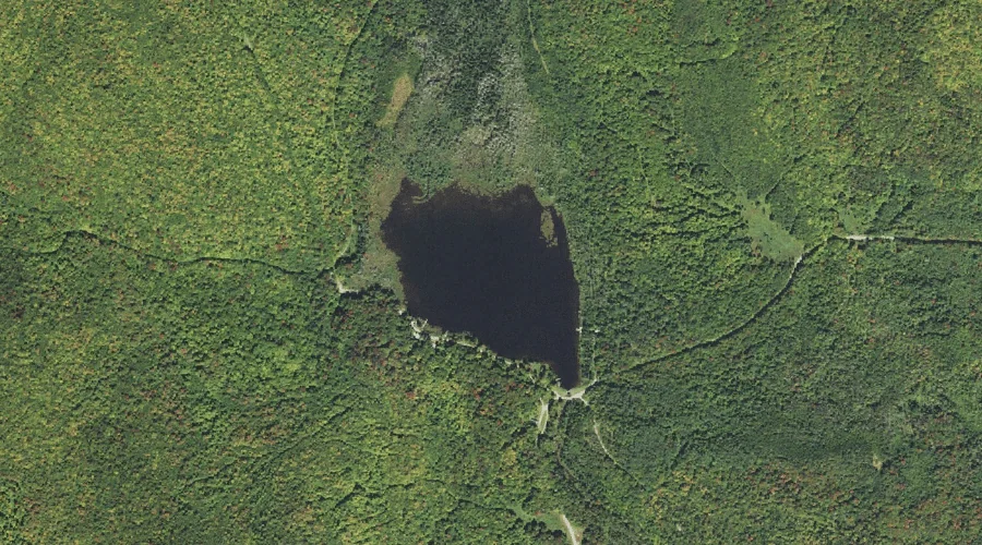
Stratford Bog Pond — Reservoirs 41.5 Miles WNW of Chapman Inn
Coos County, New Hampshire · USGS Stratford Quadrangle · GNIS 870220
Catalogued on the USGS Stratford quadrangle in Coos County, New Hampshire, Stratford Bog Pond — a reservoir — lies 41.5 miles west-northwest of Chapman Inn.
Landmark Profile
Classification & USGS reference
Catalogued under GNIS Feature ID 870220, Stratford Bog Pond is recorded as a reservoir on the USGS Stratford quadrangle in Coos County, New Hampshire (FIPS 33/007). Last revised by the Board on Geographic Names on 02/18/2018.
Coordinates & physical setting
Stratford Bog Pond sits at 44.71879° N, 71.50783° W (DMS 44°43′08″ N, 71°30′28″ W).
Other reservoirs in Coos County, New Hampshire
Coos County, NH contains 30 reservoirs catalogued in the USGS Geographic Names Information System, counting Stratford Bog Pond itself. The ones closest to Stratford Bog Pond:
| Feature | USGS Quadrangle | Distance |
|---|---|---|
| Little Bog Pond | Percy Peaks | 6.1 mi |
| Trio Pond | Dummer Ponds | 7.1 mi |
| Phillips Pond | Dixville Notch | 8.1 mi |
| Lime Pond | Bunnell Mountain | 10.6 mi |
| Connecticut River Reservoir | Groveton | 11.3 mi |
| Farm Pond | Dixville Notch | 14 mi |
| Lake Gloriette | Dixville Notch | 14.3 mi |
| Pontook Reservoir | Teakettle Ridge | 14.6 mi |
| Lake Abeniki | Dixville Notch | 15 mi |
| Mud Pond | Diamond Pond | 16.2 mi |
Features on the USGS Stratford Quadrangle
The Stratford 7.5-minute topographic quadrangle holds 22 catalogued natural features alongside Stratford Bog Pond. A sampling nearest to this location:
| Feature | Type | County | Offset |
|---|---|---|---|
| Stratford Bog Brook | Streams | Coos County, NH | 0.3 mi |
| East Branch Stratford Bog Brook | Streams | Coos County, NH | 0.6 mi |
| Sugarloaf Brook | Streams | Coos County, NH | 0.7 mi |
| Savage Mountain | Summits | Coos County, NH | 2 mi |
| Stratford Notch | Gaps | Coos County, NH | 2 mi |
| Goback Mountain | Summits | Coos County, NH | 2.2 mi |
| Spruce Mountain | Summits | Coos County, NH | 2.4 mi |
| Gay Brook | Streams | Coos County, NH | 2.6 mi |
| Teapot Mountain | Summits | Coos County, NH | 3.1 mi |
| East Branch Bog Brook | Streams | Coos County, NH | 3.8 mi |
Visiting from Chapman Inn
Distance, bearing & drive time
A 71-minute drive along back roads separates the front door of Chapman Inn from Stratford Bog Pond — 41.5 miles west-northwest as the crow flies, on compass bearing WNW.
Best time to visit
June through September for paddling and swimming; January through March for ice fishing. Being this far north (lat 44.719°), first snows typically arrive by mid-October and linger into early May — narrow the window accordingly. At 41.5 miles from the Inn, block the full day — sunrise start, late return, packed meals. Conditions at Stratford Bog Pond track the nearby Stratford Bog Brook stream (0.3 mi away) closely — if that is runnable, so is this.
Nearest features to Stratford Bog Pond
| Feature | Type | County | Distance |
|---|---|---|---|
| Stratford Bog Brook | Streams | Coos County, NH | 0.3 mi |
| East Branch Stratford Bog Brook | Streams | Coos County, NH | 0.6 mi |
| Sugarloaf Brook | Streams | Coos County, NH | 0.7 mi |
| Sugarloaf Pond | Lakes | Coos County, NH | 1.3 mi |
| Savage Mountain | Summits | Coos County, NH | 2 mi |
Frequently Asked Questions
Where is Stratford Bog Pond located?
Stratford Bog Pond is in Coos County, New Hampshire, approximately 41.5 miles west-northwest of Chapman Inn in Bethel, Maine. It appears on the USGS Stratford topographic quadrangle.
How far is Stratford Bog Pond from Chapman Inn?
The drive runs about 71 minutes, 41.5 miles west-northwest (bearing WNW) of the Inn.
What type of natural feature is Stratford Bog Pond?
The U.S. Geological Survey classifies Stratford Bog Pond as a reservoir, catalogued under GNIS Feature ID 870220 on the Stratford quadrangle.
When is the best time to visit Stratford Bog Pond?
June through September for paddling and swimming; January through March for ice fishing.
How many other reservoirs are in Coos County, New Hampshire?
GNIS lists 29 other reservoirs in Coos County, New Hampshire.
Wikidata: Q34928397.