 Aerial imagery: USGS National Map (public domain)
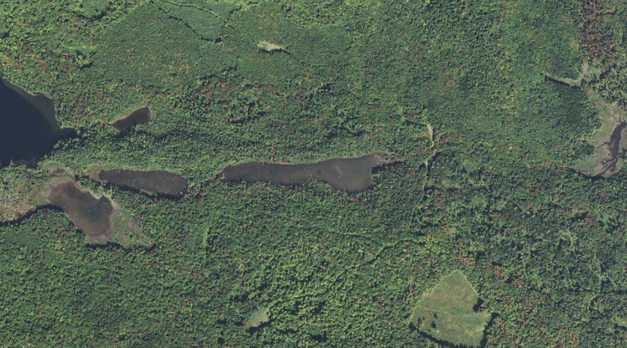
Rocky Pond — Lakes 30.2 Miles WNW of Chapman Inn
Coos County, New Hampshire · USGS West Milan Quadrangle · GNIS 869579
Within Coos County, New Hampshire, on the USGS West Milan quadrangle, the lake known as Rocky Pond sits 30.2 miles west-northwest of Chapman Inn.
Landmark Profile
Classification & USGS reference
Within Coos County, New Hampshire, the U.S. Geological Survey lists Rocky Pond as a lake on the West Milan topographic quadrangle (FIPS 33/007), under Feature ID 869579. Last revised by the Board on Geographic Names on 02/18/2018.
Coordinates & physical setting
Rocky Pond sits at 44.59057° N, 71.34275° W (DMS 44°35′26″ N, 71°20′34″ W).
Other lakes in Coos County, New Hampshire
Coos County, NH contains 99 lakes catalogued in the USGS Geographic Names Information System, counting Rocky Pond itself. The ones closest to Rocky Pond:
| Feature | USGS Quadrangle | Distance |
|---|---|---|
| South Ponds | West Milan | 1 mi |
| Pike Pond | Dummer Ponds | 2.9 mi |
| Nay Pond | West Milan | 3.3 mi |
| Cedar Pond | West Milan | 3.6 mi |
| Mud Pond | West Milan | 3.7 mi |
| Kilback Pond | West Milan | 3.8 mi |
| Christine Lake | Percy Peaks | 4.1 mi |
| Unknown Pond | Stark | 5 mi |
| Long Mountain Pond | Percy Peaks | 6.4 mi |
| Head Pond | Milan | 7.6 mi |
Features on the USGS West Milan Quadrangle
The West Milan 7.5-minute topographic quadrangle holds 32 catalogued natural features alongside Rocky Pond. A sampling nearest to this location:
| Feature | Type | County | Offset |
|---|---|---|---|
| Cold Stream | Streams | Coos County, NH | 0.7 mi |
| Location Hill | Summits | Coos County, NH | 0.7 mi |
| Devils Hopyard Stream | Streams | Coos County, NH | 0.8 mi |
| South Ponds | Lakes | Coos County, NH | 1 mi |
| Phillips Brook | Streams | Coos County, NH | 1.6 mi |
| Pond Brook | Streams | Coos County, NH | 1.9 mi |
| North Branch Upper Ammonoosuc River | Streams | Coos County, NH | 2 mi |
| Higgins Brook | Streams | Coos County, NH | 2.1 mi |
| Square Mountain | Summits | Coos County, NH | 2.3 mi |
| Greens Ledge | Benches | Coos County, NH | 2.4 mi |
Visiting from Chapman Inn
Distance, bearing & drive time
Follow the compass bearing WNW out of Bethel for 30.2 miles (west-northwest) and you reach Rocky Pond; at typical rural speeds the trip runs roughly 52 minutes.
Best time to visit
June through September for paddling and swimming; January through March for ice fishing. Being this far north (lat 44.591°), first snows typically arrive by mid-October and linger into early May — narrow the window accordingly. At 30.2 miles from the Inn, block the full day — sunrise start, late return, packed meals. Conditions at Rocky Pond track the nearby Cold Stream (0.7 mi away) closely — if that is runnable, so is this.
Nearest features to Rocky Pond
| Feature | Type | County | Distance |
|---|---|---|---|
| Cold Stream | Streams | Coos County, NH | 0.7 mi |
| Location Hill | Summits | Coos County, NH | 0.7 mi |
| Devils Hopyard Stream | Streams | Coos County, NH | 0.8 mi |
| South Ponds | Lakes | Coos County, NH | 1 mi |
| Phillips Brook | Streams | Coos County, NH | 1.6 mi |
Frequently Asked Questions
Where is Rocky Pond located?
Rocky Pond is in Coos County, New Hampshire, approximately 30.2 miles west-northwest of Chapman Inn in Bethel, Maine. It appears on the USGS West Milan topographic quadrangle.
How far is Rocky Pond from Chapman Inn?
The drive runs about 52 minutes, 30.2 miles west-northwest (bearing WNW) of the Inn.
What type of natural feature is Rocky Pond?
The U.S. Geological Survey classifies Rocky Pond as a lake, catalogued under GNIS Feature ID 869579 on the West Milan quadrangle.
When is the best time to visit Rocky Pond?
June through September for paddling and swimming; January through March for ice fishing.
How many other lakes are in Coos County, New Hampshire?
GNIS lists 98 other lakes in Coos County, New Hampshire.