 Aerial imagery: USGS National Map (public domain)
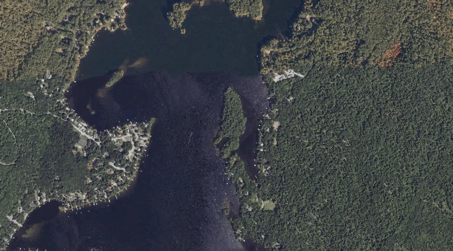
Grape Island — Islands 39.9 Miles SSE of Chapman Inn
Cumberland County, Maine · USGS Raymond Quadrangle · GNIS 1912500
39.9 miles south-southeast of Chapman Inn, on the USGS Raymond topographic quadrangle, Grape Island is a island recorded in Cumberland County, Maine by the federal Geographic Names Information System.
Wikidata short description: “island in Cumberland County, Maine, United States of America”
Landmark Profile
Classification & USGS reference
The USGS Raymond 7.5-minute topographic quadrangle places Grape Island in Cumberland County, Maine (FIPS 23/005), classified as a island in the federal GNIS (Feature ID 1912500). Catalogued in GNIS since 05/08/2001.
Coordinates & physical setting
Grape Island sits at 43.89869° N, 70.40144° W (DMS 43°53′55″ N, 70°24′05″ W).
Other islands in Cumberland County, Maine
Cumberland County, ME contains 52 islands catalogued in the USGS Geographic Names Information System, counting Grape Island itself. The ones closest to Grape Island:
| Feature | USGS Quadrangle | Distance |
|---|---|---|
| Spider Island | Raymond | 0.7 mi |
| Bean Island | Raymond | 1.2 mi |
| Martin Island | Raymond | 1.6 mi |
| Crow Island | Raymond | 1.7 mi |
| Treasure Island | Raymond | 1.8 mi |
| Bass Island | North Windham | 1.8 mi |
| Horse Island | North Windham | 1.9 mi |
| Dollys Island | Raymond | 3.5 mi |
| Lindsay Island | North Windham | 5.5 mi |
| Lpon Island | Naples | 5.6 mi |
Features on the USGS Raymond Quadrangle
The Raymond 7.5-minute topographic quadrangle holds 55 catalogued natural features alongside Grape Island. A sampling nearest to this location:
| Feature | Type | County | Offset |
|---|---|---|---|
| Hayden Bay | Bays | Cumberland County, ME | 0.4 mi |
| Krams Point | Capes | Cumberland County, ME | 0.5 mi |
| Sand Brook | Streams | Cumberland County, ME | 0.6 mi |
| Farwell Brook | Streams | Cumberland County, ME | 0.6 mi |
| Upper Narrows | Gaps | Cumberland County, ME | 0.6 mi |
| Spider Island | Islands | Cumberland County, ME | 0.7 mi |
| Meadow Brook | Streams | Cumberland County, ME | 0.8 mi |
| Lyon Point | Capes | Cumberland County, ME | 1.1 mi |
| Bean Island | Islands | Cumberland County, ME | 1.2 mi |
| Adams Hill | Summits | Cumberland County, ME | 1.3 mi |
Visiting from Chapman Inn
Distance, bearing & drive time
Chapman Inn sits 39.9 miles south-southeast (bearing SSE) of Grape Island. At moderate back-road speeds the drive runs about 68 minutes — comfortably inside a half-day outing window after breakfast.
Best time to visit
Late May through early October, when the water is safe for small-boat access. At this latitude (43.899°), the shoulder seasons are workable — April and November can be comfortable on mild years. At 39.9 miles from the Inn, block the full day — sunrise start, late return, packed meals. Conditions at Grape Island track the nearby Hayden Bay (0.4 mi away) closely — if that is runnable, so is this.
Nearest features to Grape Island
| Feature | Type | County | Distance |
|---|---|---|---|
| Hayden Bay | Bays | Cumberland County, ME | 0.4 mi |
| Krams Point | Capes | Cumberland County, ME | 0.5 mi |
| Sand Brook | Streams | Cumberland County, ME | 0.6 mi |
| Farwell Brook | Streams | Cumberland County, ME | 0.6 mi |
| Upper Narrows | Gaps | Cumberland County, ME | 0.6 mi |
Frequently Asked Questions
Where is Grape Island located?
Grape Island is in Cumberland County, Maine, approximately 39.9 miles south-southeast of Chapman Inn in Bethel, Maine. It appears on the USGS Raymond topographic quadrangle.
How far is Grape Island from Chapman Inn?
The drive runs about 68 minutes, 39.9 miles south-southeast (bearing SSE) of the Inn.
What type of natural feature is Grape Island?
The U.S. Geological Survey classifies Grape Island as a island, catalogued under GNIS Feature ID 1912500 on the Raymond quadrangle.
When is the best time to visit Grape Island?
Late May through early October, when the water is safe for small-boat access.
How many other islands are in Cumberland County, Maine?
GNIS lists 51 other islands in Cumberland County, Maine.
Wikidata: Q49639480.