 Aerial imagery: USGS National Map (public domain)
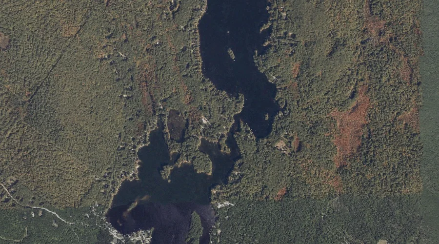
Upper Narrows — Gaps 39.4 Miles SSE of Chapman Inn
Cumberland County, Maine · USGS Raymond Quadrangle · GNIS 577635
39.4 miles south-southeast of Chapman Inn, on the USGS Raymond topographic quadrangle, Upper Narrows is a mountain gap recorded in Cumberland County, Maine by the federal Geographic Names Information System.
Landmark Profile
Classification & USGS reference
The USGS Raymond 7.5-minute topographic quadrangle places Upper Narrows in Cumberland County, Maine (FIPS 23/005), classified as a mountain gap in the federal GNIS (Feature ID 577635). Catalogued in GNIS since 09/30/1980.
Coordinates & physical setting
Upper Narrows sits at 43.90758° N, 70.39839° W (DMS 43°54′27″ N, 70°23′54″ W).
Features on the USGS Raymond Quadrangle
The Raymond 7.5-minute topographic quadrangle holds 55 catalogued natural features alongside Upper Narrows. A sampling nearest to this location:
| Feature | Type | County | Offset |
|---|---|---|---|
| Meadow Brook | Streams | Cumberland County, ME | 0.2 mi |
| Sand Brook | Streams | Cumberland County, ME | 0.4 mi |
| Farwell Brook | Streams | Cumberland County, ME | 0.4 mi |
| Grape Island | Islands | Cumberland County, ME | 0.6 mi |
| Hayden Bay | Bays | Cumberland County, ME | 0.7 mi |
| Sucker Brook | Streams | Cumberland County, ME | 1 mi |
| Krams Point | Capes | Cumberland County, ME | 1 mi |
| Farwell Bog | Lakes | Cumberland County, ME | 1.3 mi |
| Spider Island | Islands | Cumberland County, ME | 1.4 mi |
| Lyon Point | Capes | Cumberland County, ME | 1.7 mi |
Visiting from Chapman Inn
Distance, bearing & drive time
Chapman Inn sits 39.4 miles south-southeast (bearing SSE) of Upper Narrows. At moderate back-road speeds the drive runs about 68 minutes — comfortably inside a half-day outing window after breakfast.
Best time to visit
Late May through October; avoid black-fly peak in late May. At this latitude (43.908°), the shoulder seasons are workable — April and November can be comfortable on mild years. At 39.4 miles from the Inn, block the full day — sunrise start, late return, packed meals. Conditions at Upper Narrows track the nearby Meadow Brook stream (0.2 mi away) closely — if that is runnable, so is this.
Nearest features to Upper Narrows
| Feature | Type | County | Distance |
|---|---|---|---|
| Meadow Brook | Streams | Cumberland County, ME | 0.2 mi |
| Sand Brook | Streams | Cumberland County, ME | 0.4 mi |
| Farwell Brook | Streams | Cumberland County, ME | 0.4 mi |
| Grape Island | Islands | Cumberland County, ME | 0.6 mi |
| Hayden Bay | Bays | Cumberland County, ME | 0.7 mi |
Frequently Asked Questions
Where is Upper Narrows located?
Upper Narrows is in Cumberland County, Maine, approximately 39.4 miles south-southeast of Chapman Inn in Bethel, Maine. It appears on the USGS Raymond topographic quadrangle.
How far is Upper Narrows from Chapman Inn?
The drive runs about 68 minutes, 39.4 miles south-southeast (bearing SSE) of the Inn.
What type of natural feature is Upper Narrows?
The U.S. Geological Survey classifies Upper Narrows as a mountain gap, catalogued under GNIS Feature ID 577635 on the Raymond quadrangle.
When is the best time to visit Upper Narrows?
Late May through October; avoid black-fly peak in late May.