 Aerial imagery: USGS National Map (public domain)
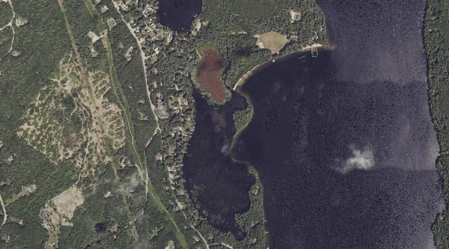
Dollys Island — Islands 37.5 Miles SSE of Chapman Inn
Cumberland County, Maine · USGS Raymond Quadrangle · GNIS 565202
Within Cumberland County, Maine, on the USGS Raymond quadrangle, the island known as Dollys Island sits 37.5 miles south-southeast of Chapman Inn.
Landmark Profile
Classification & USGS reference
Within Cumberland County, Maine, the U.S. Geological Survey lists Dollys Island as a island on the Raymond topographic quadrangle (FIPS 23/005), under Feature ID 565202. Catalogued in GNIS since 09/30/1980.
Coordinates & physical setting
Dollys Island sits at 43.91341° N, 70.46867° W (DMS 43°54′48″ N, 70°28′07″ W).
Other islands in Cumberland County, Maine
Cumberland County, ME contains 52 islands catalogued in the USGS Geographic Names Information System, counting Dollys Island itself. The ones closest to Dollys Island:
| Feature | USGS Quadrangle | Distance |
|---|---|---|
| Lpon Island | Naples | 2.1 mi |
| Inner Birch Island | Naples | 3 mi |
| Doctor Island | Naples | 3 mi |
| Outer Birch Island | Naples | 3.1 mi |
| Outer Doctor Island | Naples | 3.2 mi |
| Millstone Island | Naples | 3.2 mi |
| Battleship Island | Naples | 3.3 mi |
| Bean Island | Raymond | 3.4 mi |
| Inner Spectacle Island | Naples | 3.4 mi |
| Inner Twin Island | Naples | 3.4 mi |
Features on the USGS Raymond Quadrangle
The Raymond 7.5-minute topographic quadrangle holds 55 catalogued natural features alongside Dollys Island. A sampling nearest to this location:
| Feature | Type | County | Offset |
|---|---|---|---|
| Bettys Neck | Capes | Cumberland County, ME | 0.4 mi |
| Hayden Brook | Streams | Cumberland County, ME | 0.7 mi |
| Brown Hill | Summits | Cumberland County, ME | 0.8 mi |
| Panther Pond | Reservoirs | Cumberland County, ME | 0.9 mi |
| Ai Brook | Streams | Cumberland County, ME | 0.9 mi |
| Sloanes Cove | Bays | Cumberland County, ME | 1.3 mi |
| Panther Run | Streams | Cumberland County, ME | 1.7 mi |
| Tenny River | Streams | Cumberland County, ME | 1.8 mi |
| Nubble Brook | Streams | Cumberland County, ME | 1.9 mi |
| Tarkiln Hill | Summits | Cumberland County, ME | 2.1 mi |
Visiting from Chapman Inn
Distance, bearing & drive time
Follow the compass bearing SSE out of Bethel for 37.5 miles (south-southeast) and you reach Dollys Island; at typical rural speeds the trip runs roughly 64 minutes.
Best time to visit
Late May through early October, when the water is safe for small-boat access. At this latitude (43.913°), the shoulder seasons are workable — April and November can be comfortable on mild years. At 37.5 miles from the Inn, block the full day — sunrise start, late return, packed meals. Conditions at Dollys Island track the nearby Bettys Neck cape (0.4 mi away) closely — if that is runnable, so is this.
Nearest features to Dollys Island
| Feature | Type | County | Distance |
|---|---|---|---|
| Bettys Neck | Capes | Cumberland County, ME | 0.4 mi |
| Hayden Brook | Streams | Cumberland County, ME | 0.7 mi |
| Brown Hill | Summits | Cumberland County, ME | 0.8 mi |
| Panther Pond | Reservoirs | Cumberland County, ME | 0.9 mi |
| Ai Brook | Streams | Cumberland County, ME | 0.9 mi |
Frequently Asked Questions
Where is Dollys Island located?
Dollys Island is in Cumberland County, Maine, approximately 37.5 miles south-southeast of Chapman Inn in Bethel, Maine. It appears on the USGS Raymond topographic quadrangle.
How far is Dollys Island from Chapman Inn?
The drive runs about 64 minutes, 37.5 miles south-southeast (bearing SSE) of the Inn.
What type of natural feature is Dollys Island?
The U.S. Geological Survey classifies Dollys Island as a island, catalogued under GNIS Feature ID 565202 on the Raymond quadrangle.
When is the best time to visit Dollys Island?
Late May through early October, when the water is safe for small-boat access.
How many other islands are in Cumberland County, Maine?
GNIS lists 51 other islands in Cumberland County, Maine.
Wikidata: Q49636825.