 Aerial imagery: USGS National Map (public domain)
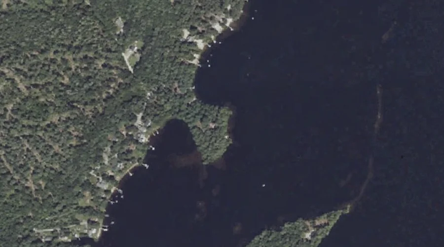
Shelldrake Point — Capes 42.2 Miles SSE of Chapman Inn
Cumberland County, Maine · USGS North Windham Quadrangle · GNIS 575370
42.2 miles south-southeast of Chapman Inn, on the USGS North Windham topographic quadrangle, Shelldrake Point is a cape recorded in Cumberland County, Maine by the federal Geographic Names Information System.
Landmark Profile
Classification & USGS reference
The USGS North Windham 7.5-minute topographic quadrangle places Shelldrake Point in Cumberland County, Maine (FIPS 23/005), classified as a cape in the federal GNIS (Feature ID 575370). Catalogued in GNIS since 09/30/1980.
Coordinates & physical setting
Shelldrake Point sits at 43.85258° N, 70.42505° W (DMS 43°51′09″ N, 70°25′30″ W).
Other capes in Cumberland County, Maine
Cumberland County, ME contains 35 capes catalogued in the USGS Geographic Names Information System, counting Shelldrake Point itself. The ones closest to Shelldrake Point:
| Feature | USGS Quadrangle | Distance |
|---|---|---|
| Shelldrake Point | North Windham | 0.5 mi |
| Hall Point | North Windham | 0.8 mi |
| Lyon Point | Raymond | 2.3 mi |
| Whites Point | North Windham | 2.7 mi |
| Krams Point | Raymond | 3.1 mi |
| Browns Point | Raymond | 3.2 mi |
| Raymond Cape | North Windham | 3.6 mi |
| Raymond Neck | Sebago Lake | 4.8 mi |
| Bettys Neck | Raymond | 5.1 mi |
| Kelseys Point | Naples | 6.1 mi |
Features on the USGS North Windham Quadrangle
The North Windham 7.5-minute topographic quadrangle holds 58 catalogued natural features alongside Shelldrake Point. A sampling nearest to this location:
| Feature | Type | County | Offset |
|---|---|---|---|
| Shelldrake Cove | Bays | Cumberland County, ME | 0.3 mi |
| Hunger Bay | Bays | Cumberland County, ME | 0.3 mi |
| Shelldrake Point | Capes | Cumberland County, ME | 0.5 mi |
| Clubhouse Cove | Bays | Cumberland County, ME | 0.5 mi |
| Boody Meadow | Swamps | Cumberland County, ME | 0.5 mi |
| Lower Narrows | Other Natural Features | Cumberland County, ME | 0.6 mi |
| Brown Cove | Bays | Cumberland County, ME | 0.6 mi |
| Hall Cove | Bays | Cumberland County, ME | 0.6 mi |
| Mud Ponds | Lakes | Cumberland County, ME | 0.6 mi |
| Tarkill Pond | Lakes | Cumberland County, ME | 0.7 mi |
Visiting from Chapman Inn
Distance, bearing & drive time
Chapman Inn sits 42.2 miles south-southeast (bearing SSE) of Shelldrake Point. At moderate back-road speeds the drive runs about 72 minutes — comfortably inside a half-day outing window after breakfast.
Best time to visit
Generally accessible May through October; winter access depends on snow cover. At this latitude (43.853°), the shoulder seasons are workable — April and November can be comfortable on mild years. At 42.2 miles from the Inn, block the full day — sunrise start, late return, packed meals. Conditions at Shelldrake Point track the nearby Shelldrake Cove bay (0.3 mi away) closely — if that is runnable, so is this.
Nearest features to Shelldrake Point
| Feature | Type | County | Distance |
|---|---|---|---|
| Shelldrake Cove | Bays | Cumberland County, ME | 0.3 mi |
| Hunger Bay | Bays | Cumberland County, ME | 0.3 mi |
| Shelldrake Point | Capes | Cumberland County, ME | 0.5 mi |
| Clubhouse Cove | Bays | Cumberland County, ME | 0.5 mi |
| Boody Meadow | Swamps | Cumberland County, ME | 0.5 mi |
Frequently Asked Questions
Where is Shelldrake Point located?
Shelldrake Point is in Cumberland County, Maine, approximately 42.2 miles south-southeast of Chapman Inn in Bethel, Maine. It appears on the USGS North Windham topographic quadrangle.
How far is Shelldrake Point from Chapman Inn?
The drive runs about 72 minutes, 42.2 miles south-southeast (bearing SSE) of the Inn.
What type of natural feature is Shelldrake Point?
The U.S. Geological Survey classifies Shelldrake Point as a cape, catalogued under GNIS Feature ID 575370 on the North Windham quadrangle.
When is the best time to visit Shelldrake Point?
Generally accessible May through October; winter access depends on snow cover.
How many other capes are in Cumberland County, Maine?
GNIS lists 34 other capes in Cumberland County, Maine.