 Aerial imagery: USGS National Map (public domain)
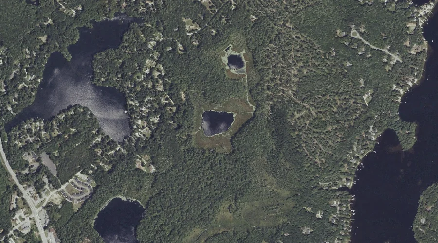
Mud Ponds — Lakes 41.9 Miles SSE of Chapman Inn
Cumberland County, Maine · USGS North Windham Quadrangle · GNIS 571956
41.9 miles south-southeast of Chapman Inn, on the USGS North Windham topographic quadrangle, Mud Ponds is a lake recorded in Cumberland County, Maine by the federal Geographic Names Information System.
Landmark Profile
Classification & USGS reference
The USGS North Windham 7.5-minute topographic quadrangle places Mud Ponds in Cumberland County, Maine (FIPS 23/005), classified as a lake in the federal GNIS (Feature ID 571956). Last revised by the Board on Geographic Names on 05/15/2018.
Coordinates & physical setting
Mud Ponds sits at 43.85299° N, 70.43716° W (DMS 43°51′11″ N, 70°26′14″ W).
Other lakes in Cumberland County, Maine
Cumberland County, ME contains 47 lakes catalogued in the USGS Geographic Names Information System, counting Mud Ponds itself. The ones closest to Mud Ponds:
| Feature | USGS Quadrangle | Distance |
|---|---|---|
| Chaffin Pond | North Windham | 0.4 mi |
| Pettingill Pond | North Windham | 0.4 mi |
| Tarkill Pond | North Windham | 0.7 mi |
| Collins Pond | North Windham | 1.6 mi |
| Upper Bay | Raymond | 2.2 mi |
| Allen Bog | North Windham | 3.1 mi |
| Little Duck Pond | Cumberland Center | 5 mi |
| Farwell Bog | Raymond | 5 mi |
| Crystal Lake | Gray | 6.6 mi |
| Otter Ponds | Sebago Lake | 7.2 mi |
Features on the USGS North Windham Quadrangle
The North Windham 7.5-minute topographic quadrangle holds 58 catalogued natural features alongside Mud Ponds. A sampling nearest to this location:
| Feature | Type | County | Offset |
|---|---|---|---|
| Boody Meadow | Swamps | Cumberland County, ME | 0.3 mi |
| Chaffin Pond | Lakes | Cumberland County, ME | 0.4 mi |
| Pettingill Pond | Lakes | Cumberland County, ME | 0.4 mi |
| Shelldrake Cove | Bays | Cumberland County, ME | 0.6 mi |
| Shelldrake Point | Capes | Cumberland County, ME | 0.6 mi |
| Tarkill Pond | Lakes | Cumberland County, ME | 0.7 mi |
| Shelldrake Point | Capes | Cumberland County, ME | 0.8 mi |
| Lower Narrows | Other Natural Features | Cumberland County, ME | 0.8 mi |
| Hunger Bay | Bays | Cumberland County, ME | 0.8 mi |
| Brown Cove | Bays | Cumberland County, ME | 1 mi |
Visiting from Chapman Inn
Distance, bearing & drive time
Chapman Inn sits 41.9 miles south-southeast (bearing SSE) of Mud Ponds. At moderate back-road speeds the drive runs about 72 minutes — comfortably inside a half-day outing window after breakfast.
Best time to visit
June through September for paddling and swimming; January through March for ice fishing. At this latitude (43.853°), the shoulder seasons are workable — April and November can be comfortable on mild years. At 41.9 miles from the Inn, block the full day — sunrise start, late return, packed meals. Conditions at Mud Ponds track the nearby Boody Meadow swamp (0.3 mi away) closely — if that is runnable, so is this.
Nearest features to Mud Ponds
| Feature | Type | County | Distance |
|---|---|---|---|
| Boody Meadow | Swamps | Cumberland County, ME | 0.3 mi |
| Chaffin Pond | Lakes | Cumberland County, ME | 0.4 mi |
| Pettingill Pond | Lakes | Cumberland County, ME | 0.4 mi |
| Shelldrake Cove | Bays | Cumberland County, ME | 0.6 mi |
| Shelldrake Point | Capes | Cumberland County, ME | 0.6 mi |
Frequently Asked Questions
Where is Mud Ponds located?
Mud Ponds is in Cumberland County, Maine, approximately 41.9 miles south-southeast of Chapman Inn in Bethel, Maine. It appears on the USGS North Windham topographic quadrangle.
How far is Mud Ponds from Chapman Inn?
The drive runs about 72 minutes, 41.9 miles south-southeast (bearing SSE) of the Inn.
What type of natural feature is Mud Ponds?
The U.S. Geological Survey classifies Mud Ponds as a lake, catalogued under GNIS Feature ID 571956 on the North Windham quadrangle.
When is the best time to visit Mud Ponds?
June through September for paddling and swimming; January through March for ice fishing.
How many other lakes are in Cumberland County, Maine?
GNIS lists 46 other lakes in Cumberland County, Maine.