 Aerial imagery: USGS National Map (public domain)
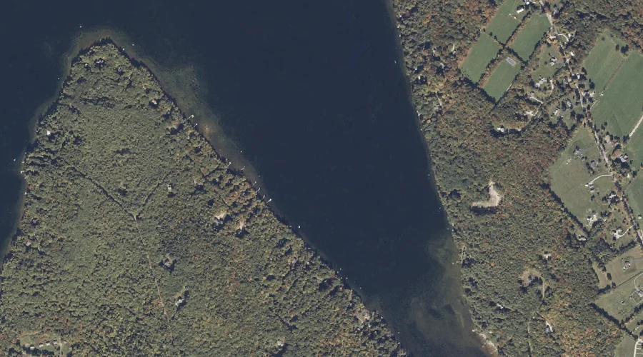
Potash Cove — Bays 29.6 Miles SSE of Chapman Inn
Androscoggin County, Maine · USGS Mechanic Falls Quadrangle · GNIS 573709
Catalogued on the USGS Mechanic Falls quadrangle in Androscoggin County, Maine, Potash Cove — a bay — lies 29.6 miles south-southeast of Chapman Inn.
Wikidata short description: “bay in Androscoggin County, Maine, United States of America”
Landmark Profile
Classification & USGS reference
Catalogued under GNIS Feature ID 573709, Potash Cove is recorded as a bay on the USGS Mechanic Falls quadrangle in Androscoggin County, Maine (FIPS 23/001). Catalogued in GNIS since 09/30/1980.
Coordinates & physical setting
Potash Cove sits at 44.04591° N, 70.46200° W (DMS 44°02′45″ N, 70°27′43″ W).
Features on the USGS Mechanic Falls Quadrangle
The Mechanic Falls 7.5-minute topographic quadrangle holds 48 catalogued natural features alongside Potash Cove. A sampling nearest to this location:
| Feature | Type | County | Offset |
|---|---|---|---|
| Abrams Point | Capes | Androscoggin County, ME | 0.5 mi |
| Potash Brook | Streams | Androscoggin County, ME | 0.6 mi |
| Megquier Hill | Summits | Androscoggin County, ME | 0.8 mi |
| Meadow Brook | Streams | Androscoggin County, ME | 1.3 mi |
| Turtle Island | Islands | Oxford County, ME | 1.3 mi |
| Birch Island | Islands | Oxford County, ME | 1.3 mi |
| Squirrel Island | Islands | Oxford County, ME | 1.3 mi |
| Crescent Island | Islands | Oxford County, ME | 1.5 mi |
| Wacipi Island | Islands | Oxford County, ME | 1.5 mi |
| Megquier Island | Islands | Androscoggin County, ME | 1.5 mi |
Visiting from Chapman Inn
Distance, bearing & drive time
A 51-minute drive along back roads separates the front door of Chapman Inn from Potash Cove — 29.6 miles south-southeast as the crow flies, on compass bearing SSE.
Best time to visit
June through September for paddling and swimming; January through March for ice fishing. At this latitude (44.046°), the shoulder seasons are workable — April and November can be comfortable on mild years. At 29.6 miles from the Inn, block the full day — sunrise start, late return, packed meals. Conditions at Potash Cove track the nearby Abrams Point cape (0.5 mi away) closely — if that is runnable, so is this.
Nearest features to Potash Cove
| Feature | Type | County | Distance |
|---|---|---|---|
| Abrams Point | Capes | Androscoggin County, ME | 0.5 mi |
| Potash Brook | Streams | Androscoggin County, ME | 0.6 mi |
| Megquier Hill | Summits | Androscoggin County, ME | 0.8 mi |
| Meadow Brook | Streams | Androscoggin County, ME | 1.3 mi |
| Turtle Island | Islands | Oxford County, ME | 1.3 mi |
Frequently Asked Questions
Where is Potash Cove located?
Potash Cove is in Androscoggin County, Maine, approximately 29.6 miles south-southeast of Chapman Inn in Bethel, Maine. It appears on the USGS Mechanic Falls topographic quadrangle.
How far is Potash Cove from Chapman Inn?
The drive runs about 51 minutes, 29.6 miles south-southeast (bearing SSE) of the Inn.
What type of natural feature is Potash Cove?
The U.S. Geological Survey classifies Potash Cove as a bay, catalogued under GNIS Feature ID 573709 on the Mechanic Falls quadrangle.
When is the best time to visit Potash Cove?
June through September for paddling and swimming; January through March for ice fishing.
Wikidata: Q49388740.