 Aerial imagery: USGS National Map (public domain)
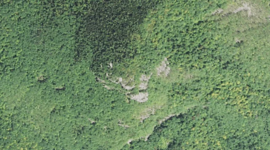
Hart Ledge — Benches 34.6 Miles SW of Chapman Inn
Carroll County, New Hampshire · USGS Bartlett Quadrangle · GNIS 872014
Catalogued on the USGS Bartlett quadrangle in Carroll County, New Hampshire, Hart Ledge — a bench terrace — lies 34.6 miles southwest of Chapman Inn.
Landmark Profile
Classification & USGS reference
Catalogued under GNIS Feature ID 872014, Hart Ledge is recorded as a bench terrace on the USGS Bartlett quadrangle in Carroll County, New Hampshire (FIPS 33/003). Catalogued in GNIS since 08/27/1980.
Coordinates & physical setting
Hart Ledge sits at 44.08729° N, 71.32813° W (DMS 44°05′14″ N, 71°19′41″ W).
Other benches in Carroll County, New Hampshire
Carroll County, NH contains 20 benches catalogued in the USGS Geographic Names Information System, counting Hart Ledge itself. The ones closest to Hart Ledge:
| Feature | USGS Quadrangle | Distance |
|---|---|---|
| Whites Ledge | North Conway West | 5.1 mi |
| Humphreys Ledge | North Conway West | 8.1 mi |
| Cathedral Ledge | North Conway West | 8.2 mi |
| White Horse Ledge | North Conway West | 8.2 mi |
| Woodchuck Ledge | Silver Lake | 8.3 mi |
| Eagle Ledge | Silver Lake | 8.8 mi |
| Carter Ledge | Mount Chocorua | 9.2 mi |
| Square Ledge | Mount Chocorua | 9.3 mi |
| White Ledge | Silver Lake | 9.6 mi |
| Overhang | Mount Chocorua | 9.8 mi |
Features on the USGS Bartlett Quadrangle
The Bartlett 7.5-minute topographic quadrangle holds 31 catalogued natural features alongside Hart Ledge. A sampling nearest to this location:
| Feature | Type | County | Offset |
|---|---|---|---|
| Stony Brook | Streams | Carroll County, NH | 0.8 mi |
| Sawyer River | Streams | Carroll County, NH | 0.9 mi |
| Sawyer Rock | Summits | Carroll County, NH | 1 mi |
| Mount Hope | Summits | Coos County, NH | 1.4 mi |
| Halfway Brook | Streams | Carroll County, NH | 1.5 mi |
| Albany Brook | Streams | Carroll County, NH | 1.6 mi |
| Cave Mountain | Summits | Carroll County, NH | 2 mi |
| Razor Brook | Streams | Coos County, NH | 2.1 mi |
| Nancy Brook | Streams | Carroll County, NH | 2.1 mi |
| McKiels Pond | Lakes | Carroll County, NH | 2.3 mi |
Visiting from Chapman Inn
Distance, bearing & drive time
A 59-minute drive along back roads separates the front door of Chapman Inn from Hart Ledge — 34.6 miles southwest as the crow flies, on compass bearing SW.
Best time to visit
Generally accessible May through October; winter access depends on snow cover. At this latitude (44.087°), the shoulder seasons are workable — April and November can be comfortable on mild years. At 34.6 miles from the Inn, block the full day — sunrise start, late return, packed meals. Conditions at Hart Ledge track the nearby Stony Brook stream (0.8 mi away) closely — if that is runnable, so is this.
Nearest features to Hart Ledge
| Feature | Type | County | Distance |
|---|---|---|---|
| Stony Brook | Streams | Carroll County, NH | 0.8 mi |
| Sawyer River | Streams | Carroll County, NH | 0.9 mi |
| Sawyer Rock | Summits | Carroll County, NH | 1 mi |
| Mount Hope | Summits | Coos County, NH | 1.4 mi |
| Halfway Brook | Streams | Carroll County, NH | 1.5 mi |
Frequently Asked Questions
Where is Hart Ledge located?
Hart Ledge is in Carroll County, New Hampshire, approximately 34.6 miles southwest of Chapman Inn in Bethel, Maine. It appears on the USGS Bartlett topographic quadrangle.
How far is Hart Ledge from Chapman Inn?
The drive runs about 59 minutes, 34.6 miles southwest (bearing SW) of the Inn.
What type of natural feature is Hart Ledge?
The U.S. Geological Survey classifies Hart Ledge as a bench terrace, catalogued under GNIS Feature ID 872014 on the Bartlett quadrangle.
When is the best time to visit Hart Ledge?
Generally accessible May through October; winter access depends on snow cover.
How many other benches are in Carroll County, New Hampshire?
GNIS lists 19 other benches in Carroll County, New Hampshire.
Wikidata: Q49172654.