 Aerial imagery: USGS National Map (public domain)
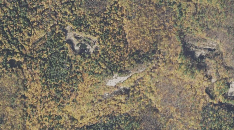
Band M Ledge — Benches 36.5 Miles SSW of Chapman Inn
Carroll County, New Hampshire · USGS Silver Lake Quadrangle · GNIS 871442
Within Carroll County, New Hampshire, on the USGS Silver Lake quadrangle, the bench terrace known as Band M Ledge sits 36.5 miles south-southwest of Chapman Inn.
Landmark Profile
Classification & USGS reference
Within Carroll County, New Hampshire, the U.S. Geological Survey lists Band M Ledge as a bench terrace on the Silver Lake topographic quadrangle (FIPS 33/003), under Feature ID 871442. Catalogued in GNIS since 08/27/1980.
Coordinates & physical setting
Band M Ledge sits at 43.95202° N, 71.16868° W (DMS 43°57′07″ N, 71°10′07″ W).
Other benches in Carroll County, New Hampshire
Carroll County, NH contains 20 benches catalogued in the USGS Geographic Names Information System, counting Band M Ledge itself. The ones closest to Band M Ledge:
| Feature | USGS Quadrangle | Distance |
|---|---|---|
| Whitton Ledge | Silver Lake | 0.9 mi |
| White Ledge | Silver Lake | 2.9 mi |
| Chamberlain Ledge | Silver Lake | 3.4 mi |
| Eagle Ledge | Silver Lake | 3.6 mi |
| Nickerson Ledge | Silver Lake | 3.7 mi |
| Bragdon Ledge | Silver Lake | 3.8 mi |
| Woodchuck Ledge | Silver Lake | 3.9 mi |
| Carter Ledge | Mount Chocorua | 4.5 mi |
| Redstone Ledge | North Conway East | 6 mi |
| White Horse Ledge | North Conway West | 6.9 mi |
Features on the USGS Silver Lake Quadrangle
The Silver Lake 7.5-minute topographic quadrangle holds 63 catalogued natural features alongside Band M Ledge. A sampling nearest to this location:
| Feature | Type | County | Offset |
|---|---|---|---|
| Ledge Pond | Lakes | Carroll County, NH | 0.5 mi |
| Swift Brook | Streams | Carroll County, NH | 0.5 mi |
| Cream Brook | Streams | Carroll County, NH | 0.8 mi |
| Tight Pond | Lakes | Carroll County, NH | 0.9 mi |
| Upper Pequawket Pond | Lakes | Carroll County, NH | 0.9 mi |
| Whitton Ledge | Benches | Carroll County, NH | 0.9 mi |
| Birch Hill | Summits | Carroll County, NH | 1.1 mi |
| Banfield Brook | Streams | Carroll County, NH | 1.2 mi |
| Oak Hill | Summits | Carroll County, NH | 1.5 mi |
| Madison Boulder | Pillars | Carroll County, NH | 1.5 mi |
Visiting from Chapman Inn
Distance, bearing & drive time
Follow the compass bearing SSW out of Bethel for 36.5 miles (south-southwest) and you reach Band M Ledge; at typical rural speeds the trip runs roughly 63 minutes.
Best time to visit
Generally accessible May through October; winter access depends on snow cover. At this latitude (43.952°), the shoulder seasons are workable — April and November can be comfortable on mild years. At 36.5 miles from the Inn, block the full day — sunrise start, late return, packed meals. Conditions at Band M Ledge track the nearby Ledge Pond lake (0.5 mi away) closely — if that is runnable, so is this.
Nearest features to Band M Ledge
| Feature | Type | County | Distance |
|---|---|---|---|
| Ledge Pond | Lakes | Carroll County, NH | 0.5 mi |
| Swift Brook | Streams | Carroll County, NH | 0.5 mi |
| Cream Brook | Streams | Carroll County, NH | 0.8 mi |
| Tight Pond | Lakes | Carroll County, NH | 0.9 mi |
| Upper Pequawket Pond | Lakes | Carroll County, NH | 0.9 mi |
Frequently Asked Questions
Where is Band M Ledge located?
Band M Ledge is in Carroll County, New Hampshire, approximately 36.5 miles south-southwest of Chapman Inn in Bethel, Maine. It appears on the USGS Silver Lake topographic quadrangle.
How far is Band M Ledge from Chapman Inn?
The drive runs about 63 minutes, 36.5 miles south-southwest (bearing SSW) of the Inn.
What type of natural feature is Band M Ledge?
The U.S. Geological Survey classifies Band M Ledge as a bench terrace, catalogued under GNIS Feature ID 871442 on the Silver Lake quadrangle.
When is the best time to visit Band M Ledge?
Generally accessible May through October; winter access depends on snow cover.
How many other benches are in Carroll County, New Hampshire?
GNIS lists 19 other benches in Carroll County, New Hampshire.
Wikidata: Q49172231.