 Aerial imagery: USGS National Map (public domain)
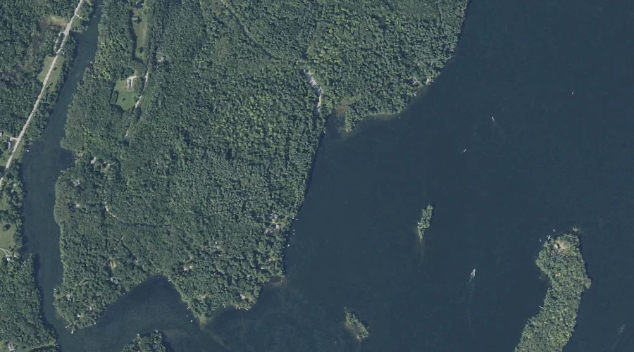
Undine Bay — Bays 42.2 Miles ESE of Chapman Inn
Kennebec County, Maine · USGS Purgatory Quadrangle · GNIS 577536
42.2 miles east-southeast of Chapman Inn, on the USGS Purgatory topographic quadrangle, Undine Bay is a bay recorded in Kennebec County, Maine by the federal Geographic Names Information System.
Wikidata short description: “bay in Kennebec County, Maine, United States of America”
Landmark Profile
Classification & USGS reference
The USGS Purgatory 7.5-minute topographic quadrangle places Undine Bay in Kennebec County, Maine (FIPS 23/011), classified as a bay in the federal GNIS (Feature ID 577536). Catalogued in GNIS since 09/30/1980.
Coordinates & physical setting
Undine Bay sits at 44.23674° N, 69.96755° W (DMS 44°14′12″ N, 69°58′03″ W).
Other bays in Kennebec County, Maine
Kennebec County, ME contains 7 bays catalogued in the USGS Geographic Names Information System, counting Undine Bay itself. The ones closest to Undine Bay:
| Feature | USGS Quadrangle | Distance |
|---|---|---|
| Ballard Bay | Purgatory | 0.7 mi |
| South Bay | Purgatory | 1.3 mi |
| True Cove | Purgatory | 1.4 mi |
| Pinkham Sound | Purgatory | 2.1 mi |
| Hatch Cove | Rome | 21.2 mi |
| North Bay | Rome | 24 mi |
Features on the USGS Purgatory Quadrangle
The Purgatory 7.5-minute topographic quadrangle holds 45 catalogued natural features alongside Undine Bay. A sampling nearest to this location:
| Feature | Type | County | Offset |
|---|---|---|---|
| Pine Island | Islands | Kennebec County, ME | 0.2 mi |
| Merrill Island | Islands | Kennebec County, ME | 0.3 mi |
| Jug Stream | Streams | Kennebec County, ME | 0.5 mi |
| Scott Island | Islands | Kennebec County, ME | 0.5 mi |
| Green Island | Islands | Kennebec County, ME | 0.6 mi |
| Lovers Island | Islands | Kennebec County, ME | 0.6 mi |
| Sheep Island | Islands | Kennebec County, ME | 0.6 mi |
| Ballard Bay | Bays | Kennebec County, ME | 0.7 mi |
| Blue Bell Island | Islands | Kennebec County, ME | 0.8 mi |
| Norris Point | Capes | Kennebec County, ME | 0.8 mi |
Visiting from Chapman Inn
Distance, bearing & drive time
Chapman Inn sits 42.2 miles east-southeast (bearing ESE) of Undine Bay. At moderate back-road speeds the drive runs about 72 minutes — comfortably inside a half-day outing window after breakfast.
Best time to visit
June through September for paddling and swimming; January through March for ice fishing. At this latitude (44.237°), the shoulder seasons are workable — April and November can be comfortable on mild years. At 42.2 miles from the Inn, block the full day — sunrise start, late return, packed meals. Conditions at Undine Bay track the nearby Pine Island (0.2 mi away) closely — if that is runnable, so is this.
Nearest features to Undine Bay
| Feature | Type | County | Distance |
|---|---|---|---|
| Pine Island | Islands | Kennebec County, ME | 0.2 mi |
| Merrill Island | Islands | Kennebec County, ME | 0.3 mi |
| Jug Stream | Streams | Kennebec County, ME | 0.5 mi |
| Scott Island | Islands | Kennebec County, ME | 0.5 mi |
| Green Island | Islands | Kennebec County, ME | 0.6 mi |
Frequently Asked Questions
Where is Undine Bay located?
Undine Bay is in Kennebec County, Maine, approximately 42.2 miles east-southeast of Chapman Inn in Bethel, Maine. It appears on the USGS Purgatory topographic quadrangle.
How far is Undine Bay from Chapman Inn?
The drive runs about 72 minutes, 42.2 miles east-southeast (bearing ESE) of the Inn.
What type of natural feature is Undine Bay?
The U.S. Geological Survey classifies Undine Bay as a bay, catalogued under GNIS Feature ID 577536 on the Purgatory quadrangle.
When is the best time to visit Undine Bay?
June through September for paddling and swimming; January through March for ice fishing.
How many other bays are in Kennebec County, Maine?
GNIS lists 6 other bays in Kennebec County, Maine.
Wikidata: Q33610962.