 Aerial imagery: USGS National Map (public domain)
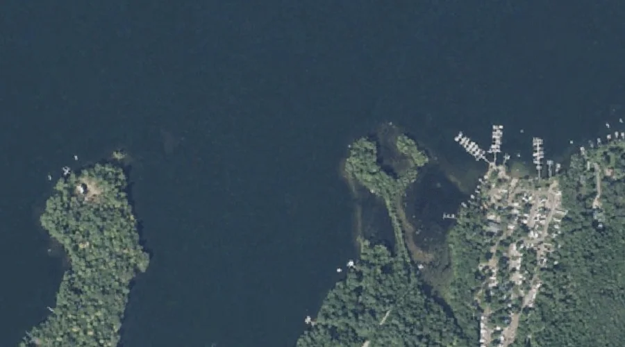
Norris Point — Capes 43.0 Miles ESE of Chapman Inn
Kennebec County, Maine · USGS Purgatory Quadrangle · GNIS 572238
43.0 miles east-southeast of Chapman Inn, on the USGS Purgatory topographic quadrangle, Norris Point is a cape recorded in Kennebec County, Maine by the federal Geographic Names Information System.
Landmark Profile
Classification & USGS reference
The USGS Purgatory 7.5-minute topographic quadrangle places Norris Point in Kennebec County, Maine (FIPS 23/011), classified as a cape in the federal GNIS (Feature ID 572238). Catalogued in GNIS since 09/30/1980.
Coordinates & physical setting
Norris Point sits at 44.23479° N, 69.95199° W (DMS 44°14′05″ N, 69°57′07″ W).
Other capes in Kennebec County, Maine
Kennebec County, ME contains 16 capes catalogued in the USGS Geographic Names Information System, counting Norris Point itself. The ones closest to Norris Point:
| Feature | USGS Quadrangle | Distance |
|---|---|---|
| Crams Point | Winthrop | 1.7 mi |
| West Point | Winthrop | 3 mi |
| Robbins Point | Winthrop | 4.9 mi |
| Welch Point | Winthrop | 6.3 mi |
| Foster Point | Rome | 19.4 mi |
| Pinewold Point | Belgrade Lakes | 20 mi |
| Hemlock Point | Rome | 20.2 mi |
| Hersom Point | Rome | 20.5 mi |
| Long Point | Rome | 20.9 mi |
| Long Point | Belgrade Lakes | 21.7 mi |
Features on the USGS Purgatory Quadrangle
The Purgatory 7.5-minute topographic quadrangle holds 45 catalogued natural features alongside Norris Point. A sampling nearest to this location:
| Feature | Type | County | Offset |
|---|---|---|---|
| Ballard Bay | Bays | Kennebec County, ME | 0.4 mi |
| Grape Island | Islands | Kennebec County, ME | 0.5 mi |
| Cobbosseecontee Lake | Reservoirs | Kennebec County, ME | 0.6 mi |
| Sheep Island | Islands | Kennebec County, ME | 0.6 mi |
| Pine Island | Islands | Kennebec County, ME | 0.6 mi |
| True Cove | Bays | Kennebec County, ME | 0.6 mi |
| LeClair Island | Islands | Kennebec County, ME | 0.7 mi |
| Lovers Island | Islands | Kennebec County, ME | 0.7 mi |
| Merrill Island | Islands | Kennebec County, ME | 0.8 mi |
| Goodwin Island | Islands | Kennebec County, ME | 0.8 mi |
Visiting from Chapman Inn
Distance, bearing & drive time
Chapman Inn sits 43.0 miles east-southeast (bearing ESE) of Norris Point. At moderate back-road speeds the drive runs about 74 minutes — comfortably inside a half-day outing window after breakfast.
Best time to visit
Generally accessible May through October; winter access depends on snow cover. At this latitude (44.235°), the shoulder seasons are workable — April and November can be comfortable on mild years. At 43.0 miles from the Inn, block the full day — sunrise start, late return, packed meals. Conditions at Norris Point track the nearby Ballard Bay (0.4 mi away) closely — if that is runnable, so is this.
Nearest features to Norris Point
| Feature | Type | County | Distance |
|---|---|---|---|
| Ballard Bay | Bays | Kennebec County, ME | 0.4 mi |
| Grape Island | Islands | Kennebec County, ME | 0.5 mi |
| Cobbosseecontee Lake | Reservoirs | Kennebec County, ME | 0.6 mi |
| Sheep Island | Islands | Kennebec County, ME | 0.6 mi |
| Pine Island | Islands | Kennebec County, ME | 0.6 mi |
Frequently Asked Questions
Where is Norris Point located?
Norris Point is in Kennebec County, Maine, approximately 43.0 miles east-southeast of Chapman Inn in Bethel, Maine. It appears on the USGS Purgatory topographic quadrangle.
How far is Norris Point from Chapman Inn?
The drive runs about 74 minutes, 43.0 miles east-southeast (bearing ESE) of the Inn.
What type of natural feature is Norris Point?
The U.S. Geological Survey classifies Norris Point as a cape, catalogued under GNIS Feature ID 572238 on the Purgatory quadrangle.
When is the best time to visit Norris Point?
Generally accessible May through October; winter access depends on snow cover.
How many other capes are in Kennebec County, Maine?
GNIS lists 15 other capes in Kennebec County, Maine.