 Aerial imagery: USGS National Map (public domain)
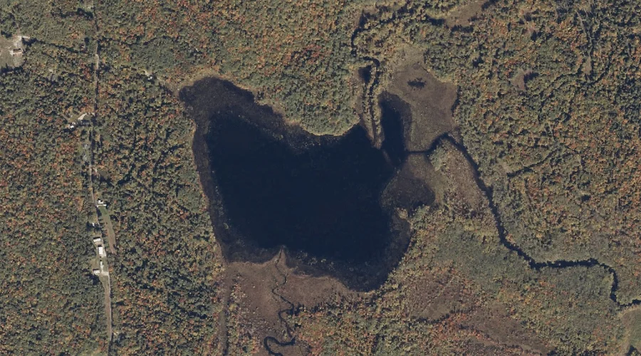
Charles Pond — Lakes 20.7 Miles SSW of Chapman Inn
Oxford County, Maine · USGS Center Lovell Quadrangle · GNIS 580981
Catalogued on the USGS Center Lovell quadrangle in Oxford County, Maine, Charles Pond — a lake — lies 20.7 miles south-southwest of Chapman Inn.
Landmark Profile
Classification & USGS reference
Catalogued under GNIS Feature ID 580981, Charles Pond is recorded as a lake on the USGS Center Lovell quadrangle in Oxford County, Maine (FIPS 23/017). Last revised by the Board on Geographic Names on 05/15/2018.
Coordinates & physical setting
Charles Pond sits at 44.13456° N, 70.96886° W (DMS 44°08′04″ N, 70°58′08″ W).
Other lakes in Oxford County, Maine
Oxford County, ME contains 157 lakes catalogued in the USGS Geographic Names Information System, counting Charles Pond itself. The ones closest to Charles Pond:
| Feature | USGS Quadrangle | Distance |
|---|---|---|
| Horseshoe Pond | Fryeburg | 1.3 mi |
| Farrington Pond | Center Lovell | 3.6 mi |
| Hunt Pond | Fryeburg | 3.8 mi |
| Horseshoe Pond | Fryeburg | 4.7 mi |
| Lily Pond | North Waterford | 5 mi |
| Noah Eastman Pond | Center Lovell | 5.3 mi |
| Kezar Pond | Fryeburg | 5.3 mi |
| Moose Pond | Center Lovell | 5.6 mi |
| Little Pond | Pleasant Mountain | 5.8 mi |
| Bog Pond | Fryeburg | 5.9 mi |
Features on the USGS Center Lovell Quadrangle
The Center Lovell 7.5-minute topographic quadrangle holds 65 catalogued natural features alongside Charles Pond. A sampling nearest to this location:
| Feature | Type | County | Offset |
|---|---|---|---|
| Cold River | Streams | Oxford County, ME | 0.1 mi |
| Kezar Outlet | Streams | Oxford County, ME | 1.1 mi |
| Charles River | Streams | Oxford County, ME | 1.2 mi |
| Little Cold River | Streams | Oxford County, NH | 1.3 mi |
| Fryeburg Harbor | Bays | Oxford County, ME | 1.6 mi |
| Long Meadow Brook | Streams | Oxford County, ME | 1.8 mi |
| Langdon Brook | Streams | Oxford County, NH | 1.9 mi |
| Langdon Brook | Streams | Carroll County, NH | 1.9 mi |
| Pigeon Point | Capes | Oxford County, ME | 2 mi |
| Lower Bay | Bays | Oxford County, ME | 2.5 mi |
Visiting from Chapman Inn
Distance, bearing & drive time
A 35-minute drive along back roads separates the front door of Chapman Inn from Charles Pond — 20.7 miles south-southwest as the crow flies, on compass bearing SSW.
Best time to visit
June through September for paddling and swimming; January through March for ice fishing. At this latitude (44.135°), the shoulder seasons are workable — April and November can be comfortable on mild years. At 20.7 miles from the Inn, plan on a comfortable day trip with time for lunch on the road. Conditions at Charles Pond track the nearby Cold River stream (essentially adjacent) closely — if that is runnable, so is this.
Nearest features to Charles Pond
| Feature | Type | County | Distance |
|---|---|---|---|
| Cold River | Streams | Oxford County, ME | 0.1 mi |
| Kezar Outlet | Streams | Oxford County, ME | 1.1 mi |
| Charles River | Streams | Oxford County, ME | 1.2 mi |
| Little Cold River | Streams | Oxford County, NH | 1.3 mi |
| Horseshoe Pond | Lakes | Oxford County, ME | 1.3 mi |
Frequently Asked Questions
Where is Charles Pond located?
Charles Pond is in Oxford County, Maine, approximately 20.7 miles south-southwest of Chapman Inn in Bethel, Maine. It appears on the USGS Center Lovell topographic quadrangle.
How far is Charles Pond from Chapman Inn?
The drive runs about 35 minutes, 20.7 miles south-southwest (bearing SSW) of the Inn.
What type of natural feature is Charles Pond?
The U.S. Geological Survey classifies Charles Pond as a lake, catalogued under GNIS Feature ID 580981 on the Center Lovell quadrangle.
When is the best time to visit Charles Pond?
June through September for paddling and swimming; January through March for ice fishing.
How many other lakes are in Oxford County, Maine?
GNIS lists 156 other lakes in Oxford County, Maine.