 Aerial imagery: USGS National Map (public domain)
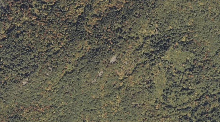
Webb Rowe Mountain — Summits 37.6 Miles S of Chapman Inn
Cumberland County, Maine · USGS Steep Falls Quadrangle · GNIS 577928
Within Cumberland County, Maine, on the USGS Steep Falls quadrangle, the summit known as Webb Rowe Mountain sits 37.6 miles south of Chapman Inn.
Landmark Profile
Classification & USGS reference
Within Cumberland County, Maine, the U.S. Geological Survey lists Webb Rowe Mountain as a summit on the Steep Falls topographic quadrangle (FIPS 23/005), under Feature ID 577928. Last revised by the Board on Geographic Names on 08/09/2022.
Coordinates & physical setting
Webb Rowe Mountain sits at 43.86486° N, 70.69847° W (DMS 43°51′53″ N, 70°41′55″ W).
Other summits in Cumberland County, Maine
Cumberland County, ME contains 108 summits catalogued in the USGS Geographic Names Information System, counting Webb Rowe Mountain itself. The ones closest to Webb Rowe Mountain:
| Feature | USGS Quadrangle | Elevation | Distance |
|---|---|---|---|
| Dykes Mountain | Steep Falls | — | 0.4 mi |
| Douglas Mountain | Steep Falls | 1,381 ft | 0.5 mi |
| Saddleback Hills | Steep Falls | — | 0.5 mi |
| Winn Mountain | Steep Falls | — | 0.8 mi |
| Decker Mountain | Steep Falls | — | 0.9 mi |
| Robinson Hill | Steep Falls | — | 1.4 mi |
| Dyke Mountain | Steep Falls | — | 2.1 mi |
| Bald Mountain | Steep Falls | — | 2.1 mi |
| Mariner Mountain | North Sebago | — | 2.3 mi |
| Lombard Hill | Hiram | — | 3.1 mi |
Features on the USGS Steep Falls Quadrangle
The Steep Falls 7.5-minute topographic quadrangle holds 35 catalogued natural features alongside Webb Rowe Mountain. A sampling nearest to this location:
| Feature | Type | County | Offset |
|---|---|---|---|
| Dykes Mountain | Summits | Cumberland County, ME | 0.4 mi |
| Douglas Mountain | Summits | Cumberland County, ME | 0.5 mi |
| Saddleback Hills | Summits | Cumberland County, ME | 0.5 mi |
| Winn Mountain | Summits | Cumberland County, ME | 0.8 mi |
| Decker Mountain | Summits | Cumberland County, ME | 0.9 mi |
| Robinson Hill | Summits | Cumberland County, ME | 1.4 mi |
| Davis Spring | Springs | Cumberland County, ME | 1.4 mi |
| Dyke Mountain | Summits | Cumberland County, ME | 2.1 mi |
| Bald Mountain | Summits | Cumberland County, ME | 2.1 mi |
| Heath Brook | Streams | Cumberland County, ME | 2.7 mi |
Visiting from Chapman Inn
Distance, bearing & drive time
Follow the compass bearing S out of Bethel for 37.6 miles (south) and you reach Webb Rowe Mountain; at typical rural speeds the trip runs roughly 64 minutes.
Best time to visit
Accessible May through November in most years. At this latitude (43.865°), the shoulder seasons are workable — April and November can be comfortable on mild years. At 37.6 miles from the Inn, block the full day — sunrise start, late return, packed meals. Conditions at Webb Rowe Mountain track the nearby Dykes Mountain summit (0.4 mi away) closely — if that is runnable, so is this.
Nearest features to Webb Rowe Mountain
| Feature | Type | County | Distance |
|---|---|---|---|
| Dykes Mountain | Summits | Cumberland County, ME | 0.4 mi |
| Douglas Mountain | Summits | Cumberland County, ME | 0.5 mi |
| Saddleback Hills | Summits | Cumberland County, ME | 0.5 mi |
| Winn Mountain | Summits | Cumberland County, ME | 0.8 mi |
| Decker Mountain | Summits | Cumberland County, ME | 0.9 mi |
Frequently Asked Questions
Where is Webb Rowe Mountain located?
Webb Rowe Mountain is in Cumberland County, Maine, approximately 37.6 miles south of Chapman Inn in Bethel, Maine. It appears on the USGS Steep Falls topographic quadrangle.
How far is Webb Rowe Mountain from Chapman Inn?
The drive runs about 64 minutes, 37.6 miles south (bearing S) of the Inn.
What type of natural feature is Webb Rowe Mountain?
The U.S. Geological Survey classifies Webb Rowe Mountain as a summit, catalogued under GNIS Feature ID 577928 on the Steep Falls quadrangle.
When is the best time to visit Webb Rowe Mountain?
Accessible May through November in most years.
How many other summits are in Cumberland County, Maine?
GNIS lists 107 other summits in Cumberland County, Maine.