 Aerial imagery: USGS National Map (public domain)
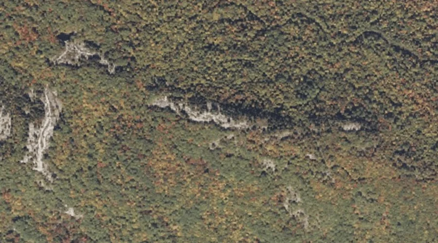
Singepole Mountain — Summits 20.8 Miles SE of Chapman Inn
Oxford County, Maine · USGS Oxford Quadrangle · GNIS 575493
20.8 miles southeast of Chapman Inn, on the USGS Oxford topographic quadrangle, Singepole Mountain is a summit recorded in Oxford County, Maine by the federal Geographic Names Information System.
Wikidata short description: “mountain in United States of America”
Landmark Profile
Classification & USGS reference
The USGS Oxford 7.5-minute topographic quadrangle places Singepole Mountain in Oxford County, Maine (FIPS 23/017), classified as a summit in the federal GNIS (Feature ID 575493). Last revised by the Board on Geographic Names on 07/23/2022.
Coordinates & physical setting
Singepole Mountain sits at 44.22537° N, 70.45016° W (DMS 44°13′31″ N, 70°27′01″ W).
Other summits in Oxford County, Maine
Oxford County, ME contains 438 summits catalogued in the USGS Geographic Names Information System, counting Singepole Mountain itself. The ones closest to Singepole Mountain:
| Feature | USGS Quadrangle | Elevation | Distance |
|---|---|---|---|
| Durrell Hill | Oxford | — | 1 mi |
| Little Singepole Mountain | Oxford | — | 1.1 mi |
| Mount Marie | Oxford | — | 1.4 mi |
| Number 4 Hill | Oxford | — | 1.8 mi |
| Brett Hill | Oxford | — | 1.9 mi |
| Streaked Mountain | Oxford | — | 2.1 mi |
| Ben Barrows Hill | Oxford | — | 2.6 mi |
| Oak Hill | West Sumner | — | 2.7 mi |
| Stone Hill | Oxford | — | 2.8 mi |
| Thomas Hill | Oxford | — | 3.1 mi |
Features on the USGS Oxford Quadrangle
The Oxford 7.5-minute topographic quadrangle holds 34 catalogued natural features alongside Singepole Mountain. A sampling nearest to this location:
| Feature | Type | County | Offset |
|---|---|---|---|
| Hall Pond | Reservoirs | Oxford County, ME | 0.6 mi |
| Durrell Hill | Summits | Oxford County, ME | 1 mi |
| Little Singepole Mountain | Summits | Oxford County, ME | 1.1 mi |
| Mount Marie | Summits | Oxford County, ME | 1.4 mi |
| Noble Brook | Streams | Oxford County, ME | 1.8 mi |
| Number 4 Hill | Summits | Oxford County, ME | 1.8 mi |
| Brett Hill | Summits | Oxford County, ME | 1.9 mi |
| Streaked Mountain | Summits | Oxford County, ME | 2.1 mi |
| Twitchell Brook | Streams | Oxford County, ME | 2.4 mi |
| Mud Pond | Lakes | Oxford County, ME | 2.5 mi |
Visiting from Chapman Inn
Distance, bearing & drive time
Chapman Inn sits 20.8 miles southeast (bearing SE) of Singepole Mountain. At moderate back-road speeds the drive runs about 36 minutes — comfortably inside a half-day outing window after breakfast.
Best time to visit
Accessible May through November in most years. At this latitude (44.225°), the shoulder seasons are workable — April and November can be comfortable on mild years. At 20.8 miles from the Inn, plan on a comfortable day trip with time for lunch on the road. Conditions at Singepole Mountain track the nearby Hall Pond reservoir (0.6 mi away) closely — if that is runnable, so is this.
Nearest features to Singepole Mountain
| Feature | Type | County | Distance |
|---|---|---|---|
| Hall Pond | Reservoirs | Oxford County, ME | 0.6 mi |
| Durrell Hill | Summits | Oxford County, ME | 1 mi |
| Little Singepole Mountain | Summits | Oxford County, ME | 1.1 mi |
| Mount Marie | Summits | Oxford County, ME | 1.4 mi |
| Noble Brook | Streams | Oxford County, ME | 1.8 mi |
Frequently Asked Questions
Where is Singepole Mountain located?
Singepole Mountain is in Oxford County, Maine, approximately 20.8 miles southeast of Chapman Inn in Bethel, Maine. It appears on the USGS Oxford topographic quadrangle.
How far is Singepole Mountain from Chapman Inn?
The drive runs about 36 minutes, 20.8 miles southeast (bearing SE) of the Inn.
What type of natural feature is Singepole Mountain?
The U.S. Geological Survey classifies Singepole Mountain as a summit, catalogued under GNIS Feature ID 575493 on the Oxford quadrangle.
When is the best time to visit Singepole Mountain?
Accessible May through November in most years.
How many other summits are in Oxford County, Maine?
GNIS lists 437 other summits in Oxford County, Maine.
Wikidata: Q33147828.