 Aerial imagery: USGS National Map (public domain)
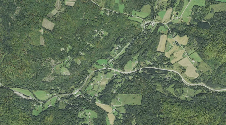
West Branch Mohawk River — Streams 43.4 Miles NW of Chapman Inn
Coos County, New Hampshire · USGS Diamond Pond Quadrangle · GNIS 871143
43.4 miles northwest of Chapman Inn, on the USGS Diamond Pond topographic quadrangle, West Branch Mohawk River is a stream recorded in Coos County, New Hampshire by the federal Geographic Names Information System.
Wikidata short description: “river in New Hampshire, United States”
Landmark Profile
Classification & USGS reference
The USGS Diamond Pond 7.5-minute topographic quadrangle places West Branch Mohawk River in Coos County, New Hampshire (FIPS 33/007), classified as a stream in the federal GNIS (Feature ID 871143). Catalogued in GNIS since 08/27/1980.
Coordinates & physical setting
West Branch Mohawk River sits at 44.87616° N, 71.37119° W (DMS 44°52′34″ N, 71°22′16″ W).
As a linear feature its source lies near 44.94255° N, 71.38869° W (DMS 44°56′33″ N, 71°23′19″ W) — useful for anglers and paddlers tracing the upstream end.
Other streams in Coos County, New Hampshire
Coos County, NH contains 300 streams catalogued in the USGS Geographic Names Information System, counting West Branch Mohawk River itself. The ones closest to West Branch Mohawk River:
| Feature | USGS Quadrangle | Distance |
|---|---|---|
| East Branch Mohawk River | Diamond Pond | 0 mi |
| Roaring Brook | Bunnell Mountain | 0.4 mi |
| Moose Brook | Dixville Notch | 2 mi |
| Read Brook | Lovering Mountain | 2.7 mi |
| Hix Brook | Diamond Pond | 3 mi |
| Flume Brook | Dixville Notch | 4.6 mi |
| East Branch Simms Stream | Bunnell Mountain | 4.9 mi |
| Moran Brook | Bunnell Mountain | 4.9 mi |
| Cascade Brook | Dixville Notch | 5 mi |
| Haines Brook | Lovering Mountain | 5 mi |
Features on the USGS Diamond Pond Quadrangle
The Diamond Pond 7.5-minute topographic quadrangle holds 37 catalogued natural features alongside West Branch Mohawk River. A sampling nearest to this location:
| Feature | Type | County | Offset |
|---|---|---|---|
| East Branch Mohawk River | Streams | Coos County, NH | 0 mi |
| Moose Pond (historical) | Lakes | Coos County, NH | 2.7 mi |
| Keazer Mountain | Summits | Coos County, NH | 2.8 mi |
| Harvey Swell | Summits | Coos County, NH | 2.9 mi |
| Hix Brook | Streams | Coos County, NH | 3 mi |
| Abeniki Mountain | Summits | Coos County, NH | 3.1 mi |
| Lake Abeniki | Lakes | Coos County, NH | 3.6 mi |
| Van Dyck Mountain | Summits | Coos County, NH | 3.7 mi |
| Mud Pond | Reservoirs | Coos County, NH | 3.8 mi |
| Paul Hill | Summits | Coos County, NH | 4.3 mi |
Historical record
The West Branch of the Mohawk River is a 5.5-mile-long (8.9 km) river in northern New Hampshire in the United States. It is a tributary of the Mohawk River, which flows west to the Connecticut River, which in turn flows south to Long Island Sound, an arm of the Atlantic Ocean. Open the Wikipedia article →
Visiting from Chapman Inn
Distance, bearing & drive time
Chapman Inn sits 43.4 miles northwest (bearing NW) of West Branch Mohawk River. At moderate back-road speeds the drive runs about 74 minutes — comfortably inside a half-day outing window after breakfast.
Best time to visit
Best observed in late spring and early summer when flow is strong and banks are visible. Being this far north (lat 44.876°), first snows typically arrive by mid-October and linger into early May — narrow the window accordingly. At 43.4 miles from the Inn, block the full day — sunrise start, late return, packed meals. Conditions at West Branch Mohawk River track the nearby East Branch Mohawk River stream (essentially adjacent) closely — if that is runnable, so is this.
Nearest features to West Branch Mohawk River
| Feature | Type | County | Distance |
|---|---|---|---|
| East Branch Mohawk River | Streams | Coos County, NH | 0 mi |
| Roaring Brook | Streams | Coos County, NH | 0.4 mi |
| Moose Brook | Streams | Coos County, NH | 2 mi |
| Cilley Hill | Summits | Coos County, NH | 2.3 mi |
| Farm Pond | Reservoirs | Coos County, NH | 2.7 mi |
Frequently Asked Questions
Where is West Branch Mohawk River located?
West Branch Mohawk River is in Coos County, New Hampshire, approximately 43.4 miles northwest of Chapman Inn in Bethel, Maine. It appears on the USGS Diamond Pond topographic quadrangle.
How far is West Branch Mohawk River from Chapman Inn?
The drive runs about 74 minutes, 43.4 miles northwest (bearing NW) of the Inn.
What type of natural feature is West Branch Mohawk River?
The U.S. Geological Survey classifies West Branch Mohawk River as a stream, catalogued under GNIS Feature ID 871143 on the Diamond Pond quadrangle.
When is the best time to visit West Branch Mohawk River?
Best observed in late spring and early summer when flow is strong and banks are visible.
How many other streams are in Coos County, New Hampshire?
GNIS lists 299 other streams in Coos County, New Hampshire.
Wikidata: Q7984531.