 Aerial imagery: USGS National Map (public domain)
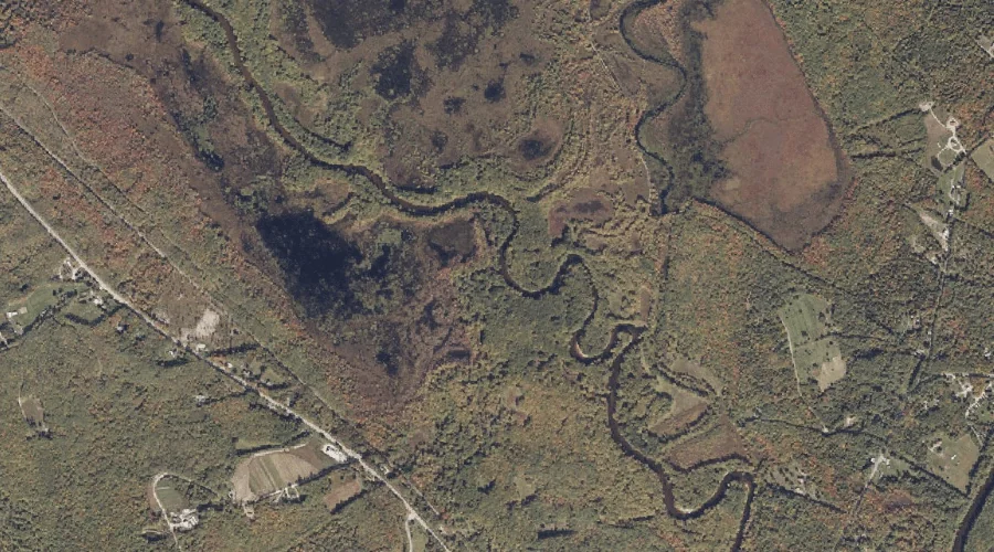
Shepards River — Streams 30.6 Miles S of Chapman Inn
Oxford County, New Hampshire · USGS Brownfield Quadrangle · GNIS 575375
Within Oxford County, New Hampshire, on the USGS Brownfield quadrangle, the stream known as Shepards River sits 30.6 miles south of Chapman Inn.
Landmark Profile
Classification & USGS reference
Within Oxford County, New Hampshire, the U.S. Geological Survey lists Shepards River as a stream on the Brownfield topographic quadrangle (FIPS 23/017), under Feature ID 575375. Last revised by the Board on Geographic Names on 06/22/2021.
Coordinates & physical setting
Shepards River sits at 43.96855° N, 70.89687° W (DMS 43°58′07″ N, 70°53′49″ W).
As a linear feature its source lies near 43.93507° N, 71.01223° W (DMS 43°56′06″ N, 71°00′44″ W) — useful for anglers and paddlers tracing the upstream end.
Other streams in Oxford County, New Hampshire
Oxford County, NH contains 26 streams catalogued in the USGS Geographic Names Information System, counting Shepards River itself. The ones closest to Shepards River:
| Feature | USGS Quadrangle | Distance |
|---|---|---|
| Paine Brook | Brownfield | 3.2 mi |
| Cole Brook | Brownfield | 5 mi |
| Linscott Brook | Brownfield | 5.3 mi |
| Weeks Brook | Fryeburg | 6.5 mi |
| Province Brook | North Conway East | 10.8 mi |
| Little Cold River | Center Lovell | 13.2 mi |
| Langdon Brook | Center Lovell | 13.9 mi |
| Bradley Brook | Center Lovell | 15 mi |
| Shell Pond Brook | Chatham | 19.8 mi |
| Basin Brook | Wild River | 21.4 mi |
Features on the USGS Brownfield Quadrangle
The Brownfield 7.5-minute topographic quadrangle holds 31 catalogued natural features alongside Shepards River. A sampling nearest to this location:
| Feature | Type | County | Offset |
|---|---|---|---|
| Little Saco River | Streams | Oxford County, ME | 1.4 mi |
| Frost Mountain | Summits | Oxford County, ME | 1.5 mi |
| Burnt Meadow Brook | Streams | Oxford County, ME | 1.7 mi |
| Peary Mountain | Summits | Oxford County, ME | 2.1 mi |
| Beaver Brook | Streams | Oxford County, ME | 2.2 mi |
| Pine Island | Islands | Oxford County, ME | 2.4 mi |
| Billy Brook | Streams | Oxford County, ME | 2.6 mi |
| Burnt Meadow Pond | Reservoirs | Oxford County, ME | 3 mi |
| Clays Pond | Lakes | Oxford County, ME | 3 mi |
| Peat Pond | Lakes | Oxford County, ME | 3 mi |
Visiting from Chapman Inn
Distance, bearing & drive time
Follow the compass bearing S out of Bethel for 30.6 miles (south) and you reach Shepards River; at typical rural speeds the trip runs roughly 52 minutes.
Best time to visit
Best observed in late spring and early summer when flow is strong and banks are visible. At this latitude (43.969°), the shoulder seasons are workable — April and November can be comfortable on mild years. At 30.6 miles from the Inn, block the full day — sunrise start, late return, packed meals. Conditions at Shepards River track the nearby Little Saco River stream (1.4 mi away) closely — if that is runnable, so is this.
Nearest features to Shepards River
| Feature | Type | County | Distance |
|---|---|---|---|
| Little Saco River | Streams | Oxford County, ME | 1.4 mi |
| Frost Mountain | Summits | Oxford County, ME | 1.5 mi |
| Burnt Meadow Brook | Streams | Oxford County, ME | 1.7 mi |
| Peary Mountain | Summits | Oxford County, ME | 2.1 mi |
| Buck Meadow Brook | Streams | Oxford County, ME | 2.2 mi |
Frequently Asked Questions
Where is Shepards River located?
Shepards River is in Oxford County, New Hampshire, approximately 30.6 miles south of Chapman Inn in Bethel, Maine. It appears on the USGS Brownfield topographic quadrangle.
How far is Shepards River from Chapman Inn?
The drive runs about 52 minutes, 30.6 miles south (bearing S) of the Inn.
What type of natural feature is Shepards River?
The U.S. Geological Survey classifies Shepards River as a stream, catalogued under GNIS Feature ID 575375 on the Brownfield quadrangle.
When is the best time to visit Shepards River?
Best observed in late spring and early summer when flow is strong and banks are visible.
How many other streams are in Oxford County, New Hampshire?
GNIS lists 25 other streams in Oxford County, New Hampshire.