 Aerial imagery: USGS National Map (public domain)
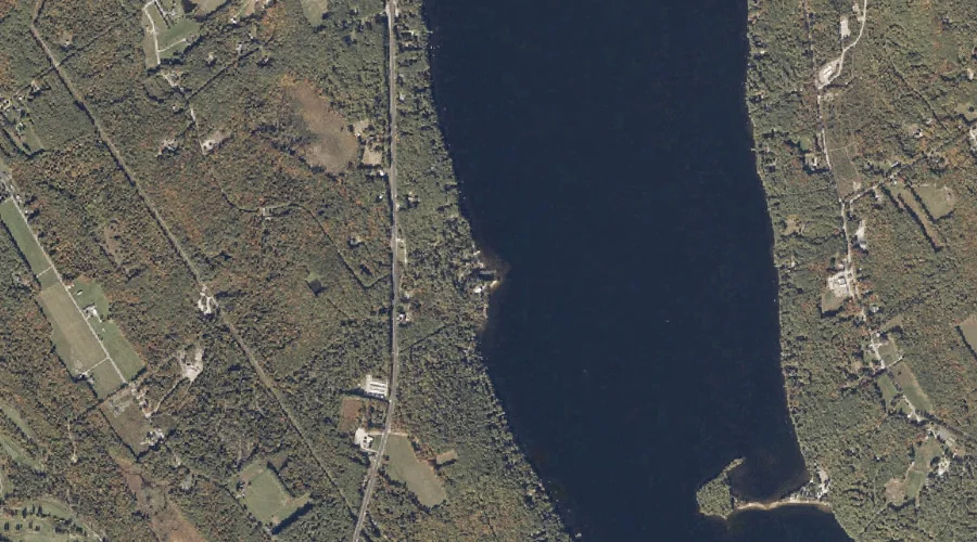
Rodgers Brook — Streams 22.5 Miles SSE of Chapman Inn
Cumberland County, Maine · USGS Bridgton Quadrangle · GNIS 574417
Catalogued on the USGS Bridgton quadrangle in Cumberland County, Maine, Rodgers Brook — a stream — lies 22.5 miles south-southeast of Chapman Inn.
Wikidata short description: “stream in Cumberland County, Maine, United States”
Landmark Profile
Classification & USGS reference
Catalogued under GNIS Feature ID 574417, Rodgers Brook is recorded as a stream on the USGS Bridgton quadrangle in Cumberland County, Maine (FIPS 23/005). Catalogued in GNIS since 09/30/1980.
Coordinates & physical setting
Rodgers Brook sits at 44.08674° N, 70.69312° W (DMS 44°05′12″ N, 70°41′35″ W).
As a linear feature its source lies near 44.09500° N, 70.72944° W (DMS 44°05′42″ N, 70°43′46″ W) — useful for anglers and paddlers tracing the upstream end.
Other streams in Cumberland County, Maine
Cumberland County, ME contains 110 streams catalogued in the USGS Geographic Names Information System, counting Rodgers Brook itself. The ones closest to Rodgers Brook:
| Feature | USGS Quadrangle | Distance |
|---|---|---|
| Smith Brook | Bridgton | 1 mi |
| Bear River | Bridgton | 1.7 mi |
| Carsley Brook | Bridgton | 2 mi |
| Stevens Brook | Bridgton | 2.4 mi |
| Willett Brook | Bridgton | 2.5 mi |
| Woodsum Brook | Waterford Flat | 3.2 mi |
| Russell Brook | Casco | 4.3 mi |
| Thomes Brook | Bridgton | 4.7 mi |
| Jack Branch | Bridgton | 5.8 mi |
| Day Brook | Bridgton | 6.3 mi |
Features on the USGS Bridgton Quadrangle
The Bridgton 7.5-minute topographic quadrangle holds 49 catalogued natural features alongside Rodgers Brook. A sampling nearest to this location:
| Feature | Type | County | Offset |
|---|---|---|---|
| Bluff Point | Capes | Cumberland County, ME | 0.8 mi |
| Bells Point | Capes | Cumberland County, ME | 0.9 mi |
| Smith Brook | Streams | Cumberland County, ME | 1 mi |
| Town Farm Hill | Summits | Cumberland County, ME | 1.4 mi |
| Loon Island | Islands | Cumberland County, ME | 1.4 mi |
| Monk Point | Capes | Cumberland County, ME | 1.6 mi |
| Sunset Rock | Summits | Cumberland County, ME | 1.7 mi |
| Bear River | Streams | Cumberland County, ME | 1.7 mi |
| Lower Ridge | Ridges | Cumberland County, ME | 1.7 mi |
| Zakelo Island | Islands | Cumberland County, ME | 1.9 mi |
Visiting from Chapman Inn
Distance, bearing & drive time
A 39-minute drive along back roads separates the front door of Chapman Inn from Rodgers Brook — 22.5 miles south-southeast as the crow flies, on compass bearing SSE.
Best time to visit
Best observed in late spring and early summer when flow is strong and banks are visible. At this latitude (44.087°), the shoulder seasons are workable — April and November can be comfortable on mild years. At 22.5 miles from the Inn, plan on a comfortable day trip with time for lunch on the road. Conditions at Rodgers Brook track the nearby Bluff Point cape (0.8 mi away) closely — if that is runnable, so is this.
Nearest features to Rodgers Brook
| Feature | Type | County | Distance |
|---|---|---|---|
| Bluff Point | Capes | Cumberland County, ME | 0.8 mi |
| Bells Point | Capes | Cumberland County, ME | 0.9 mi |
| Smith Brook | Streams | Cumberland County, ME | 1 mi |
| Town Farm Hill | Summits | Cumberland County, ME | 1.4 mi |
| Loon Island | Islands | Cumberland County, ME | 1.4 mi |
Frequently Asked Questions
Where is Rodgers Brook located?
Rodgers Brook is in Cumberland County, Maine, approximately 22.5 miles south-southeast of Chapman Inn in Bethel, Maine. It appears on the USGS Bridgton topographic quadrangle.
How far is Rodgers Brook from Chapman Inn?
The drive runs about 39 minutes, 22.5 miles south-southeast (bearing SSE) of the Inn.
What type of natural feature is Rodgers Brook?
The U.S. Geological Survey classifies Rodgers Brook as a stream, catalogued under GNIS Feature ID 574417 on the Bridgton quadrangle.
When is the best time to visit Rodgers Brook?
Best observed in late spring and early summer when flow is strong and banks are visible.
How many other streams are in Cumberland County, Maine?
GNIS lists 109 other streams in Cumberland County, Maine.
Wikidata: Q35263617.