 Aerial imagery: USGS National Map (public domain)
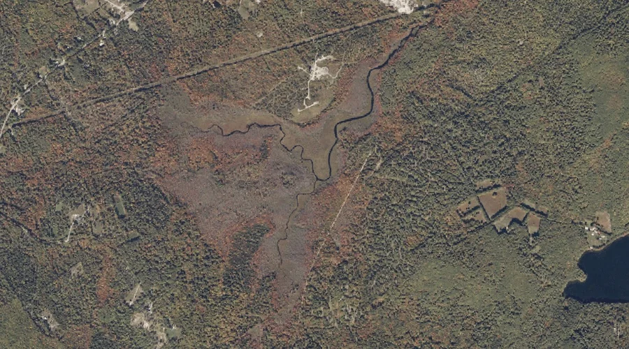
Day Brook — Streams 28.1 Miles S of Chapman Inn
Cumberland County, Maine · USGS Bridgton Quadrangle · GNIS 564831
28.1 miles south of Chapman Inn, on the USGS Bridgton topographic quadrangle, Day Brook is a stream recorded in Cumberland County, Maine by the federal Geographic Names Information System.
Landmark Profile
Classification & USGS reference
The USGS Bridgton 7.5-minute topographic quadrangle places Day Brook in Cumberland County, Maine (FIPS 23/005), classified as a stream in the federal GNIS (Feature ID 564831). Catalogued in GNIS since 09/30/1980.
Coordinates & physical setting
Day Brook sits at 44.00063° N, 70.73562° W (DMS 44°00′02″ N, 70°44′08″ W).
As a linear feature its source lies near 44.03674° N, 70.76506° W (DMS 44°02′12″ N, 70°45′54″ W) — useful for anglers and paddlers tracing the upstream end.
Other streams in Cumberland County, Maine
Cumberland County, ME contains 110 streams catalogued in the USGS Geographic Names Information System, counting Day Brook itself. The ones closest to Day Brook:
| Feature | USGS Quadrangle | Distance |
|---|---|---|
| Jack Branch | Bridgton | 0.6 mi |
| Town Farm Brook | North Sebago | 2.9 mi |
| Gristmill Brook | North Sebago | 3.1 mi |
| Sucker Brook | North Sebago | 3.3 mi |
| Willett Brook | Bridgton | 3.8 mi |
| Tingley Brook | North Sebago | 4.5 mi |
| Lakin Brook | North Sebago | 4.5 mi |
| Stevens Brook | Bridgton | 4.6 mi |
| Weeman Brook | North Sebago | 4.8 mi |
| Thomes Brook | Bridgton | 5 mi |
Features on the USGS Bridgton Quadrangle
The Bridgton 7.5-minute topographic quadrangle holds 49 catalogued natural features alongside Day Brook. A sampling nearest to this location:
| Feature | Type | County | Offset |
|---|---|---|---|
| Jack Branch | Streams | Cumberland County, ME | 0.6 mi |
| Dearborn Hill | Summits | Cumberland County, ME | 1.3 mi |
| Willett Brook | Reservoirs | Cumberland County, ME | 1.7 mi |
| Choate Hill | Summits | Cumberland County, ME | 2.1 mi |
| Woods Pond | Reservoirs | Cumberland County, ME | 2.2 mi |
| Otter Pond | Lakes | Cumberland County, ME | 3.3 mi |
| Packard Hill | Summits | Cumberland County, ME | 3.5 mi |
| Mount Henry | Summits | Cumberland County, ME | 3.6 mi |
| Willett Brook | Streams | Cumberland County, ME | 3.8 mi |
| Abners Nose | Capes | Cumberland County, ME | 4.2 mi |
Visiting from Chapman Inn
Distance, bearing & drive time
Chapman Inn sits 28.1 miles south (bearing S) of Day Brook. At moderate back-road speeds the drive runs about 48 minutes — comfortably inside a half-day outing window after breakfast.
Best time to visit
Best observed in late spring and early summer when flow is strong and banks are visible. At this latitude (44.001°), the shoulder seasons are workable — April and November can be comfortable on mild years. At 28.1 miles from the Inn, block the full day — sunrise start, late return, packed meals. Conditions at Day Brook track the nearby Jack Branch stream (0.6 mi away) closely — if that is runnable, so is this.
Nearest features to Day Brook
| Feature | Type | County | Distance |
|---|---|---|---|
| Jack Branch | Streams | Cumberland County, ME | 0.6 mi |
| Adams Pond | Reservoirs | Cumberland County, ME | 1.2 mi |
| Dearborn Hill | Summits | Cumberland County, ME | 1.3 mi |
| Willett Brook | Reservoirs | Cumberland County, ME | 1.7 mi |
| Fessenden Hill | Summits | Oxford County, ME | 1.8 mi |
Frequently Asked Questions
Where is Day Brook located?
Day Brook is in Cumberland County, Maine, approximately 28.1 miles south of Chapman Inn in Bethel, Maine. It appears on the USGS Bridgton topographic quadrangle.
How far is Day Brook from Chapman Inn?
The drive runs about 48 minutes, 28.1 miles south (bearing S) of the Inn.
What type of natural feature is Day Brook?
The U.S. Geological Survey classifies Day Brook as a stream, catalogued under GNIS Feature ID 564831 on the Bridgton quadrangle.
When is the best time to visit Day Brook?
Best observed in late spring and early summer when flow is strong and banks are visible.
How many other streams are in Cumberland County, Maine?
GNIS lists 109 other streams in Cumberland County, Maine.