 Aerial imagery: USGS National Map (public domain)
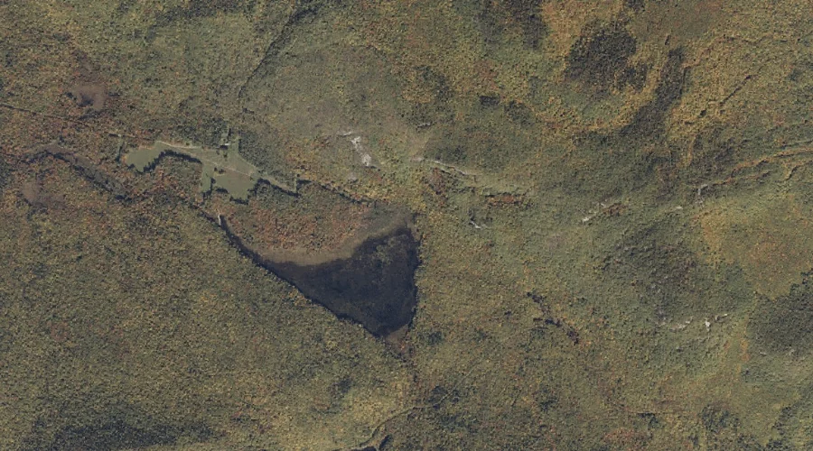
Rattlesnake Brook — Streams 14.1 Miles SW of Chapman Inn
Oxford County, Maine · USGS Center Lovell Quadrangle · GNIS 581185
Catalogued on the USGS Center Lovell quadrangle in Oxford County, Maine, Rattlesnake Brook — a stream — lies 14.1 miles southwest of Chapman Inn.
Landmark Profile
Classification & USGS reference
Catalogued under GNIS Feature ID 581185, Rattlesnake Brook is recorded as a stream on the USGS Center Lovell quadrangle in Oxford County, Maine (FIPS 23/017). Catalogued in GNIS since 09/30/1980.
Coordinates & physical setting
Rattlesnake Brook sits at 44.24701° N, 70.96813° W (DMS 44°14′49″ N, 70°58′05″ W).
As a linear feature its source lies near 44.28729° N, 70.96063° W (DMS 44°17′14″ N, 70°57′38″ W) — useful for anglers and paddlers tracing the upstream end.
Other streams in Oxford County, Maine
Oxford County, ME contains 296 streams catalogued in the USGS Geographic Names Information System, counting Rattlesnake Brook itself. The ones closest to Rattlesnake Brook:
| Feature | USGS Quadrangle | Distance |
|---|---|---|
| Bickford Brook | Wild River | 2.2 mi |
| Cold Brook | Center Lovell | 3.2 mi |
| Great Brook | Center Lovell | 3.4 mi |
| Willard Brook | Speckled Mountain | 3.5 mi |
| Howard Brook | Center Lovell | 3.5 mi |
| Beaver Brook | Speckled Mountain | 3.6 mi |
| Mosquito Brook | Center Lovell | 3.6 mi |
| Colton Brook | Center Lovell | 3.8 mi |
| Red Rock Brook | Speckled Mountain | 4.1 mi |
| Coffin Brook | Center Lovell | 4.2 mi |
Features on the USGS Center Lovell Quadrangle
The Center Lovell 7.5-minute topographic quadrangle holds 65 catalogued natural features alongside Rattlesnake Brook. A sampling nearest to this location:
| Feature | Type | County | Offset |
|---|---|---|---|
| Shell Pond | Lakes | Oxford County, ME | 0.2 mi |
| Adams Mountain | Summits | Oxford County, ME | 0.8 mi |
| Deer Hill | Summits | Oxford County, ME | 1.2 mi |
| Stiles Mountain | Summits | Oxford County, ME | 1.2 mi |
| Harndon Hill | Summits | Oxford County, ME | 1.3 mi |
| Deer Hill Spring | Springs | Oxford County, ME | 1.6 mi |
| Little Deer Hill | Summits | Oxford County, ME | 1.7 mi |
| Lord Hill | Summits | Oxford County, ME | 1.7 mi |
| Horseshoe Pond | Lakes | Oxford County, ME | 1.9 mi |
| Pine Hill | Summits | Oxford County, ME | 2.1 mi |
Visiting from Chapman Inn
Distance, bearing & drive time
A 24-minute drive along back roads separates the front door of Chapman Inn from Rattlesnake Brook — 14.1 miles southwest as the crow flies, on compass bearing SW.
Best time to visit
Best observed in late spring and early summer when flow is strong and banks are visible. At this latitude (44.247°), the shoulder seasons are workable — April and November can be comfortable on mild years. At 14.1 miles from the Inn, plan on a comfortable day trip with time for lunch on the road. Conditions at Rattlesnake Brook track the nearby Shell Pond lake (0.2 mi away) closely — if that is runnable, so is this.
Nearest features to Rattlesnake Brook
| Feature | Type | County | Distance |
|---|---|---|---|
| Shell Pond | Lakes | Oxford County, ME | 0.2 mi |
| Rattlesnake Mountain | Summits | Oxford County, ME | 0.3 mi |
| Palmer Mountain | Summits | Oxford County, ME | 0.7 mi |
| Adams Mountain | Summits | Oxford County, ME | 0.8 mi |
| Deer Hill | Summits | Oxford County, ME | 1.2 mi |
Frequently Asked Questions
Where is Rattlesnake Brook located?
Rattlesnake Brook is in Oxford County, Maine, approximately 14.1 miles southwest of Chapman Inn in Bethel, Maine. It appears on the USGS Center Lovell topographic quadrangle.
How far is Rattlesnake Brook from Chapman Inn?
The drive runs about 24 minutes, 14.1 miles southwest (bearing SW) of the Inn.
What type of natural feature is Rattlesnake Brook?
The U.S. Geological Survey classifies Rattlesnake Brook as a stream, catalogued under GNIS Feature ID 581185 on the Center Lovell quadrangle.
When is the best time to visit Rattlesnake Brook?
Best observed in late spring and early summer when flow is strong and banks are visible.
How many other streams are in Oxford County, Maine?
GNIS lists 295 other streams in Oxford County, Maine.