 Aerial imagery: USGS National Map (public domain)
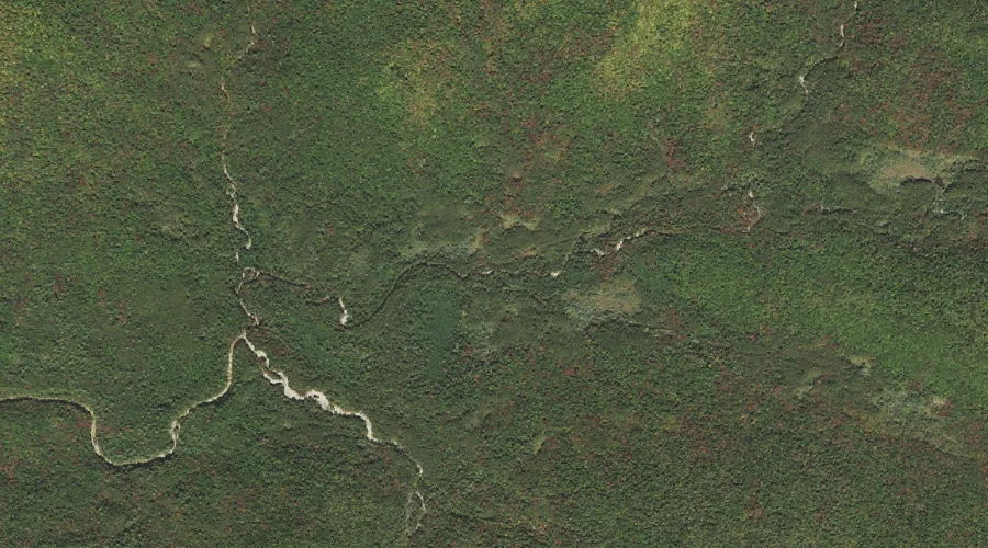
Norcross Brook — Streams 38.4 Miles WSW of Chapman Inn
Grafton County, New Hampshire · USGS Mount Carrigain Quadrangle · GNIS 872384
Within Grafton County, New Hampshire, on the USGS Mount Carrigain quadrangle, the stream known as Norcross Brook sits 38.4 miles west-southwest of Chapman Inn.
Landmark Profile
Classification & USGS reference
Within Grafton County, New Hampshire, the U.S. Geological Survey lists Norcross Brook as a stream on the Mount Carrigain topographic quadrangle (FIPS 33/009), under Feature ID 872384. Catalogued in GNIS since 08/27/1980.
Coordinates & physical setting
Norcross Brook sits at 44.12146° N, 71.45758° W (DMS 44°07′17″ N, 71°27′27″ W).
As a linear feature its source lies near 44.11417° N, 71.40472° W (DMS 44°06′51″ N, 71°24′17″ W) — useful for anglers and paddlers tracing the upstream end.
Other streams in Grafton County, New Hampshire
Grafton County, NH contains 89 streams catalogued in the USGS Geographic Names Information System, counting Norcross Brook itself. The ones closest to Norcross Brook:
| Feature | USGS Quadrangle | Distance |
|---|---|---|
| Notch Brook | Mount Carrigain | 0 mi |
| Shoal Pond Brook | Mount Carrigain | 0.6 mi |
| Carrigain Branch | Mount Carrigain | 0.6 mi |
| Anderson Brook | Mount Carrigain | 0.6 mi |
| Crystal Brook | Mount Carrigain | 1.7 mi |
| North Fork East Branch Pemigewasset River | Mount Osceola | 2.4 mi |
| Jumping Brook | Crawford Notch | 2.6 mi |
| Whitewall Brook | Crawford Notch | 3.3 mi |
| Black Brook | Mount Osceola | 4 mi |
| Avalanche Brook | Crawford Notch | 5 mi |
Features on the USGS Mount Carrigain Quadrangle
The Mount Carrigain 7.5-minute topographic quadrangle holds 36 catalogued natural features alongside Norcross Brook. A sampling nearest to this location:
| Feature | Type | County | Offset |
|---|---|---|---|
| Notch Brook | Streams | Grafton County, NH | 0 mi |
| Shoal Pond Brook | Streams | Grafton County, NH | 0.6 mi |
| Carrigain Branch | Streams | Grafton County, NH | 0.6 mi |
| Anderson Brook | Streams | Grafton County, NH | 0.6 mi |
| Vose Spur | Ridges | Grafton County, NH | 1.7 mi |
| Crystal Brook | Streams | Grafton County, NH | 1.7 mi |
| Carrigain Notch | Gaps | Grafton County, NH | 1.8 mi |
| Mount Carrigain | Summits | Grafton County, NH | 2 mi |
| Mount Anderson | Summits | Grafton County, NH | 2.1 mi |
| Signal Ridge | Ridges | Grafton County, NH | 2.1 mi |
Visiting from Chapman Inn
Distance, bearing & drive time
Follow the compass bearing WSW out of Bethel for 38.4 miles (west-southwest) and you reach Norcross Brook; at typical rural speeds the trip runs roughly 66 minutes.
Best time to visit
Best observed in late spring and early summer when flow is strong and banks are visible. At this latitude (44.121°), the shoulder seasons are workable — April and November can be comfortable on mild years. At 38.4 miles from the Inn, block the full day — sunrise start, late return, packed meals. Conditions at Norcross Brook track the nearby Notch Brook stream (essentially adjacent) closely — if that is runnable, so is this.
Nearest features to Norcross Brook
| Feature | Type | County | Distance |
|---|---|---|---|
| Notch Brook | Streams | Grafton County, NH | 0 mi |
| Shoal Pond Brook | Streams | Grafton County, NH | 0.6 mi |
| Carrigain Branch | Streams | Grafton County, NH | 0.6 mi |
| Anderson Brook | Streams | Grafton County, NH | 0.6 mi |
| Vose Spur | Ridges | Grafton County, NH | 1.7 mi |
Frequently Asked Questions
Where is Norcross Brook located?
Norcross Brook is in Grafton County, New Hampshire, approximately 38.4 miles west-southwest of Chapman Inn in Bethel, Maine. It appears on the USGS Mount Carrigain topographic quadrangle.
How far is Norcross Brook from Chapman Inn?
The drive runs about 66 minutes, 38.4 miles west-southwest (bearing WSW) of the Inn.
What type of natural feature is Norcross Brook?
The U.S. Geological Survey classifies Norcross Brook as a stream, catalogued under GNIS Feature ID 872384 on the Mount Carrigain quadrangle.
When is the best time to visit Norcross Brook?
Best observed in late spring and early summer when flow is strong and banks are visible.
How many other streams are in Grafton County, New Hampshire?
GNIS lists 88 other streams in Grafton County, New Hampshire.