 Aerial imagery: USGS National Map (public domain)
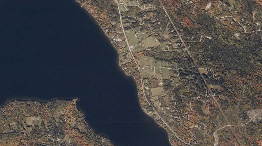
Nile Brook — Streams 37.9 Miles NNE of Chapman Inn
Franklin County, Maine · USGS Rangeley Quadrangle · GNIS 572172
37.9 miles north-northeast of Chapman Inn, on the USGS Rangeley topographic quadrangle, Nile Brook is a stream recorded in Franklin County, Maine by the federal Geographic Names Information System.
Landmark Profile
Classification & USGS reference
The USGS Rangeley 7.5-minute topographic quadrangle places Nile Brook in Franklin County, Maine (FIPS 23/007), classified as a stream in the federal GNIS (Feature ID 572172). Catalogued in GNIS since 09/30/1980.
Coordinates & physical setting
Nile Brook sits at 44.94200° N, 70.63535° W (DMS 44°56′31″ N, 70°38′07″ W).
As a linear feature its source lies near 44.95478° N, 70.59785° W (DMS 44°57′17″ N, 70°35′52″ W) — useful for anglers and paddlers tracing the upstream end.
Other streams in Franklin County, Maine
Franklin County, ME contains 134 streams catalogued in the USGS Geographic Names Information System, counting Nile Brook itself. The ones closest to Nile Brook:
| Feature | USGS Quadrangle | Distance |
|---|---|---|
| Long Pond Stream | Saddleback Mountain | 1.4 mi |
| Cascade Stream | Saddleback Mountain | 1.8 mi |
| Hatchery Brook | Rangeley | 1.9 mi |
| Mill Brook | Saddleback Mountain | 2.2 mi |
| Haley Brook | Saddleback Mountain | 3.5 mi |
| Geneva Bog Brook | Saddleback Mountain | 3.8 mi |
| Martin Brook | Rangeley | 4 mi |
| Rock Pond Stream | Saddleback Mountain | 4.2 mi |
| Haley Brook | Saddleback Mountain | 4.5 mi |
| Mountain Pond Stream | Rangeley | 4.5 mi |
Features on the USGS Rangeley Quadrangle
The Rangeley 7.5-minute topographic quadrangle holds 28 catalogued natural features alongside Nile Brook. A sampling nearest to this location:
| Feature | Type | County | Offset |
|---|---|---|---|
| Haines Point | Capes | Franklin County, ME | 0.6 mi |
| Greenvale Cove | Bays | Franklin County, ME | 0.7 mi |
| City Cove | Bays | Franklin County, ME | 1.5 mi |
| Maneskootuk Island | Islands | Franklin County, ME | 1.5 mi |
| Haley Pond | Reservoirs | Franklin County, ME | 1.8 mi |
| Hatchery Brook | Streams | Franklin County, ME | 1.9 mi |
| Rangeley Lake | Reservoirs | Franklin County, ME | 2.9 mi |
| Mud Pond | Lakes | Franklin County, ME | 3 mi |
| Ross Pond | Lakes | Franklin County, ME | 3.1 mi |
| South Cove | Bays | Franklin County, ME | 3.2 mi |
Visiting from Chapman Inn
Distance, bearing & drive time
Chapman Inn sits 37.9 miles north-northeast (bearing NNE) of Nile Brook. At moderate back-road speeds the drive runs about 65 minutes — comfortably inside a half-day outing window after breakfast.
Best time to visit
Best observed in late spring and early summer when flow is strong and banks are visible. Being this far north (lat 44.942°), first snows typically arrive by mid-October and linger into early May — narrow the window accordingly. At 37.9 miles from the Inn, block the full day — sunrise start, late return, packed meals. Conditions at Nile Brook track the nearby Haines Point cape (0.6 mi away) closely — if that is runnable, so is this.
Nearest features to Nile Brook
| Feature | Type | County | Distance |
|---|---|---|---|
| Haines Point | Capes | Franklin County, ME | 0.6 mi |
| Greenvale Cove | Bays | Franklin County, ME | 0.7 mi |
| Long Pond Stream | Streams | Franklin County, ME | 1.4 mi |
| City Cove | Bays | Franklin County, ME | 1.5 mi |
| Maneskootuk Island | Islands | Franklin County, ME | 1.5 mi |
Frequently Asked Questions
Where is Nile Brook located?
Nile Brook is in Franklin County, Maine, approximately 37.9 miles north-northeast of Chapman Inn in Bethel, Maine. It appears on the USGS Rangeley topographic quadrangle.
How far is Nile Brook from Chapman Inn?
The drive runs about 65 minutes, 37.9 miles north-northeast (bearing NNE) of the Inn.
What type of natural feature is Nile Brook?
The U.S. Geological Survey classifies Nile Brook as a stream, catalogued under GNIS Feature ID 572172 on the Rangeley quadrangle.
When is the best time to visit Nile Brook?
Best observed in late spring and early summer when flow is strong and banks are visible.
How many other streams are in Franklin County, Maine?
GNIS lists 133 other streams in Franklin County, Maine.