 Aerial imagery: USGS National Map (public domain)
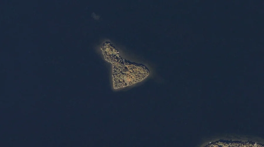
Maneskootuk Island — Islands 37.7 Miles N of Chapman Inn
Franklin County, Maine · USGS Rangeley Quadrangle · GNIS 565144
Catalogued on the USGS Rangeley quadrangle in Franklin County, Maine, Maneskootuk Island — a island — lies 37.7 miles north of Chapman Inn.
Landmark Profile
Classification & USGS reference
Catalogued under GNIS Feature ID 565144, Maneskootuk Island is recorded as a island on the USGS Rangeley quadrangle in Franklin County, Maine (FIPS 23/007). Last revised by the Board on Geographic Names on 12/16/2017.
Coordinates & physical setting
Maneskootuk Island sits at 44.94339° N, 70.66674° W (DMS 44°56′36″ N, 70°40′00″ W).
Features on the USGS Rangeley Quadrangle
The Rangeley 7.5-minute topographic quadrangle holds 28 catalogued natural features alongside Maneskootuk Island. A sampling nearest to this location:
| Feature | Type | County | Offset |
|---|---|---|---|
| Haines Point | Capes | Franklin County, ME | 1.1 mi |
| Rangeley Lake | Reservoirs | Franklin County, ME | 1.3 mi |
| Nile Brook | Streams | Franklin County, ME | 1.5 mi |
| City Cove | Bays | Franklin County, ME | 1.6 mi |
| Hatchery Brook | Streams | Franklin County, ME | 1.7 mi |
| Greenvale Cove | Bays | Franklin County, ME | 1.7 mi |
| South Cove | Bays | Franklin County, ME | 1.8 mi |
| Haley Pond | Reservoirs | Franklin County, ME | 2.3 mi |
| Ross Pond | Lakes | Franklin County, ME | 2.5 mi |
| Hunter Cove | Bays | Franklin County, ME | 2.7 mi |
Historical record
The U.S. Board on Geographic Names recorded a Official (Board Decision) on December 14, 2017 for this name.
Visiting from Chapman Inn
Distance, bearing & drive time
A 65-minute drive along back roads separates the front door of Chapman Inn from Maneskootuk Island — 37.7 miles north as the crow flies, on compass bearing N.
Best time to visit
Late May through early October, when the water is safe for small-boat access. Being this far north (lat 44.943°), first snows typically arrive by mid-October and linger into early May — narrow the window accordingly. At 37.7 miles from the Inn, block the full day — sunrise start, late return, packed meals. Conditions at Maneskootuk Island track the nearby Haines Point cape (1.1 mi away) closely — if that is runnable, so is this.
Nearest features to Maneskootuk Island
| Feature | Type | County | Distance |
|---|---|---|---|
| Haines Point | Capes | Franklin County, ME | 1.1 mi |
| Rangeley Lake | Reservoirs | Franklin County, ME | 1.3 mi |
| Nile Brook | Streams | Franklin County, ME | 1.5 mi |
| City Cove | Bays | Franklin County, ME | 1.6 mi |
| Hatchery Brook | Streams | Franklin County, ME | 1.7 mi |
Frequently Asked Questions
Where is Maneskootuk Island located?
Maneskootuk Island is in Franklin County, Maine, approximately 37.7 miles north of Chapman Inn in Bethel, Maine. It appears on the USGS Rangeley topographic quadrangle.
How far is Maneskootuk Island from Chapman Inn?
The drive runs about 65 minutes, 37.7 miles north (bearing N) of the Inn.
What type of natural feature is Maneskootuk Island?
The U.S. Geological Survey classifies Maneskootuk Island as a island, catalogued under GNIS Feature ID 565144 on the Rangeley quadrangle.
When is the best time to visit Maneskootuk Island?
Late May through early October, when the water is safe for small-boat access.