 Aerial imagery: USGS National Map (public domain)
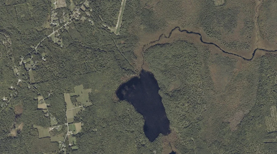
James Brook — Streams 32.7 Miles ENE of Chapman Inn
Franklin County, Maine · USGS Wilton Quadrangle · GNIS 568760
Within Franklin County, Maine, on the USGS Wilton quadrangle, the stream known as James Brook sits 32.7 miles east-northeast of Chapman Inn.
Landmark Profile
Classification & USGS reference
Within Franklin County, Maine, the U.S. Geological Survey lists James Brook as a stream on the Wilton topographic quadrangle (FIPS 23/007), under Feature ID 568760. Catalogued in GNIS since 09/30/1980.
Coordinates & physical setting
James Brook sits at 44.51173° N, 70.14311° W (DMS 44°30′42″ N, 70°08′35″ W).
As a linear feature its source lies near 44.55139° N, 70.19472° W (DMS 44°33′05″ N, 70°11′41″ W) — useful for anglers and paddlers tracing the upstream end.
Other streams in Franklin County, Maine
Franklin County, ME contains 134 streams catalogued in the USGS Geographic Names Information System, counting James Brook itself. The ones closest to James Brook:
| Feature | USGS Quadrangle | Distance |
|---|---|---|
| Nash Brook | Wilton | 0.4 mi |
| Fuller Brook | Wilton | 0.9 mi |
| Sugar Brook | Farmington Falls | 2.4 mi |
| Huckleberry Stream | Wilton | 2.6 mi |
| Mosquito Brook | Livermore Falls | 3.4 mi |
| Sevenmile Stream | Wilton | 5.3 mi |
| Ridley Brook | East Dixfield | 5.5 mi |
| Jolly Brook | East Dixfield | 5.6 mi |
| Coubers Brook | Wilton | 6.5 mi |
| Meadow Brook | Wilton | 6.5 mi |
Features on the USGS Wilton Quadrangle
The Wilton 7.5-minute topographic quadrangle holds 18 catalogued natural features alongside James Brook. A sampling nearest to this location:
| Feature | Type | County | Offset |
|---|---|---|---|
| Parker Pond | Lakes | Franklin County, ME | 0.2 mi |
| Nash Brook | Streams | Franklin County, ME | 0.4 mi |
| Fuller Brook | Streams | Franklin County, ME | 0.9 mi |
| Huckleberry Stream | Streams | Franklin County, ME | 2.6 mi |
| Macomber Hill | Summits | Franklin County, ME | 3.9 mi |
| Androscoggin River Reservoir | Reservoirs | Franklin County, ME | 4 mi |
| Jay Hill | Summits | Franklin County, ME | 4.1 mi |
| Spruce Mountain | Summits | Franklin County, ME | 4.2 mi |
| Bean Island | Islands | Franklin County, ME | 5.2 mi |
| Androscoggin River Reservoir | Reservoirs | Franklin County, ME | 5.3 mi |
Visiting from Chapman Inn
Distance, bearing & drive time
Follow the compass bearing ENE out of Bethel for 32.7 miles (east-northeast) and you reach James Brook; at typical rural speeds the trip runs roughly 56 minutes.
Best time to visit
Best observed in late spring and early summer when flow is strong and banks are visible. Being this far north (lat 44.512°), first snows typically arrive by mid-October and linger into early May — narrow the window accordingly. At 32.7 miles from the Inn, block the full day — sunrise start, late return, packed meals. Conditions at James Brook track the nearby Parker Pond lake (0.2 mi away) closely — if that is runnable, so is this.
Nearest features to James Brook
| Feature | Type | County | Distance |
|---|---|---|---|
| Parker Pond | Lakes | Franklin County, ME | 0.2 mi |
| Nash Brook | Streams | Franklin County, ME | 0.4 mi |
| Fuller Brook | Streams | Franklin County, ME | 0.9 mi |
| Little Moose Hill | Summits | Franklin County, ME | 1.3 mi |
| Warren Hill | Summits | Franklin County, ME | 1.3 mi |
Frequently Asked Questions
Where is James Brook located?
James Brook is in Franklin County, Maine, approximately 32.7 miles east-northeast of Chapman Inn in Bethel, Maine. It appears on the USGS Wilton topographic quadrangle.
How far is James Brook from Chapman Inn?
The drive runs about 56 minutes, 32.7 miles east-northeast (bearing ENE) of the Inn.
What type of natural feature is James Brook?
The U.S. Geological Survey classifies James Brook as a stream, catalogued under GNIS Feature ID 568760 on the Wilton quadrangle.
When is the best time to visit James Brook?
Best observed in late spring and early summer when flow is strong and banks are visible.
How many other streams are in Franklin County, Maine?
GNIS lists 133 other streams in Franklin County, Maine.