 Aerial imagery: USGS National Map (public domain)
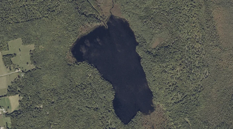
Parker Pond — Lakes 32.7 Miles ENE of Chapman Inn
Franklin County, Maine · USGS Wilton Quadrangle · GNIS 572989
Catalogued on the USGS Wilton quadrangle in Franklin County, Maine, Parker Pond — a lake — lies 32.7 miles east-northeast of Chapman Inn.
Landmark Profile
Classification & USGS reference
Catalogued under GNIS Feature ID 572989, Parker Pond is recorded as a lake on the USGS Wilton quadrangle in Franklin County, Maine (FIPS 23/007). Last revised by the Board on Geographic Names on 05/12/2018.
Coordinates & physical setting
Parker Pond sits at 44.50851° N, 70.14181° W (DMS 44°30′31″ N, 70°08′31″ W).
Other lakes in Franklin County, Maine
Franklin County, ME contains 98 lakes catalogued in the USGS Geographic Names Information System, counting Parker Pond itself. The ones closest to Parker Pond:
| Feature | USGS Quadrangle | Distance |
|---|---|---|
| North Pond | Farmington Falls | 2.4 mi |
| Round Pond | Farmington Falls | 2.8 mi |
| Fellows Pond | Farmington Falls | 3.1 mi |
| Horseshoe Pond | Farmington Falls | 3.3 mi |
| Robinson Pond | Farmington Falls | 3.7 mi |
| Sand Pond | Farmington Falls | 4.3 mi |
| Locke Pond | Farmington Falls | 5 mi |
| Pease Pond | Wilton | 6.5 mi |
| Crowell Pond | Farmington Falls | 7.6 mi |
| Wilson Pond | East Dixfield | 8.1 mi |
Features on the USGS Wilton Quadrangle
The Wilton 7.5-minute topographic quadrangle holds 18 catalogued natural features alongside Parker Pond. A sampling nearest to this location:
| Feature | Type | County | Offset |
|---|---|---|---|
| James Brook | Streams | Franklin County, ME | 0.2 mi |
| Nash Brook | Streams | Franklin County, ME | 0.6 mi |
| Fuller Brook | Streams | Franklin County, ME | 1.1 mi |
| Huckleberry Stream | Streams | Franklin County, ME | 2.8 mi |
| Androscoggin River Reservoir | Reservoirs | Franklin County, ME | 4 mi |
| Macomber Hill | Summits | Franklin County, ME | 4 mi |
| Jay Hill | Summits | Franklin County, ME | 4.2 mi |
| Spruce Mountain | Summits | Franklin County, ME | 4.4 mi |
| Bean Island | Islands | Franklin County, ME | 5.3 mi |
| Androscoggin River Reservoir | Reservoirs | Franklin County, ME | 5.3 mi |
Visiting from Chapman Inn
Distance, bearing & drive time
A 56-minute drive along back roads separates the front door of Chapman Inn from Parker Pond — 32.7 miles east-northeast as the crow flies, on compass bearing ENE.
Best time to visit
June through September for paddling and swimming; January through March for ice fishing. Being this far north (lat 44.509°), first snows typically arrive by mid-October and linger into early May — narrow the window accordingly. At 32.7 miles from the Inn, block the full day — sunrise start, late return, packed meals. Conditions at Parker Pond track the nearby James Brook stream (0.2 mi away) closely — if that is runnable, so is this.
Nearest features to Parker Pond
| Feature | Type | County | Distance |
|---|---|---|---|
| James Brook | Streams | Franklin County, ME | 0.2 mi |
| Nash Brook | Streams | Franklin County, ME | 0.6 mi |
| Fuller Brook | Streams | Franklin County, ME | 1.1 mi |
| Little Moose Hill | Summits | Franklin County, ME | 1.1 mi |
| Warren Hill | Summits | Franklin County, ME | 1.2 mi |
Frequently Asked Questions
Where is Parker Pond located?
Parker Pond is in Franklin County, Maine, approximately 32.7 miles east-northeast of Chapman Inn in Bethel, Maine. It appears on the USGS Wilton topographic quadrangle.
How far is Parker Pond from Chapman Inn?
The drive runs about 56 minutes, 32.7 miles east-northeast (bearing ENE) of the Inn.
What type of natural feature is Parker Pond?
The U.S. Geological Survey classifies Parker Pond as a lake, catalogued under GNIS Feature ID 572989 on the Wilton quadrangle.
When is the best time to visit Parker Pond?
June through September for paddling and swimming; January through March for ice fishing.
How many other lakes are in Franklin County, Maine?
GNIS lists 97 other lakes in Franklin County, Maine.