 Aerial imagery: USGS National Map (public domain)
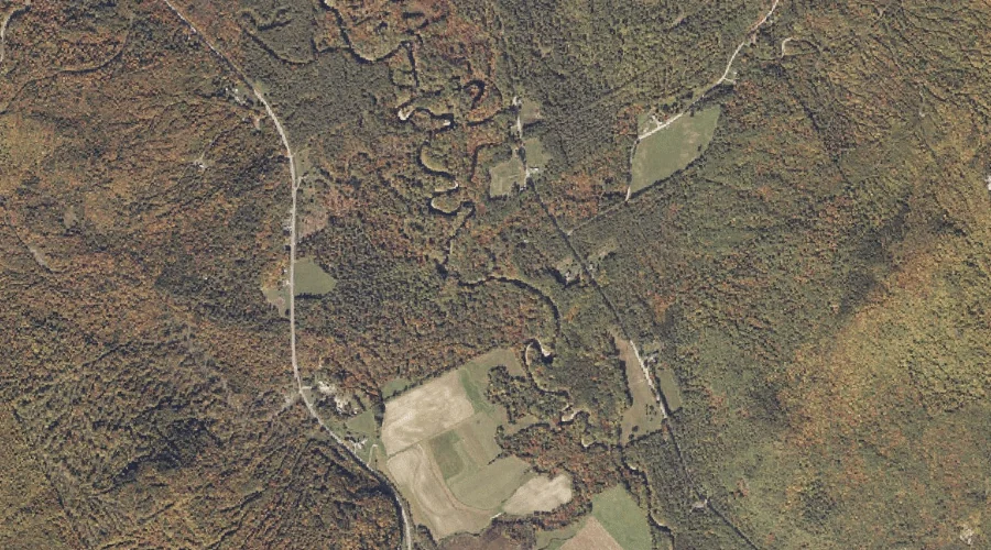
Coburn Brook — Streams 11.7 Miles NNE of Chapman Inn
Oxford County, Maine · USGS East Andover Quadrangle · GNIS 564132
11.7 miles north-northeast of Chapman Inn, on the USGS East Andover topographic quadrangle, Coburn Brook is a stream recorded in Oxford County, Maine by the federal Geographic Names Information System.
Landmark Profile
Classification & USGS reference
The USGS East Andover 7.5-minute topographic quadrangle places Coburn Brook in Oxford County, Maine (FIPS 23/017), classified as a stream in the federal GNIS (Feature ID 564132). Catalogued in GNIS since 09/30/1980.
Coordinates & physical setting
Coburn Brook sits at 44.56256° N, 70.70562° W (DMS 44°33′45″ N, 70°42′20″ W).
As a linear feature its source lies near 44.58639° N, 70.67083° W (DMS 44°35′11″ N, 70°40′15″ W) — useful for anglers and paddlers tracing the upstream end.
Other streams in Oxford County, Maine
Oxford County, ME contains 296 streams catalogued in the USGS Geographic Names Information System, counting Coburn Brook itself. The ones closest to Coburn Brook:
| Feature | USGS Quadrangle | Distance |
|---|---|---|
| Howe Brook | East Andover | 0.1 mi |
| Gardner Brook | East Andover | 1.7 mi |
| Meadow Brook | East Andover | 2.8 mi |
| Lone Brook | East Andover | 3.5 mi |
| West Branch Ellis River | East Andover | 4 mi |
| Meadow Brook | East Andover | 4 mi |
| Horseshoe Brook | Ellis Pond | 4.3 mi |
| Pond Stream | Bryant Pond | 4.7 mi |
| Meadow Brook | Ellis Pond | 5.5 mi |
| Black Brook | Ellis Pond | 5.5 mi |
Features on the USGS East Andover Quadrangle
The East Andover 7.5-minute topographic quadrangle holds 16 catalogued natural features alongside Coburn Brook. A sampling nearest to this location:
| Feature | Type | County | Offset |
|---|---|---|---|
| Howe Brook | Streams | Oxford County, ME | 0.1 mi |
| Farmers Hill | Summits | Oxford County, ME | 1.7 mi |
| Gardner Brook | Streams | Oxford County, ME | 1.7 mi |
| Whitecap Mountain | Summits | Oxford County, ME | 2.3 mi |
| Horseshoe Pond | Lakes | Oxford County, ME | 2.7 mi |
| Coon Hollow | Valleys | Oxford County, ME | 2.7 mi |
| Davis Pond | Lakes | Oxford County, ME | 2.8 mi |
| Meadow Brook | Streams | Oxford County, ME | 2.8 mi |
| Mount Dimmock | Summits | Oxford County, ME | 3.2 mi |
| Lone Brook | Streams | Oxford County, ME | 3.5 mi |
Visiting from Chapman Inn
Distance, bearing & drive time
Chapman Inn sits 11.7 miles north-northeast (bearing NNE) of Coburn Brook. At moderate back-road speeds the drive runs about 20 minutes — comfortably inside a half-day outing window after breakfast.
Best time to visit
Best observed in late spring and early summer when flow is strong and banks are visible. At this latitude (44.563°), the shoulder seasons are workable — April and November can be comfortable on mild years. At 11.7 miles from the Inn, plan on a comfortable day trip with time for lunch on the road. Conditions at Coburn Brook track the nearby Howe Brook stream (essentially adjacent) closely — if that is runnable, so is this.
Nearest features to Coburn Brook
| Feature | Type | County | Distance |
|---|---|---|---|
| Howe Brook | Streams | Oxford County, ME | 0.1 mi |
| Farmers Hill | Summits | Oxford County, ME | 1.7 mi |
| Gardner Brook | Streams | Oxford County, ME | 1.7 mi |
| Whitecap Mountain | Summits | Oxford County, ME | 2.3 mi |
| Horseshoe Pond | Lakes | Oxford County, ME | 2.7 mi |
Frequently Asked Questions
Where is Coburn Brook located?
Coburn Brook is in Oxford County, Maine, approximately 11.7 miles north-northeast of Chapman Inn in Bethel, Maine. It appears on the USGS East Andover topographic quadrangle.
How far is Coburn Brook from Chapman Inn?
The drive runs about 20 minutes, 11.7 miles north-northeast (bearing NNE) of the Inn.
What type of natural feature is Coburn Brook?
The U.S. Geological Survey classifies Coburn Brook as a stream, catalogued under GNIS Feature ID 564132 on the East Andover quadrangle.
When is the best time to visit Coburn Brook?
Best observed in late spring and early summer when flow is strong and banks are visible.
How many other streams are in Oxford County, Maine?
GNIS lists 295 other streams in Oxford County, Maine.