 Aerial imagery: USGS National Map (public domain)
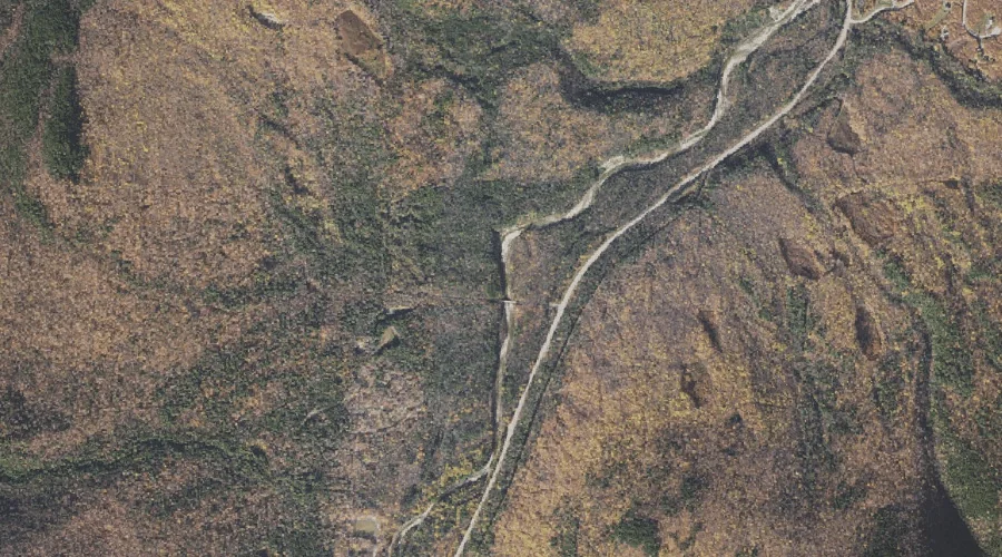
Barnes Brook — Streams 21.4 Miles WSW of Chapman Inn
Coos County, New Hampshire · USGS Carter Dome Quadrangle · GNIS 871445
Within Coos County, New Hampshire, on the USGS Carter Dome quadrangle, the stream known as Barnes Brook sits 21.4 miles west-southwest of Chapman Inn.
Wikidata short description: “river in Coös County, New Hampshire, United States of America”
Landmark Profile
Classification & USGS reference
Within Coos County, New Hampshire, the U.S. Geological Survey lists Barnes Brook as a stream on the Carter Dome topographic quadrangle (FIPS 33/007), under Feature ID 871445. Last revised by the Board on Geographic Names on 02/23/2011.
Coordinates & physical setting
Barnes Brook sits at 44.33701° N, 71.21257° W (DMS 44°20′13″ N, 71°12′45″ W).
As a linear feature its source lies near 44.33778° N, 71.23500° W (DMS 44°20′16″ N, 71°14′06″ W) — useful for anglers and paddlers tracing the upstream end.
Other streams in Coos County, New Hampshire
Coos County, NH contains 300 streams catalogued in the USGS Geographic Names Information System, counting Barnes Brook itself. The ones closest to Barnes Brook:
| Feature | USGS Quadrangle | Distance |
|---|---|---|
| Culhane Brook | Carter Dome | 0.1 mi |
| Bear Spring Brook | Carter Dome | 0.1 mi |
| Imp Brook | Carter Dome | 0.5 mi |
| Clay Brook | Carter Dome | 1 mi |
| Townline Brook | Carter Dome | 1.1 mi |
| West Branch Peabody River | Carter Dome | 1.8 mi |
| Cowboy Brook | Carter Dome | 2 mi |
| Nineteen Brook | Carter Dome | 2.4 mi |
| Townline Brook | Carter Dome | 2.6 mi |
| Stony Brook | Carter Dome | 2.7 mi |
Features on the USGS Carter Dome Quadrangle
The Carter Dome 7.5-minute topographic quadrangle holds 30 catalogued natural features alongside Barnes Brook. A sampling nearest to this location:
| Feature | Type | County | Offset |
|---|---|---|---|
| Culhane Brook | Streams | Coos County, NH | 0.1 mi |
| Bear Spring Brook | Streams | Coos County, NH | 0.1 mi |
| Imp Brook | Streams | Coos County, NH | 0.5 mi |
| Clay Brook | Streams | Coos County, NH | 1 mi |
| Townline Brook | Streams | Coos County, NH | 1.1 mi |
| Imp Face | Summits | Coos County, NH | 1.6 mi |
| West Branch Peabody River | Streams | Coos County, NH | 1.8 mi |
| Pine Mountain | Summits | Coos County, NH | 2 mi |
| Cowboy Brook | Streams | Coos County, NH | 2 mi |
| Triple Falls | Waterfalls | Coos County, NH | 2.2 mi |
Historical record
The U.S. Board on Geographic Names recorded a Official (Board Decision) on January 1, 1936 for this name.
Visiting from Chapman Inn
Distance, bearing & drive time
Follow the compass bearing WSW out of Bethel for 21.4 miles (west-southwest) and you reach Barnes Brook; at typical rural speeds the trip runs roughly 37 minutes.
Best time to visit
Best observed in late spring and early summer when flow is strong and banks are visible. Being this far north (lat 44.337°), first snows typically arrive by mid-October and linger into early May — narrow the window accordingly. At 21.4 miles from the Inn, plan on a comfortable day trip with time for lunch on the road. Conditions at Barnes Brook track the nearby Culhane Brook stream (essentially adjacent) closely — if that is runnable, so is this.
Nearest features to Barnes Brook
| Feature | Type | County | Distance |
|---|---|---|---|
| Culhane Brook | Streams | Coos County, NH | 0.1 mi |
| Bear Spring Brook | Streams | Coos County, NH | 0.1 mi |
| Imp Brook | Streams | Coos County, NH | 0.5 mi |
| Clay Brook | Streams | Coos County, NH | 1 mi |
| Townline Brook | Streams | Coos County, NH | 1.1 mi |
Frequently Asked Questions
Where is Barnes Brook located?
Barnes Brook is in Coos County, New Hampshire, approximately 21.4 miles west-southwest of Chapman Inn in Bethel, Maine. It appears on the USGS Carter Dome topographic quadrangle.
How far is Barnes Brook from Chapman Inn?
The drive runs about 37 minutes, 21.4 miles west-southwest (bearing WSW) of the Inn.
What type of natural feature is Barnes Brook?
The U.S. Geological Survey classifies Barnes Brook as a stream, catalogued under GNIS Feature ID 871445 on the Carter Dome quadrangle.
When is the best time to visit Barnes Brook?
Best observed in late spring and early summer when flow is strong and banks are visible.
How many other streams are in Coos County, New Hampshire?
GNIS lists 299 other streams in Coos County, New Hampshire.
Wikidata: Q34651214.