 Aerial imagery: USGS National Map (public domain)
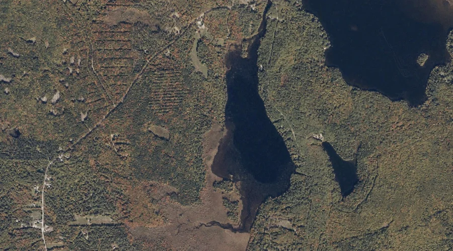
Anderson Brook — Streams 24.5 Miles SSW of Chapman Inn
Carroll County, New Hampshire · USGS North Conway East Quadrangle · GNIS 871394
Within Carroll County, New Hampshire, on the USGS North Conway East quadrangle, the stream known as Anderson Brook sits 24.5 miles south-southwest of Chapman Inn.
Wikidata short description: “river in Carroll County, New Hampshire, United States of America”
Landmark Profile
Classification & USGS reference
Within Carroll County, New Hampshire, the U.S. Geological Survey lists Anderson Brook as a stream on the North Conway East topographic quadrangle (FIPS 33/003), under Feature ID 871394. Catalogued in GNIS since 08/27/1980.
Coordinates & physical setting
Anderson Brook sits at 44.08757° N, 71.01146° W (DMS 44°05′15″ N, 71°00′41″ W).
As a linear feature its source lies near 44.11778° N, 71.03194° W (DMS 44°07′04″ N, 71°01′55″ W) — useful for anglers and paddlers tracing the upstream end.
Other streams in Carroll County, New Hampshire
Carroll County, NH contains 152 streams catalogued in the USGS Geographic Names Information System, counting Anderson Brook itself. The ones closest to Anderson Brook:
| Feature | USGS Quadrangle | Distance |
|---|---|---|
| Middle Brook | North Conway East | 0.5 mi |
| White Lot Brook | Fryeburg | 3.6 mi |
| Black Brook | North Conway East | 4.2 mi |
| Hoyt Brook | North Conway East | 4.9 mi |
| Langdon Brook | Center Lovell | 5.1 mi |
| McDonough Brook | Chatham | 5.9 mi |
| Watson Brook | Chatham | 5.9 mi |
| Artist Brook | North Conway East | 6 mi |
| Mason Brook | North Conway East | 6 mi |
| Whitten Brook | North Conway West | 6.3 mi |
Features on the USGS North Conway East Quadrangle
The North Conway East 7.5-minute topographic quadrangle holds 27 catalogued natural features alongside Anderson Brook. A sampling nearest to this location:
| Feature | Type | County | Offset |
|---|---|---|---|
| Upper Kimball Pond | Lakes | Carroll County, NH | 0.1 mi |
| Middle Brook | Streams | Carroll County, NH | 0.5 mi |
| Upper Kimball Lake | Reservoirs | Carroll County, NH | 0.7 mi |
| Province Brook | Streams | Oxford County, NH | 1.2 mi |
| Mack Hill | Summits | Carroll County, NH | 1.6 mi |
| Peaked Hill | Summits | Carroll County, NH | 2.7 mi |
| Shingle Pond | Lakes | Carroll County, NH | 3.2 mi |
| Hurricane Mountain | Summits | Carroll County, NH | 3.2 mi |
| Green Hills | Summits | Carroll County, NH | 3.5 mi |
| Black Cap | Summits | Carroll County, NH | 3.5 mi |
Visiting from Chapman Inn
Distance, bearing & drive time
Follow the compass bearing SSW out of Bethel for 24.5 miles (south-southwest) and you reach Anderson Brook; at typical rural speeds the trip runs roughly 42 minutes.
Best time to visit
Best observed in late spring and early summer when flow is strong and banks are visible. At this latitude (44.088°), the shoulder seasons are workable — April and November can be comfortable on mild years. At 24.5 miles from the Inn, plan on a comfortable day trip with time for lunch on the road. Conditions at Anderson Brook track the nearby Upper Kimball Pond lake (essentially adjacent) closely — if that is runnable, so is this.
Nearest features to Anderson Brook
| Feature | Type | County | Distance |
|---|---|---|---|
| Upper Kimball Pond | Lakes | Carroll County, NH | 0.1 mi |
| Middle Brook | Streams | Carroll County, NH | 0.5 mi |
| Hunt Pond | Lakes | Oxford County, ME | 0.7 mi |
| Upper Kimball Lake | Reservoirs | Carroll County, NH | 0.7 mi |
| Lower Kimball Pond | Lakes | Oxford County, NH | 1 mi |
Frequently Asked Questions
Where is Anderson Brook located?
Anderson Brook is in Carroll County, New Hampshire, approximately 24.5 miles south-southwest of Chapman Inn in Bethel, Maine. It appears on the USGS North Conway East topographic quadrangle.
How far is Anderson Brook from Chapman Inn?
The drive runs about 42 minutes, 24.5 miles south-southwest (bearing SSW) of the Inn.
What type of natural feature is Anderson Brook?
The U.S. Geological Survey classifies Anderson Brook as a stream, catalogued under GNIS Feature ID 871394 on the North Conway East quadrangle.
When is the best time to visit Anderson Brook?
Best observed in late spring and early summer when flow is strong and banks are visible.
How many other streams are in Carroll County, New Hampshire?
GNIS lists 151 other streams in Carroll County, New Hampshire.
Wikidata: Q34642600.