 Aerial imagery: USGS National Map (public domain)
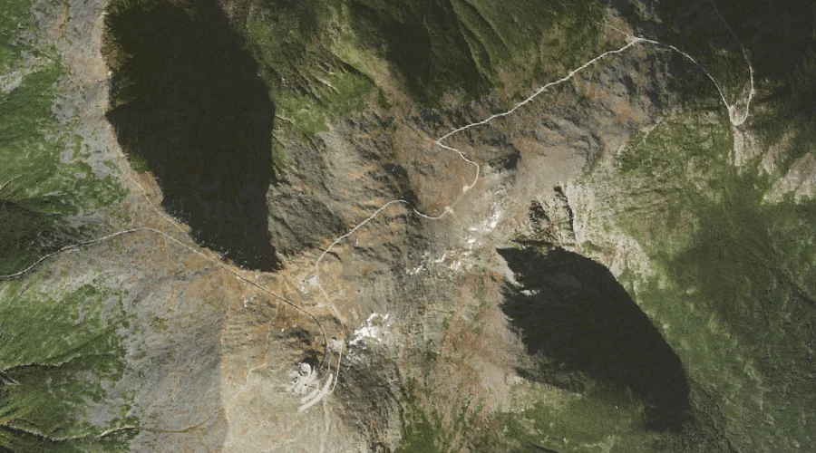
Chandler Ridge — Ridges 26.6 Miles WSW of Chapman Inn
Coos County, New Hampshire · USGS Mount Washington Quadrangle · GNIS 871662
26.6 miles west-southwest of Chapman Inn, on the USGS Mount Washington topographic quadrangle, Chandler Ridge is a ridge recorded in Coos County, New Hampshire by the federal Geographic Names Information System.
Landmark Profile
Classification & USGS reference
The USGS Mount Washington 7.5-minute topographic quadrangle places Chandler Ridge in Coos County, New Hampshire (FIPS 33/007), classified as a ridge in the federal GNIS (Feature ID 871662). Last revised by the Board on Geographic Names on 11/24/2020.
Coordinates & physical setting
Chandler Ridge sits at 44.27691° N, 71.29691° W (DMS 44°16′37″ N, 71°17′49″ W).
Other ridges in Coos County, New Hampshire
Coos County, NH contains 32 ridges catalogued in the USGS Geographic Names Information System, counting Chandler Ridge itself. The ones closest to Chandler Ridge:
| Feature | USGS Quadrangle | Elevation | Distance |
|---|---|---|---|
| Ridge of the Caps | Mount Washington | — | 2.1 mi |
| Castellated Ridge | Mount Washington | — | 2.2 mi |
| Rocky Branch Ridge | Stairs Mountain | — | 2.7 mi |
| Israel Ridge | Mount Washington | — | 2.9 mi |
| Montalban Ridge | Stairs Mountain | — | 3.1 mi |
| Nowell Ridge | Mount Washington | — | 3.2 mi |
| Durand Ridge | Mount Washington | — | 3.4 mi |
| Osgood Ridge | Mount Washington | — | 3.8 mi |
| Gordon Ridge | Mount Washington | — | 3.8 mi |
| Howker Ridge | Mount Washington | — | 3.9 mi |
Features on the USGS Mount Washington Quadrangle
The Mount Washington 7.5-minute topographic quadrangle holds 68 catalogued natural features alongside Chandler Ridge. A sampling nearest to this location:
| Feature | Type | County | Offset |
|---|---|---|---|
| Ball Crag | Pillars | Coos County, NH | 0.2 mi |
| Agiocochook Crag | Summits | Coos County, NH | 0.3 mi |
| Alpine Gardens | Other Natural Features | Coos County, NH | 0.5 mi |
| Mount Washington | Summits | Coos County, NH | 0.5 mi |
| Presidential Range | Ranges | Coos County, NH | 0.6 mi |
| Nelson Crag | Pillars | Coos County, NH | 0.6 mi |
| White Mountains | Ranges | Coos County, NH | 0.6 mi |
| Spaulding Lake | Lakes | Coos County, NH | 0.7 mi |
| Lion Head | Pillars | Coos County, NH | 0.8 mi |
| Bigelow Lawn | Other Natural Features | Coos County, NH | 1.1 mi |
Visiting from Chapman Inn
Distance, bearing & drive time
Chapman Inn sits 26.6 miles west-southwest (bearing WSW) of Chandler Ridge. At moderate back-road speeds the drive runs about 46 minutes — comfortably inside a half-day outing window after breakfast.
Best time to visit
Accessible May through November in most years. Being this far north (lat 44.277°), first snows typically arrive by mid-October and linger into early May — narrow the window accordingly. At 26.6 miles from the Inn, block the full day — sunrise start, late return, packed meals. Conditions at Chandler Ridge track the nearby Ball Crag rock pillar (0.2 mi away) closely — if that is runnable, so is this.
Nearest features to Chandler Ridge
| Feature | Type | County | Distance |
|---|---|---|---|
| Ball Crag | Pillars | Coos County, NH | 0.2 mi |
| Agiocochook Crag | Summits | Coos County, NH | 0.3 mi |
| Alpine Gardens | Other Natural Features | Coos County, NH | 0.5 mi |
| Mount Washington | Summits | Coos County, NH | 0.5 mi |
| Presidential Range | Ranges | Coos County, NH | 0.6 mi |
Frequently Asked Questions
Where is Chandler Ridge located?
Chandler Ridge is in Coos County, New Hampshire, approximately 26.6 miles west-southwest of Chapman Inn in Bethel, Maine. It appears on the USGS Mount Washington topographic quadrangle.
How far is Chandler Ridge from Chapman Inn?
The drive runs about 46 minutes, 26.6 miles west-southwest (bearing WSW) of the Inn.
What type of natural feature is Chandler Ridge?
The U.S. Geological Survey classifies Chandler Ridge as a ridge, catalogued under GNIS Feature ID 871662 on the Mount Washington quadrangle.
When is the best time to visit Chandler Ridge?
Accessible May through November in most years.
How many other ridges are in Coos County, New Hampshire?
GNIS lists 31 other ridges in Coos County, New Hampshire.