 Aerial imagery: USGS National Map (public domain)
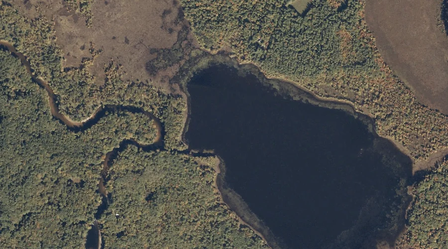
Mill Pond — Reservoirs 28.0 Miles S of Chapman Inn
Oxford County, Maine · USGS Fryeburg Quadrangle · GNIS 1774532
Within Oxford County, Maine, on the USGS Fryeburg quadrangle, the reservoir known as Mill Pond sits 28.0 miles south of Chapman Inn.
Landmark Profile
Classification & USGS reference
Within Oxford County, Maine, the U.S. Geological Survey lists Mill Pond as a reservoir on the Fryeburg topographic quadrangle (FIPS 23/017), under Feature ID 1774532. Catalogued in GNIS since 01/08/1998.
Coordinates & physical setting
Mill Pond sits at 44.00674° N, 70.89118° W (DMS 44°00′24″ N, 70°53′28″ W).
Other reservoirs in Oxford County, Maine
Oxford County, ME contains 51 reservoirs catalogued in the USGS Geographic Names Information System, counting Mill Pond itself. The ones closest to Mill Pond:
| Feature | USGS Quadrangle | Distance |
|---|---|---|
| Wards Pond | Fryeburg | 4.1 mi |
| Saco River Reservoir | Fryeburg | 5.1 mi |
| Burnt Meadow Pond | Brownfield | 5.6 mi |
| Berry Pond | Pleasant Mountain | 7.8 mi |
| Pickerel Pond | North Sebago | 8.2 mi |
| Hancock Pond | North Sebago | 8.5 mi |
| Barker Pond | Hiram | 10.2 mi |
| Colcord Pond | Kezar Falls | 11.5 mi |
| Saco River Reservoir | Cornish | 11.6 mi |
| Stanley Pond | Kezar Falls | 11.8 mi |
Features on the USGS Fryeburg Quadrangle
The Fryeburg 7.5-minute topographic quadrangle holds 33 catalogued natural features alongside Mill Pond. A sampling nearest to this location:
| Feature | Type | County | Offset |
|---|---|---|---|
| Pleasant Pond | Lakes | Oxford County, ME | 0.2 mi |
| Walker Island | Islands | Oxford County, ME | 0.5 mi |
| Black Brook | Streams | Oxford County, ME | 1 mi |
| Stanley Hill | Summits | Oxford County, ME | 1 mi |
| Lovewell Pond | Lakes | Oxford County, ME | 2 mi |
| Loon Island | Islands | Oxford County, ME | 2.1 mi |
| Cat Pond | Lakes | Oxford County, ME | 2.4 mi |
| Fight Brook | Streams | Oxford County, ME | 2.4 mi |
| Mount Tom | Summits | Oxford County, ME | 2.7 mi |
| Oak Hill | Summits | Oxford County, ME | 3.3 mi |
Visiting from Chapman Inn
Distance, bearing & drive time
Follow the compass bearing S out of Bethel for 28.0 miles (south) and you reach Mill Pond; at typical rural speeds the trip runs roughly 48 minutes.
Best time to visit
June through September for paddling and swimming; January through March for ice fishing. At this latitude (44.007°), the shoulder seasons are workable — April and November can be comfortable on mild years. At 28.0 miles from the Inn, block the full day — sunrise start, late return, packed meals. Conditions at Mill Pond track the nearby Pleasant Pond lake (0.2 mi away) closely — if that is runnable, so is this.
Nearest features to Mill Pond
| Feature | Type | County | Distance |
|---|---|---|---|
| Pleasant Pond | Lakes | Oxford County, ME | 0.2 mi |
| Walker Island | Islands | Oxford County, ME | 0.5 mi |
| Beaver Brook | Streams | Oxford County, ME | 0.9 mi |
| Black Brook | Streams | Oxford County, ME | 1 mi |
| Stanley Hill | Summits | Oxford County, ME | 1 mi |
Frequently Asked Questions
Where is Mill Pond located?
Mill Pond is in Oxford County, Maine, approximately 28.0 miles south of Chapman Inn in Bethel, Maine. It appears on the USGS Fryeburg topographic quadrangle.
How far is Mill Pond from Chapman Inn?
The drive runs about 48 minutes, 28.0 miles south (bearing S) of the Inn.
What type of natural feature is Mill Pond?
The U.S. Geological Survey classifies Mill Pond as a reservoir, catalogued under GNIS Feature ID 1774532 on the Fryeburg quadrangle.
When is the best time to visit Mill Pond?
June through September for paddling and swimming; January through March for ice fishing.
How many other reservoirs are in Oxford County, Maine?
GNIS lists 50 other reservoirs in Oxford County, Maine.