 Aerial imagery: USGS National Map (public domain)
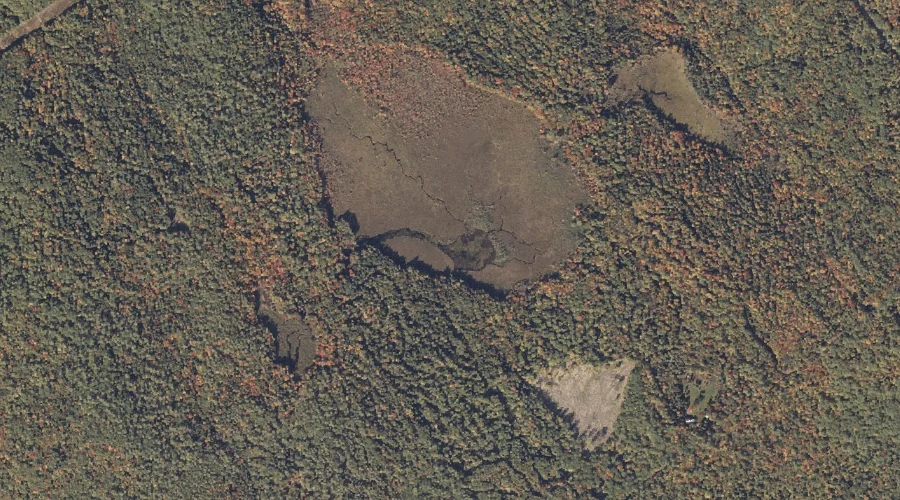
Berry Pond — Reservoirs 21.0 Miles S of Chapman Inn
Oxford County, Maine · USGS Pleasant Mountain Quadrangle · GNIS 562095
21.0 miles south of Chapman Inn, on the USGS Pleasant Mountain topographic quadrangle, Berry Pond is a reservoir recorded in Oxford County, Maine by the federal Geographic Names Information System.
Landmark Profile
Classification & USGS reference
The USGS Pleasant Mountain 7.5-minute topographic quadrangle places Berry Pond in Oxford County, Maine (FIPS 23/017), classified as a reservoir in the federal GNIS (Feature ID 562095). Last revised by the Board on Geographic Names on 05/15/2018.
Coordinates & physical setting
Berry Pond sits at 44.10069° N, 70.80491° W (DMS 44°06′02″ N, 70°48′18″ W).
Other reservoirs in Oxford County, Maine
Oxford County, ME contains 51 reservoirs catalogued in the USGS Geographic Names Information System, counting Berry Pond itself. The ones closest to Berry Pond:
| Feature | USGS Quadrangle | Distance |
|---|---|---|
| Bear Pond | Waterford Flat | 5.6 mi |
| Kezar Lake | Center Lovell | 7.5 mi |
| Mill Pond | Fryeburg | 7.8 mi |
| Cushman Pond | North Waterford | 8.4 mi |
| Heald Pond | North Waterford | 8.7 mi |
| Pickerel Pond | North Sebago | 9.8 mi |
| Saco River Reservoir | Fryeburg | 9.9 mi |
| Wards Pond | Fryeburg | 10.4 mi |
| Keewaydin Lake | East Stoneham | 11.3 mi |
| Hancock Pond | North Sebago | 11.4 mi |
Features on the USGS Pleasant Mountain Quadrangle
The Pleasant Mountain 7.5-minute topographic quadrangle holds 25 catalogued natural features alongside Berry Pond. A sampling nearest to this location:
| Feature | Type | County | Offset |
|---|---|---|---|
| Plummer Brook | Streams | Oxford County, ME | 0.9 mi |
| Plummer Mountain | Summits | Oxford County, ME | 1.1 mi |
| Ingalls Hill | Summits | Cumberland County, ME | 1.1 mi |
| Green Hill | Summits | Oxford County, ME | 1.2 mi |
| Pickett Hill | Summits | Oxford County, ME | 1.4 mi |
| Black Mountain | Summits | Oxford County, ME | 1.5 mi |
| Webber Pond | Lakes | Oxford County, ME | 1.7 mi |
| Stearns Pond | Lakes | Oxford County, ME | 2 mi |
| Woodbury Hill | Summits | Oxford County, ME | 2.1 mi |
| Knight Hill | Summits | Cumberland County, ME | 2.3 mi |
Visiting from Chapman Inn
Distance, bearing & drive time
Chapman Inn sits 21.0 miles south (bearing S) of Berry Pond. At moderate back-road speeds the drive runs about 36 minutes — comfortably inside a half-day outing window after breakfast.
Best time to visit
June through September for paddling and swimming; January through March for ice fishing. At this latitude (44.101°), the shoulder seasons are workable — April and November can be comfortable on mild years. At 21.0 miles from the Inn, plan on a comfortable day trip with time for lunch on the road. Conditions at Berry Pond track the nearby Plummer Brook stream (0.9 mi away) closely — if that is runnable, so is this.
Nearest features to Berry Pond
| Feature | Type | County | Distance |
|---|---|---|---|
| Plummer Brook | Streams | Oxford County, ME | 0.9 mi |
| Plummer Mountain | Summits | Oxford County, ME | 1.1 mi |
| Ingalls Hill | Summits | Cumberland County, ME | 1.1 mi |
| Green Hill | Summits | Oxford County, ME | 1.2 mi |
| Pickett Hill | Summits | Oxford County, ME | 1.4 mi |
Frequently Asked Questions
Where is Berry Pond located?
Berry Pond is in Oxford County, Maine, approximately 21.0 miles south of Chapman Inn in Bethel, Maine. It appears on the USGS Pleasant Mountain topographic quadrangle.
How far is Berry Pond from Chapman Inn?
The drive runs about 36 minutes, 21.0 miles south (bearing S) of the Inn.
What type of natural feature is Berry Pond?
The U.S. Geological Survey classifies Berry Pond as a reservoir, catalogued under GNIS Feature ID 562095 on the Pleasant Mountain quadrangle.
When is the best time to visit Berry Pond?
June through September for paddling and swimming; January through March for ice fishing.
How many other reservoirs are in Oxford County, Maine?
GNIS lists 50 other reservoirs in Oxford County, Maine.