 Aerial imagery: USGS National Map (public domain)
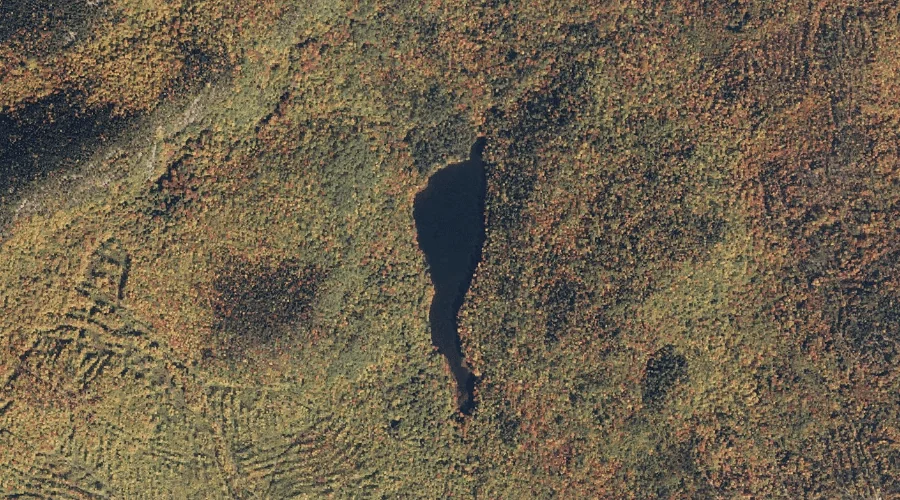
Trout Pond — Lakes 4.9 Miles WSW of Chapman Inn
Oxford County, Maine · USGS East Stoneham Quadrangle · GNIS 581245
Catalogued on the USGS East Stoneham quadrangle in Oxford County, Maine, Trout Pond — a lake — lies 4.9 miles west-southwest of Chapman Inn.
Landmark Profile
Classification & USGS reference
Catalogued under GNIS Feature ID 581245, Trout Pond is recorded as a lake on the USGS East Stoneham quadrangle in Oxford County, Maine (FIPS 23/017). Last revised by the Board on Geographic Names on 05/12/2018.
Coordinates & physical setting
Trout Pond sits at 44.36992° N, 70.87434° W (DMS 44°22′12″ N, 70°52′28″ W).
Other lakes in Oxford County, Maine
Oxford County, ME contains 157 lakes catalogued in the USGS Geographic Names Information System, counting Trout Pond itself. The ones closest to Trout Pond:
| Feature | USGS Quadrangle | Distance |
|---|---|---|
| Songo Pond | East Stoneham | 4.2 mi |
| Sunken Pond | East Stoneham | 4.6 mi |
| Crocker Pond | East Stoneham | 4.9 mi |
| Broken Bridge Pond | East Stoneham | 4.9 mi |
| Round Pond | East Stoneham | 5.7 mi |
| Mosquito Pond | East Stoneham | 6.1 mi |
| Kneeland Pond | East Stoneham | 7.5 mi |
| Little Papoose Pond | East Stoneham | 8.4 mi |
| Little Pond | Speckled Mountain | 8.4 mi |
| Bradley Pond | North Waterford | 9.3 mi |
Features on the USGS East Stoneham Quadrangle
The East Stoneham 7.5-minute topographic quadrangle holds 49 catalogued natural features alongside Trout Pond. A sampling nearest to this location:
| Feature | Type | County | Offset |
|---|---|---|---|
| West Branch Pleasant River | Streams | Oxford County, ME | 1.3 mi |
| East Branch Pleasant River | Streams | Oxford County, ME | 1.7 mi |
| Bad Mountain | Summits | Oxford County, ME | 2.1 mi |
| Cummings Hill | Summits | Oxford County, ME | 2.5 mi |
| Browns Hill | Summits | Oxford County, ME | 3.1 mi |
| Browns Ledge | Cliffs | Oxford County, ME | 3.4 mi |
| Emery Hill | Summits | Oxford County, ME | 3.6 mi |
| Farwell Mountain | Summits | Oxford County, ME | 3.9 mi |
| Patte Brook Waterfowl Impoundment Reservoir | Reservoirs | Oxford County, ME | 4.1 mi |
| Songo Pond | Lakes | Oxford County, ME | 4.2 mi |
Visiting from Chapman Inn
Distance, bearing & drive time
A 8-minute drive along back roads separates the front door of Chapman Inn from Trout Pond — 4.9 miles west-southwest as the crow flies, on compass bearing WSW.
Best time to visit
June through September for paddling and swimming; January through March for ice fishing. At this latitude (44.370°), the shoulder seasons are workable — April and November can be comfortable on mild years. The 4.9-mile drive from Chapman Inn makes it practical for a half-day outing — you can check conditions in the morning and still turn back if the weather closes in. Conditions at Trout Pond track the nearby Pine Mountain summit (0.7 mi away) closely — if that is runnable, so is this.
Nearest features to Trout Pond
| Feature | Type | County | Distance |
|---|---|---|---|
| Pine Mountain | Summits | Oxford County, ME | 0.7 mi |
| Pickett Henry Mountain | Summits | Oxford County, ME | 0.7 mi |
| West Branch Pleasant River | Streams | Oxford County, ME | 1.3 mi |
| Tyler Mountain | Summits | Oxford County, ME | 1.6 mi |
| East Branch Pleasant River | Streams | Oxford County, ME | 1.7 mi |
Frequently Asked Questions
Where is Trout Pond located?
Trout Pond is in Oxford County, Maine, approximately 4.9 miles west-southwest of Chapman Inn in Bethel, Maine. It appears on the USGS East Stoneham topographic quadrangle.
How far is Trout Pond from Chapman Inn?
The drive runs about 8 minutes, 4.9 miles west-southwest (bearing WSW) of the Inn.
What type of natural feature is Trout Pond?
The U.S. Geological Survey classifies Trout Pond as a lake, catalogued under GNIS Feature ID 581245 on the East Stoneham quadrangle.
When is the best time to visit Trout Pond?
June through September for paddling and swimming; January through March for ice fishing.
How many other lakes are in Oxford County, Maine?
GNIS lists 156 other lakes in Oxford County, Maine.