 Aerial imagery: USGS National Map (public domain)
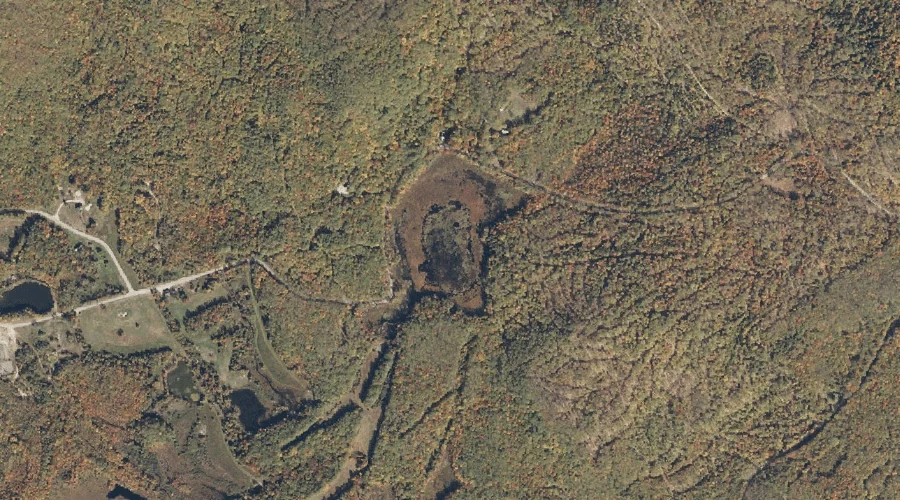
Little Pond — Lakes 12.3 Miles SSW of Chapman Inn
Oxford County, Maine · USGS Speckled Mountain Quadrangle · GNIS 581098
Catalogued on the USGS Speckled Mountain quadrangle in Oxford County, Maine, Little Pond — a lake — lies 12.3 miles south-southwest of Chapman Inn.
Landmark Profile
Classification & USGS reference
Catalogued under GNIS Feature ID 581098, Little Pond is recorded as a lake on the USGS Speckled Mountain quadrangle in Oxford County, Maine (FIPS 23/017). Last revised by the Board on Geographic Names on 05/15/2018.
Coordinates & physical setting
Little Pond sits at 44.25156° N, 70.91689° W (DMS 44°15′06″ N, 70°55′01″ W).
Other lakes in Oxford County, Maine
Oxford County, ME contains 157 lakes catalogued in the USGS Geographic Names Information System, counting Little Pond itself. The ones closest to Little Pond:
| Feature | USGS Quadrangle | Distance |
|---|---|---|
| Mud Pond | Center Lovell | 1.2 mi |
| Horseshoe Pond | Center Lovell | 2.1 mi |
| Shell Pond | Center Lovell | 2.7 mi |
| Bradley Pond | North Waterford | 2.9 mi |
| Moose Pond | Center Lovell | 3 mi |
| Noah Eastman Pond | Center Lovell | 3.3 mi |
| Trout Pond | North Waterford | 4.8 mi |
| Farrington Pond | Center Lovell | 5.1 mi |
| Weymouth Pond | North Waterford | 5.9 mi |
| Round Pond | East Stoneham | 6 mi |
Features on the USGS Speckled Mountain Quadrangle
The Speckled Mountain 7.5-minute topographic quadrangle holds 37 catalogued natural features alongside Little Pond. A sampling nearest to this location:
| Feature | Type | County | Offset |
|---|---|---|---|
| Beaver Brook | Streams | Oxford County, ME | 1.1 mi |
| Sugarloaf Mountain | Summits | Oxford County, ME | 1.4 mi |
| Willard Brook | Streams | Oxford County, ME | 1.8 mi |
| Mason Hill | Summits | Oxford County, ME | 2.1 mi |
| Palmer Mountain | Summits | Oxford County, ME | 2.2 mi |
| Rattlesnake Mountain | Summits | Oxford County, ME | 2.5 mi |
| Red Rock Brook | Streams | Oxford County, ME | 2.5 mi |
| Isaiah Mountain | Summits | Oxford County, ME | 2.9 mi |
| Shirley Brook | Streams | Oxford County, ME | 2.9 mi |
| Blueberry Mountain | Summits | Oxford County, ME | 3.2 mi |
Visiting from Chapman Inn
Distance, bearing & drive time
A 21-minute drive along back roads separates the front door of Chapman Inn from Little Pond — 12.3 miles south-southwest as the crow flies, on compass bearing SSW.
Best time to visit
June through September for paddling and swimming; January through March for ice fishing. At this latitude (44.252°), the shoulder seasons are workable — April and November can be comfortable on mild years. At 12.3 miles from the Inn, plan on a comfortable day trip with time for lunch on the road. Conditions at Little Pond track the nearby Gammon Hill summit (0.3 mi away) closely — if that is runnable, so is this.
Nearest features to Little Pond
| Feature | Type | County | Distance |
|---|---|---|---|
| Gammon Hill | Summits | Oxford County, ME | 0.3 mi |
| Cold Brook | Streams | Oxford County, ME | 1.1 mi |
| Great Brook | Streams | Oxford County, ME | 1.1 mi |
| Beaver Brook | Streams | Oxford County, ME | 1.1 mi |
| Mud Pond | Lakes | Oxford County, ME | 1.2 mi |
Frequently Asked Questions
Where is Little Pond located?
Little Pond is in Oxford County, Maine, approximately 12.3 miles south-southwest of Chapman Inn in Bethel, Maine. It appears on the USGS Speckled Mountain topographic quadrangle.
How far is Little Pond from Chapman Inn?
The drive runs about 21 minutes, 12.3 miles south-southwest (bearing SSW) of the Inn.
What type of natural feature is Little Pond?
The U.S. Geological Survey classifies Little Pond as a lake, catalogued under GNIS Feature ID 581098 on the Speckled Mountain quadrangle.
When is the best time to visit Little Pond?
June through September for paddling and swimming; January through March for ice fishing.
How many other lakes are in Oxford County, Maine?
GNIS lists 156 other lakes in Oxford County, Maine.